SAR image real-time geometric correction method and system based on RD plane pixel mapping

A geometric correction and pixel mapping technology, which is applied in the fields of guidance, image processing and remote sensing, can solve the problems of ground distance correction result distortion, accuracy dependent on platform height information, etc., and achieve simple processing process, low position information requirements and processing complexity , Realize the effect of real-time geometric correction

Pending Publication Date: 2020-05-08
SPACE STAR TECH CO LTD
View PDF6 Cites 2 Cited by
  • Summary
  • Abstract
  • Description
  • Claims
  • Application Information

AI Technical Summary

Problems solved by technology

Non-patent literature (Geometric Correction Algorithm for Missile-borne SAR Images Introduced Coordinate Mapping Principle, Ye Xiaoming) proposed a geometric correction method for the descent section of needle-borne SAR using spectrum analysis to realize the pixel mapping between

Method used


Image

  • SAR image real-time geometric correction method and system based on RD plane pixel mapping
  • SAR image real-time geometric correction method and system based on RD plane pixel mapping
  • SAR image real-time geometric correction method and system based on RD plane pixel mapping

Examples


Embodiment Construction

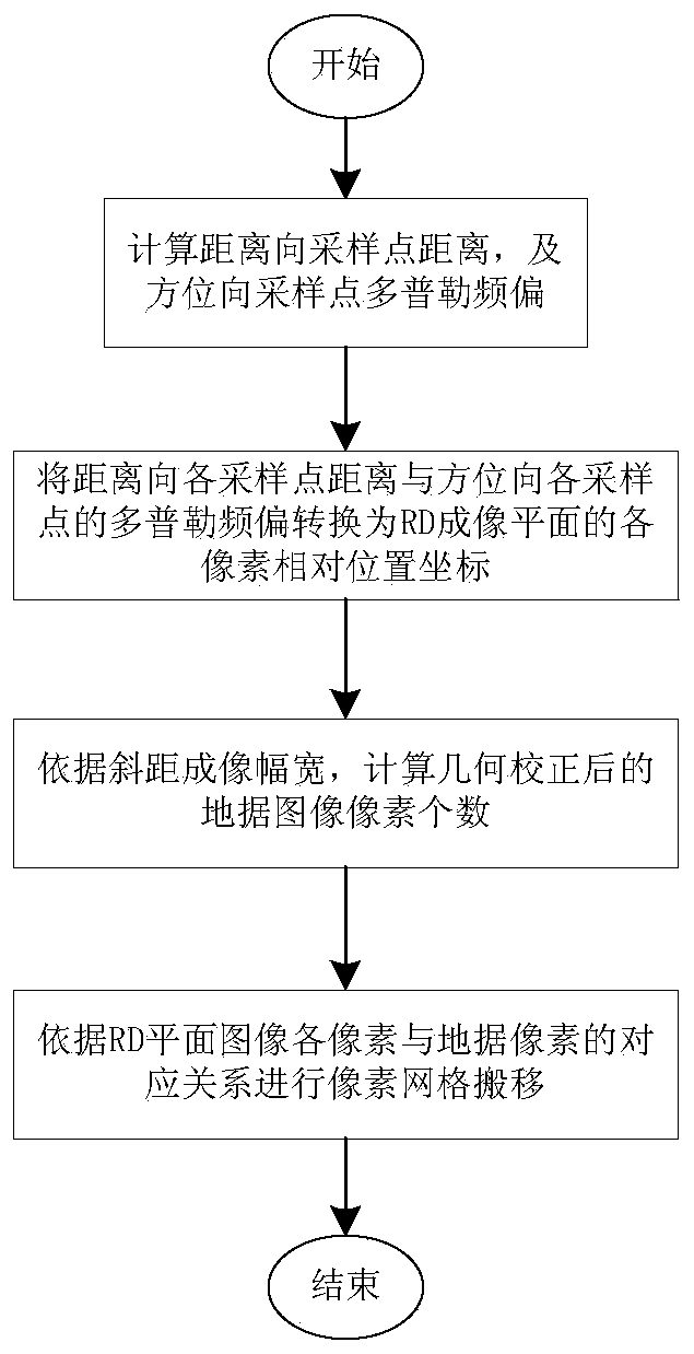
[0026] Exemplary embodiments of the present disclosure will be described in more detail below with reference to the accompanying drawings. Although exemplary embodiments of the present disclosure are shown in the drawings, it should be understood that the present disclosure may be embodied in various forms and should not be limited by the embodiments set forth herein. Rather, these embodiments are provided for more thorough understanding of the present disclosure and to fully convey the scope of the present disclosure to those skilled in the art. It should be noted that, in the case of no conflict, the embodiments of the present invention and the features in the embodiments can be combined with each other. The present invention will be described in detail below with reference to the accompanying drawings and examples.

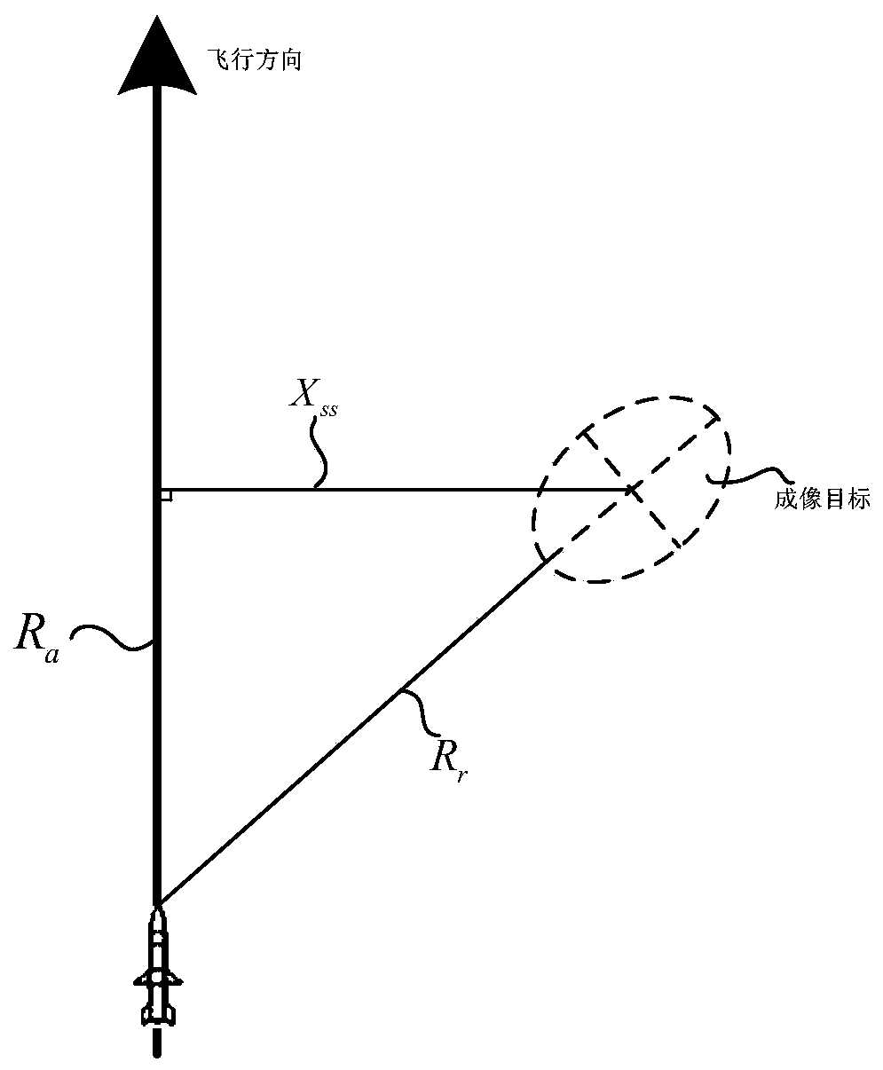
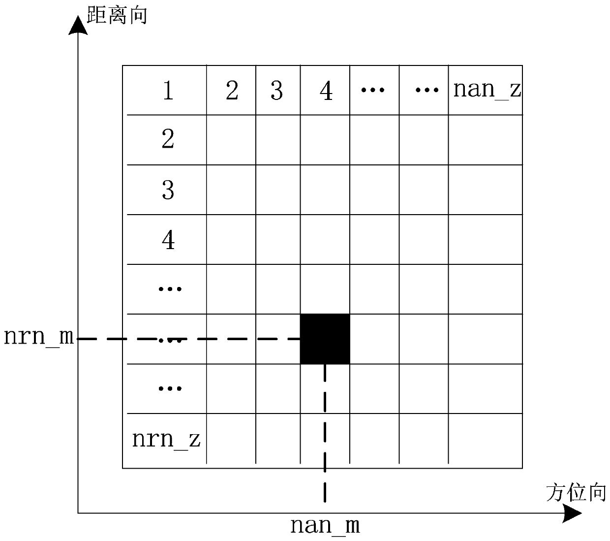
[0027] figure 1 It is a flow chart of the SAR image real-time geometric correction method of the embodiment of the present invention, such as figure 1 As sh...


PUM


Abstract

The invention discloses an SAR image real-time geometric correction method and a system based on RD plane pixel mapping. The SAR image real-time geometric correction method comprises two methods of mapping correspondence of an RD imaging plane and a ground distance plane and ground distance pixel scale determination. According to the method, an SAR radar imaging principle is utilized to calculatea distance sampling interval and an azimuth Doppler sampling interval in an original RD imaging plane, pixel coordinates of the original imaging result RD plane are calculated, and ground distance position coordinates of pixels of a real-time SAR imaging result are calculated through an imaging geometrical relationship. Meanwhile, in the pixel ground distance grid positioning process, ground distance pixel scale adjustment is achieved through ground distance position coordinates. The method can be applied to a real-time SAR imaging system, image geometric correction with a simple processing process and high real-time performance can be realized, and the problem of geometric correction of the input image of a real-time airborne/missile-borne SAR scene matching system is solved.

Description

technical field [0001] The invention belongs to the technical field of image processing in the field of remote sensing and guidance, and in particular relates to a method and system for real-time geometric correction of SAR images based on RD plane pixel mapping. Background technique [0002] For the real-time SAR scene matching system, most of its reference images are the ground target features directly below acquired by spaceborne or airborne image sensors. However, due to the imaging principle of the real-time SAR radar imaging platform on the large forward-looking RD plane, the imaging results have obvious oblique geometric distortion compared with the upright and downward-looking reference surveying and mapping images, and the pixel scale of the imaging results also changes due to the different real-time attitudes of the radar. , these two changes severely restrict the matching probability and accuracy of the SAR scene matching system. In order to solve the above contr...

Claims


Application Information

Patent Timeline
IPC IPC(8): G06T5/00
CPCG06T5/006G06T2207/10044
Inventor 刘乃强戴宗武张少甫段岑薇门宇博
Owner SPACE STAR TECH CO LTD
Why Eureka
Try Eureka