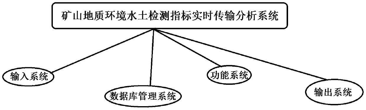
Mine geological environment water and soil detection index real-time transmission analysis system
A geological environment and real-time transmission technology, applied in the direction of measuring devices, structured data retrieval, geographic information databases, etc., can solve the problems of inability to obtain the whole picture of the mining area, data processing, collation and summary analysis, and information management, etc., to achieve convenient Effects of macro-management and convenient environmental function zoning
- Summary
- Abstract
- Description
- Claims
- Application Information
AI Technical Summary
Problems solved by technology
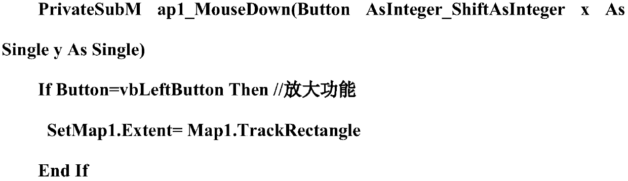
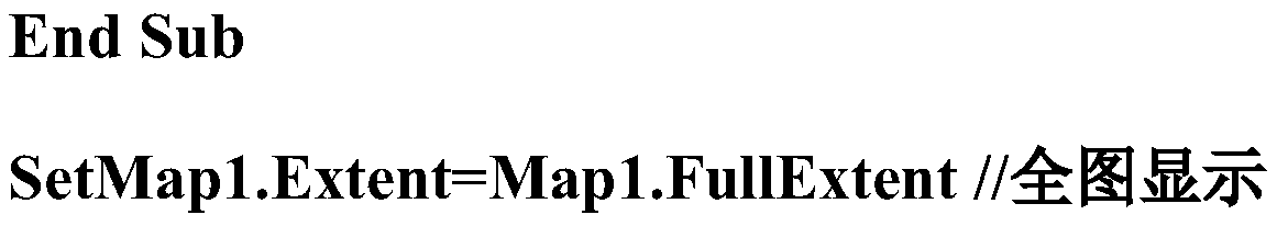
Method used
Image

Examples
Embodiment Construction
[0027] Mine environmental pollution has the following characteristics: large pollution area, wide area, serious pollution degree, many types of pollution, more difficult pollution control, and high degree of complexity. The distinctive features of mine environmental information are rich data sources, large amounts of data, numerous data types, and complex data structures, that is, the so-called multi-source, multi-quantity, multi-class, and multi-dimensional. A geographic information system is a spatial information system that uses computer software and hardware equipment to assist users in collecting, storing, managing, analyzing and describing data related to space and geographic distribution on the entire and part of the earth's surface (including the atmosphere). Based on the characteristics of mine environmental pollution, we can learn from the environmental geographic information system and mine geographic information system to establish a real-time transmission and analy...
PUM
 Abstract
Description
Claims
Application Information