A multi-vehicle joint absolute positioning method based on Internet of Vehicles

An absolute positioning and Internet of Vehicles technology, applied in the field of multi-source fusion navigation, can solve problems such as centimeter-level high-precision positioning, RTK’s difficulty in obtaining fixed ambiguity solutions, and poor geometric structure of satellites. Enhanced operability and improved solution performance

Active Publication Date: 2021-12-14
WUHAN UNIV
View PDF8 Cites 0 Cited by
  • Summary
  • Abstract
  • Description
  • Claims
  • Application Information

AI Technical Summary

Problems solved by technology

GNSS is the key sensor for obtaining high-precision positions in integrated navigation systems. In open environments, GNSS-RTK (Real Time Kinematic) can provide real-time centimeter-level absolute positions. In occluded environments such as canyons, the number of visible satellites drops rapidly, and the satellite geometry is poor. It is difficult for RTK to obtain a fixed ambiguity solution, and it is difficult to achieve centimeter-level high-precision positioning

Method used


Image

  • A multi-vehicle joint absolute positioning method based on Internet of Vehicles
  • A multi-vehicle joint absolute positioning method based on Internet of Vehicles
  • A multi-vehicle joint absolute positioning method based on Internet of Vehicles

Examples


Embodiment Construction

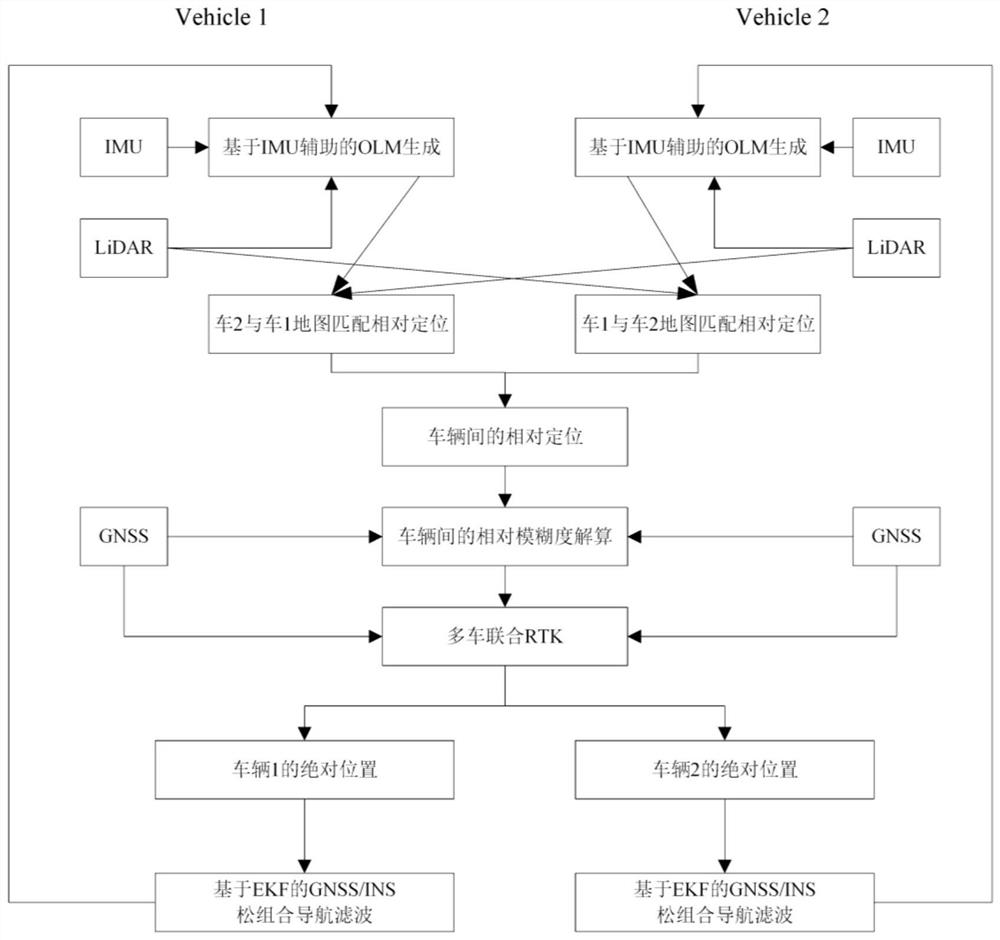
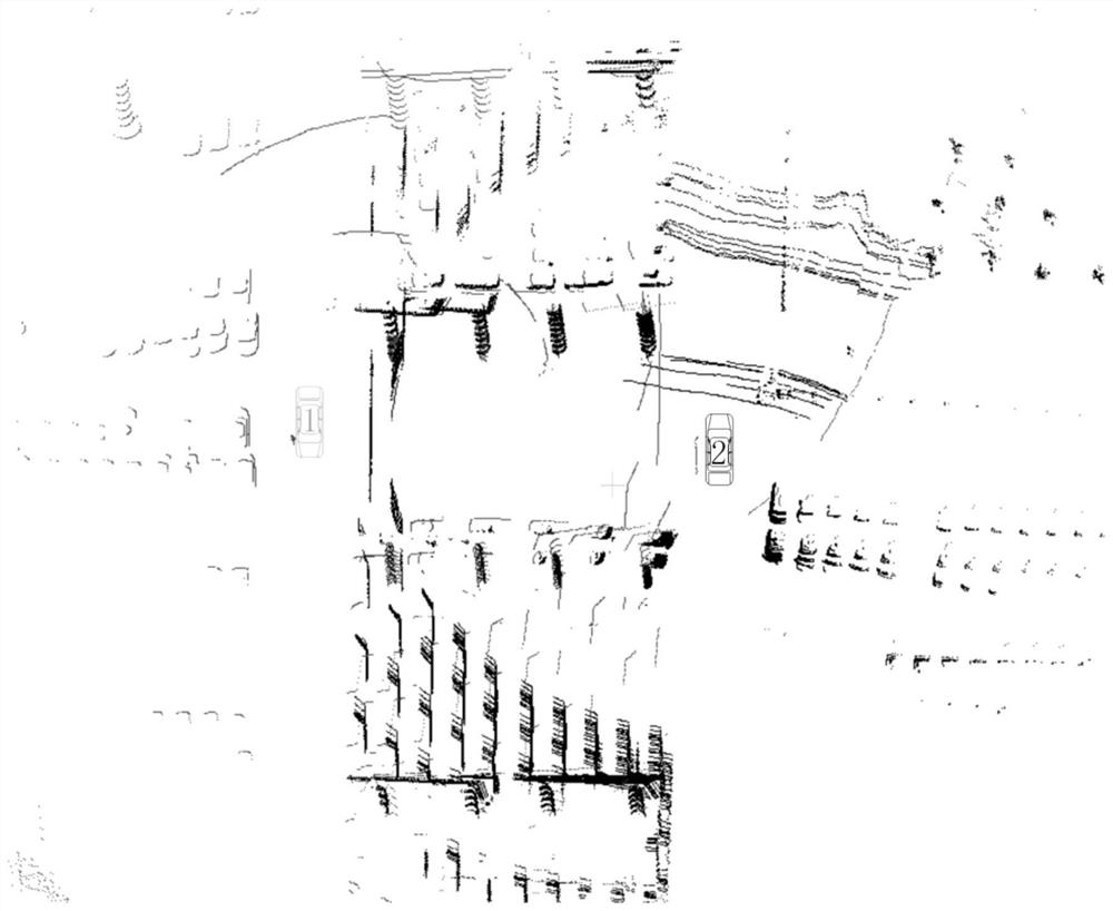
[0097] A multi-vehicle joint absolute positioning method based on the Internet of Vehicles provided by the present invention utilizes sensors such as GNSS, INS, and laser radar equipped with intelligent vehicles, and the characteristics that multi-vehicle data can be jointly processed under the condition of Internet of Vehicles, the multi-vehicle Joint processing of GNSS, INS and lidar data. This method is an epoch-by-epoch process. Each vehicle uses its own GNSS position results and INS to perform EKF loose combination to estimate the combined navigation results of the current vehicle, including position, velocity and attitude. Secondly, the high-precision relative positioning between vehicles is realized through multi-vehicle lidar data, which mainly uses the simultaneous localization and mapping method (SLAM) of INS-assisted lidar, the feature matching method of frame and map matching, etc.; and then in A GNSS double-difference observation model is constructed between vehic...


PUM


Abstract

The invention discloses a multi-vehicle joint absolute positioning method based on the Internet of Vehicles, using GNSS, INS, laser radar and other sensors equipped with vehicles, and the characteristics of multi-vehicle data joint processing under the condition of Internet of Vehicles, the multi-vehicle GNSS, INS Joint processing with lidar data. The high-precision relative positioning between vehicles is realized through the laser radar data of multiple vehicles, and then the high-precision relative position between vehicles obtained by laser radar is used to assist the relative ambiguity resolution between vehicles, and the fixed rate of relative ambiguity is improved. Finally, the joint The RTK model jointly solves the GNSS data of multiple vehicles, and takes into account the high-precision relative position constraints and relative ambiguity constraints between vehicles. Compared with the GNSS observation of a single vehicle, the joint RTK model can integrate the GNSS data of multiple vehicles. The observation data and geometric structure are better than the single-vehicle GNSS data, thereby improving the ambiguity fixation rate and improving the absolute positioning accuracy of the vehicle, especially in the occlusion environment, the advantages of this method are very significant.

Description

technical field [0001] The present invention relates to the field of multi-source fusion navigation, in particular to a global navigation satellite system (Global Navigation Satellite System, GNSS), inertial navigation system (Inertial Navigation System, INS), laser radar (light detection and ranging, LiDAR) data to achieve high-precision absolute positioning of vehicles. Background technique [0002] With the development of autonomous driving and the Internet of Things, smart cars and connected cars are getting more and more attention. Both of them need to accurately locate the car in operation. At present, the high-precision navigation and positioning of cars mainly depends on the Global Navigation Satellite System (GNSS) , an integrated navigation system composed of an inertial navigation system (INS), etc. GNSS is the key sensor for obtaining high-precision positions in integrated navigation systems. In open environments, GNSS-RTK (Real Time Kinematic) can provide real-...

Claims


Application Information

Patent Timeline
Patent Type & Authority Patents(China)
IPC IPC(8): G01C21/00G01S17/86G01S19/47G06T7/246G06T7/277G06T7/73
CPCG01C21/005G01S19/45G01S17/875G06T7/75G06T7/251G06T7/277G06T2207/10028G06T2207/30252
Inventor 钱闯张红娟唐健李文卓温景仁刘晖
Owner WUHAN UNIV
Why Eureka
Try Eureka