Visual control system based on unmanned aerial vehicle ground station
A technology of control system and unmanned aerial vehicle, applied in the field of visual control system, can solve the problem that the visual cannot be controlled flexibly in real time, and achieve the effect of improving the overall user experience, solving the problem of difficult expansion, and improving versatility
- Summary
- Abstract
- Description
- Claims
- Application Information
AI Technical Summary
Problems solved by technology
Method used
Image
Examples
Embodiment 1
[0043] This embodiment provides a visual control system. The development of the visual control system of the present embodiment is based on the OSG (OpenScene Graph) open source application program interface, using VS2010, QT5.
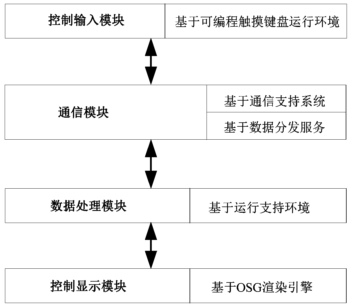
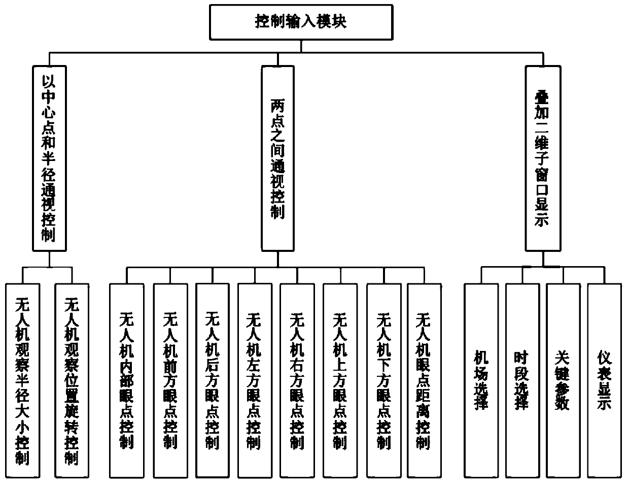
[0044] figure 1 It is a block diagram of the relationship between the modules of the visual control system, such as figure 1 As shown, the visual control system of this embodiment is composed of a control input module, a communication module, a data processing module, and a control display module. The control input module provides the observer with the function of quickly inputting control commands on the programmable touch keyboard. The communication module provides a unified transceiver interface for each functional module of the visual control system. The data processing module completes the parsing and updating of the received data. The control and display module responds to the update data of the data processing module in real time, and reali...
Embodiment 2
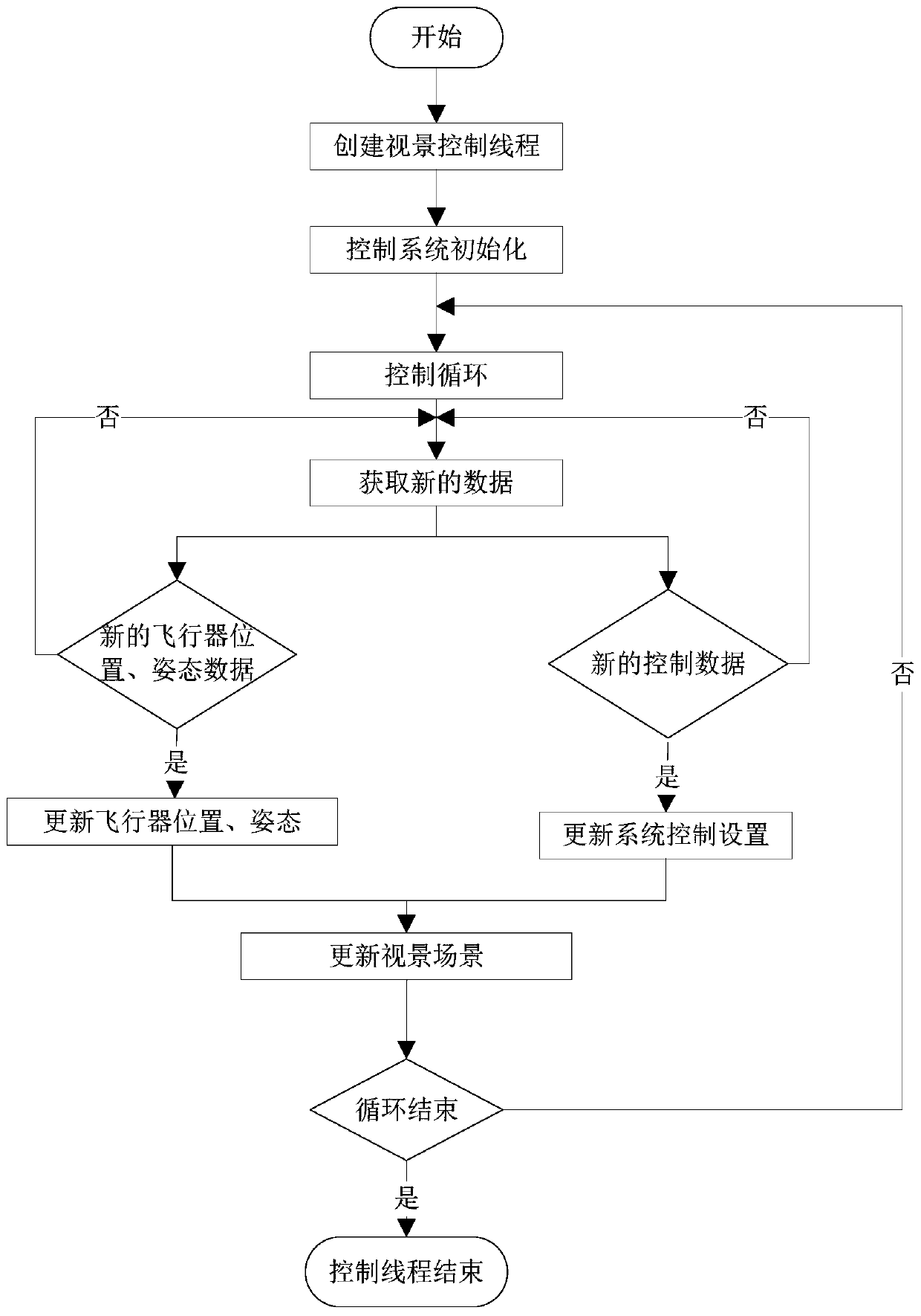
[0055] To observe the three-dimensional physical laws of the drone, it is necessary to display the position (longitude, latitude, height) and attitude data (pitch angle, yaw angle, roll angle) of the drone at different times, and want to flexibly adjust the viewing angle position and observation attitude, the observer also needs to be able to flexibly adjust its longitude, latitude, altitude, pitch angle, yaw angle, and roll angle. Radius visibility control analysis, visibility control analysis between two points, superimposed two-dimensional sub-window display part analysis. In the software working thread, the frame cycle updates the position data of the drone, and the scene moving body is driven in real time through the 3D engine. In each frame of the scene, the drone's longitude, latitude, height, and pitch are updated once. Use these values to set the position of the 3D solid model of the UAV, and draw the scene environment at the new position, so as to realize the relat...
PUM
 Abstract
Description
Claims
Application Information
 - R&D
- Intellectual Property
- Life Sciences
- Materials
- Tech Scout
- Unparalleled Data Quality
- Higher Quality Content
- 60% Fewer Hallucinations
Browse by: Latest US Patents, China's latest patents, Technical Efficacy Thesaurus, Application Domain, Technology Topic, Popular Technical Reports.
© 2025 PatSnap. All rights reserved.Legal|Privacy policy|Modern Slavery Act Transparency Statement|Sitemap|About US| Contact US: help@patsnap.com


