Method for applying weather radar standard format base data in geographic information system

A GIS, standard format technology, applied in special data processing applications, geographic information databases, structured data retrieval, etc. Easy to use, accurate map data

Active Publication Date: 2020-06-26
昆明市气象局
View PDF5 Cites 1 Cited by
  • Summary
  • Abstract
  • Description
  • Claims
  • Application Information

AI Technical Summary

Problems solved by technology

[0005] The purpose of the present invention is to complete the independent research and development of a free geographic information system applicable to the meteorological industry, and solve the problem that the meteorological industry lacks a geographic information system with highly customizable layers

Method used


Image

  • Method for applying weather radar standard format base data in geographic information system
  • Method for applying weather radar standard format base data in geographic information system
  • Method for applying weather radar standard format base data in geographic information system

Examples


Embodiment 1

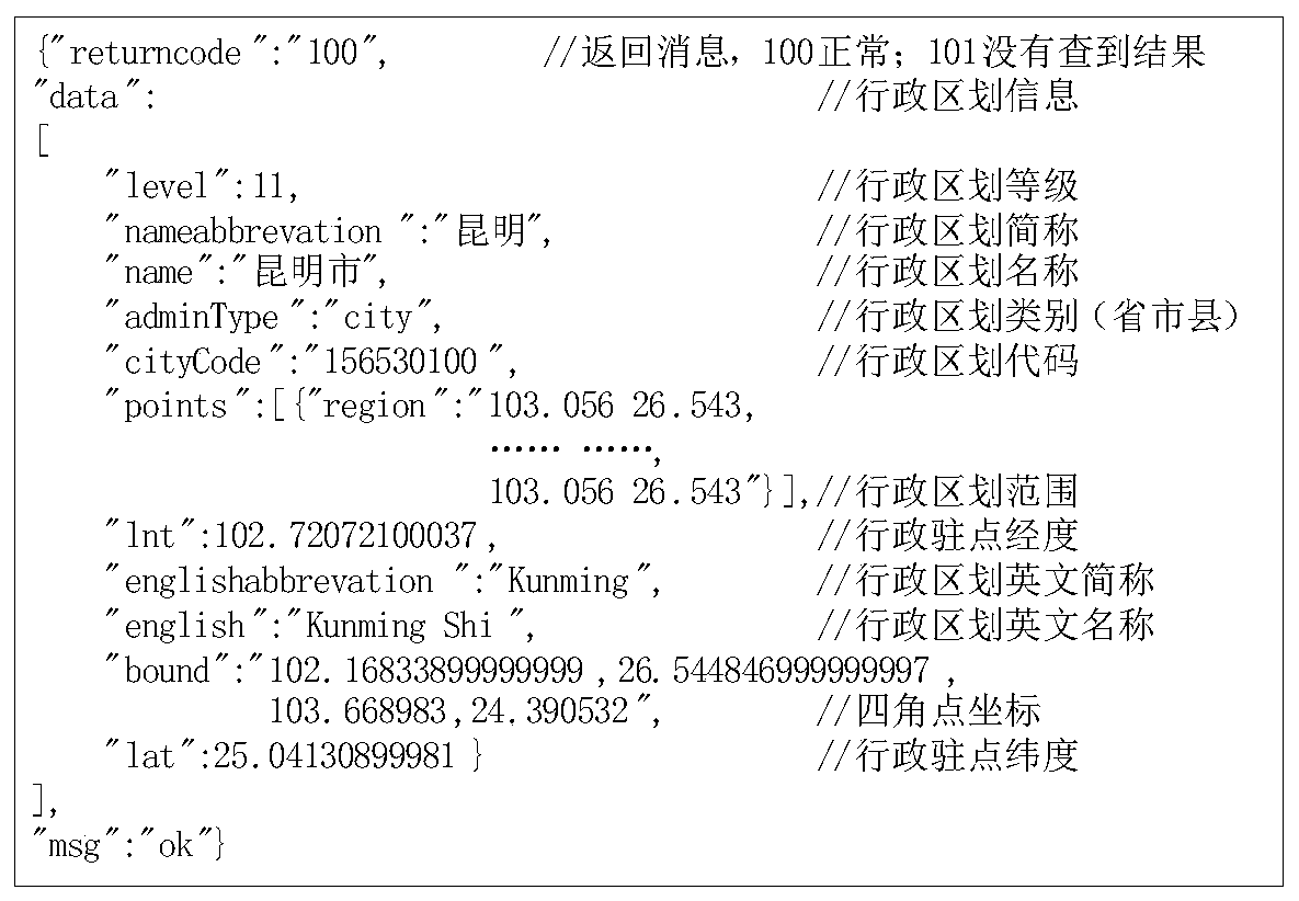
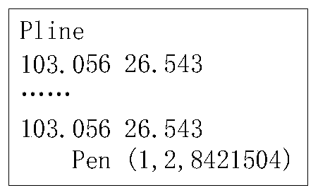
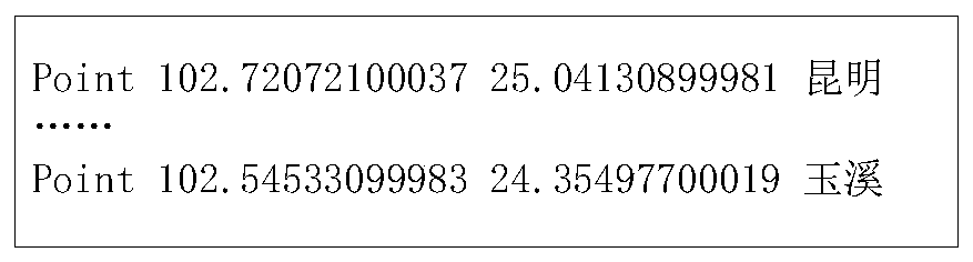
[0023] Embodiment 1: The method for applying weather radar standard format basic data in geographic information system, using the national geographic information public service platform, i.e. the administrative division data in Tiantu and the data information of townships, administrative villages, and natural villages in Yunnan digital villages as data Source, read the latitude and longitude dot matrix data in the C# development environment, use the equidistant cylindrical projection method to realize the drawing of the geographic information layer, and use the control combination and control technology to complete the overlay control of the transparent layer and the basics of the geographic information system Features.

[0024] Taking Kunming as an example, the specific application steps are as follows:

[0025] S1. Acquisition of GIS data: including acquisition of provincial, prefecture (state / city), county-level administrative divisions and administrative station data, as w...


PUM


Abstract

The invention discloses a method for applying weather radar standard format base data to a geographic information system, and relates to an information system, in particular to an information system combining a geographic information system (GIS) and the weather radar standard format base data. According to the method, a national geographic information public service platform is used; administrative division data in a sky map and data information of villages and towns, administrative villages and natural villages in Yunnan digital villages are used as data sources; longitude and latitude dot matrix data are read in a C # development environment, drawing of a geographic information layer is realized by adopting an equidistant cylindrical projection mode, and superposition control of a transparent layer and basic functions of a geographic information system are completed by adopting a control combination and control technology. The method does not need to install any control, is convenient to use, accurate in map data and free of display deviation, can be matched with meteorological products, and can meet the practical requirements of the meteorological industry for geographic information.

Description

technical field [0001] The invention relates to an information system, in particular to an information system combining a geographic information system (GIS) and basic data in a weather radar standard format. Background technique [0002] Next-generation weather radars provide important high-quality atmospheric observations for nowcasting and severe weather warnings. Making full use of the new generation of weather radar detection data can improve the ability of disastrous weather forecasting, meteorological service, disaster prevention and mitigation. With the development of society and economy, meteorological services are gradually being valued. The new generation of weather radar with high temporal and spatial resolution and continuous monitoring methods can meet the requirements of meteorological services for observation data. How to combine weather radar detection data with geographic information system (GIS) ) combined to provide useful weather services to governments...

Claims


Application Information

Patent Timeline
Patent Type & Authority Applications(China)
IPC IPC(8): G06F16/29G06T11/60
CPCG06F16/29G06T11/60Y02A90/10
Inventor 甄廷忠唐学军江龙石宝灵
Owner 昆明市气象局
Why Eureka
Try Eureka