
Semi-supervised fuzzy recognition model and soil humidity measurement method based on model

A fuzzy recognition, soil moisture technology, applied in the direction of measuring devices, using microwaves to test moisture content, instruments, etc., can solve the problem of low accuracy

Pending Publication Date: 2020-07-03
山东航向电子科技有限公司
View PDF6 Cites 7 Cited by
  • Summary
  • Abstract
  • Description
  • Claims
  • Application Information

AI Technical Summary

Problems solved by technology

In the GNSS-R ground-based single-antenna observation mode, the linear regression model is usually used for inversion. Although this method is simple, the accuracy is generally not high; large amount of data for training

Method used


Image

  • Semi-supervised fuzzy recognition model and soil humidity measurement method based on model
  • Semi-supervised fuzzy recognition model and soil humidity measurement method based on model
  • Semi-supervised fuzzy recognition model and soil humidity measurement method based on model

Examples


Embodiment 1

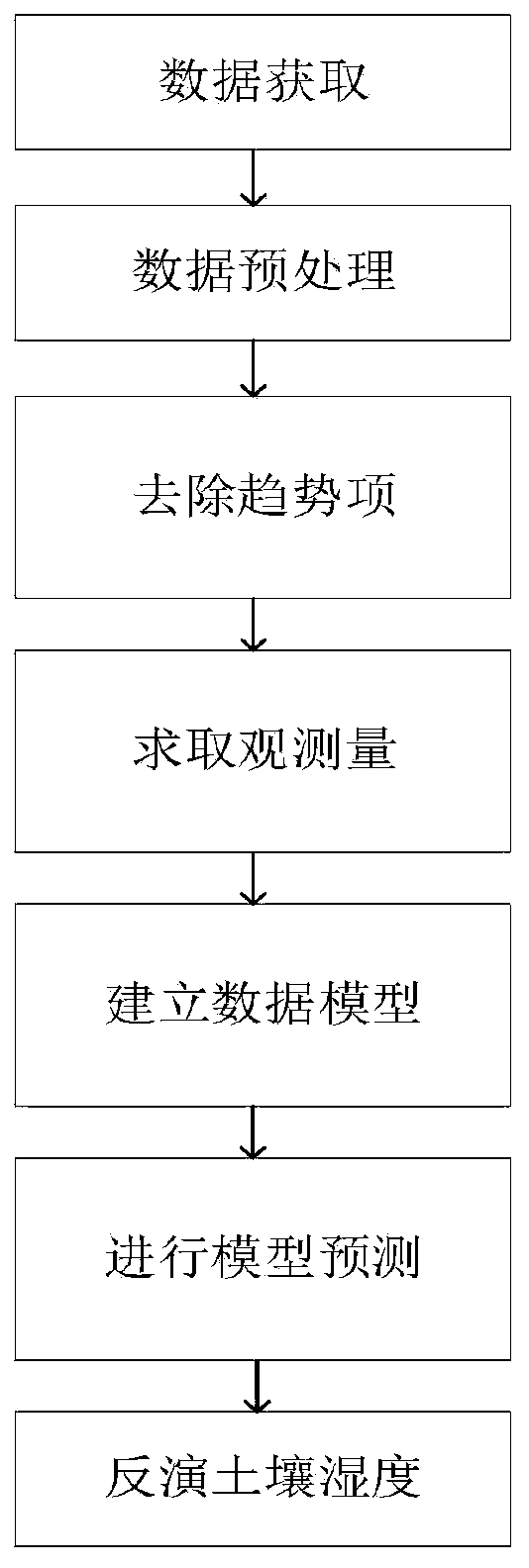
[0090] The semi-supervised fuzzy recognition model of the present invention has a process as follows: figure 1 shown, including the following steps:

[0091] Step 1: Data Acquisition

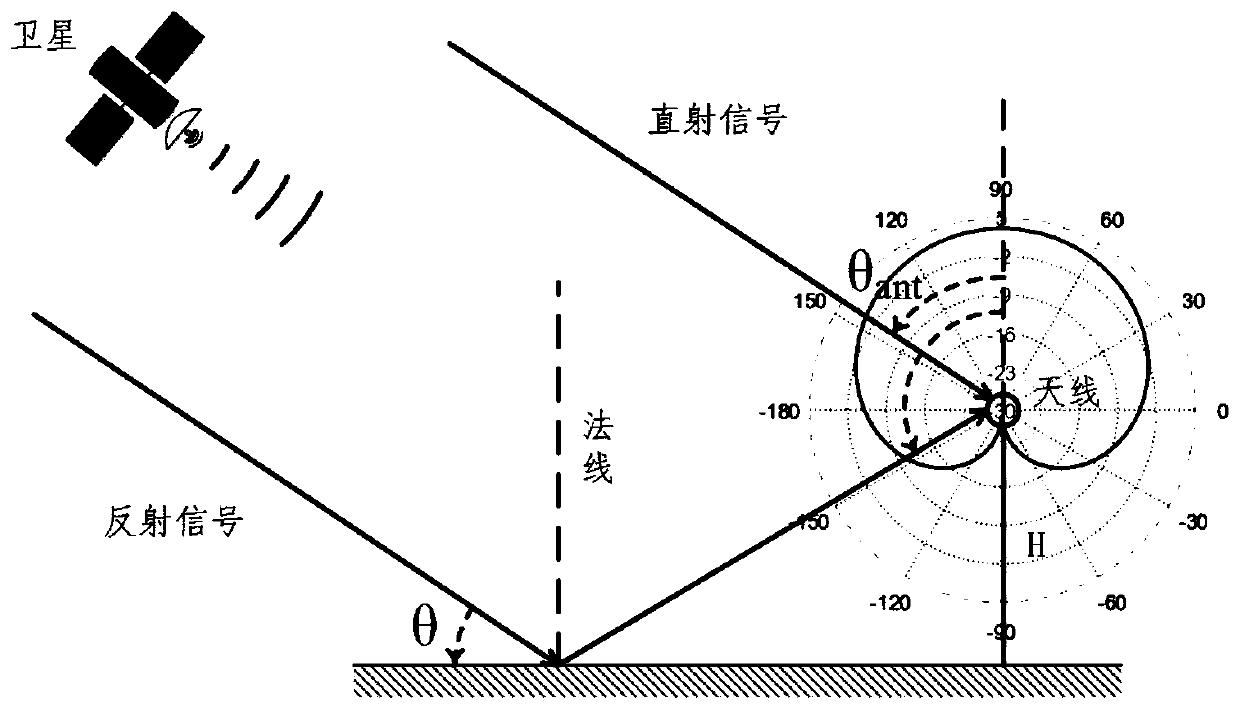
[0092] like figure 2 As shown in the figure, a surveying and mapping-level receiver is selected to be installed in the experimental site, output data in RINEX format, and obtain the required information from the O file and N file of the observation data; process the above O file and N file, and extract GPS and GLONASS satellites from them. Elevation, azimuth, UTC time and SNR data of different satellites. The extracted data is screened, and a low elevation angle is selected, and in the present embodiment, the data whose azimuth angle remains basically unchanged in the range of 2°-25° is selected;

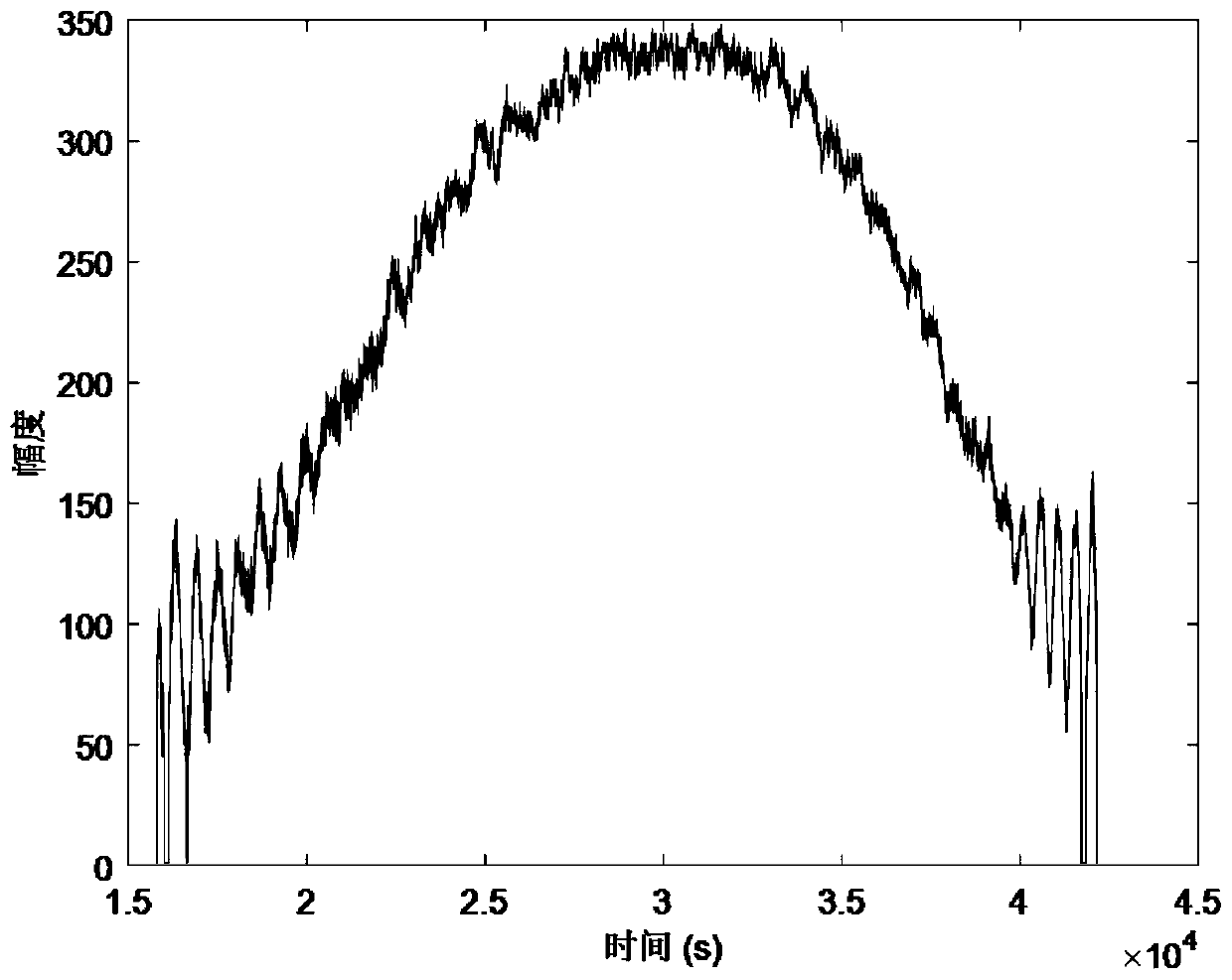
[0093] Step 2: Data Preprocessing

[0094] In the original SNR data, there are many noises, which are caused by complex factors such as hardware, weather, and temperature. Some data need to be r...

Embodiment 2

[0165] On the basis of Embodiment 1, the method for measuring soil moisture based on a semi-supervised fuzzy recognition model of the present invention includes the following steps:

[0166] Step 21: establish a semi-supervised fuzzy recognition model;

[0167] Step 22: Model prediction, bring the test data into the above model to test the model accuracy, predict soil moisture, and perform soil moisture inversion.

[0168] The working principle of this embodiment is: take the GPS and GLONASS frequency (f), amplitude (A) and phase (P) observations obtained in step 4 as the eigenvalue x of the sample in the model ij , take one of the GPS and GLONASS samples as an example, record the GPS frequency observation as x 11 , the GLONASS frequency observations are x 12 , the GPS phase observation is x 13 , the GLONASS phase observation is x 14 , the GPS amplitude observation is x 15 , the GLONASS amplitude observation is x 16 , so n sample eigenvalue matrices The soil moisture s...


PUM


Abstract

The invention discloses a semi-supervised fuzzy recognition model and a soil humidity measurement method based on the model and belongs to the technical field of soil humidity measurement. The methodcomprises steps of acquiring original data by establishing a foundation monitoring station; extracting data of a plurality of constellations and a plurality of satellites; acquiring signal-to-noise ratio data of different wave bands and the information such as an elevation angle and an azimuth angle; then screening the data, screening the signal-to-noise ratio data with a low elevation angle rangeand obvious oscillation, determining a weight, carrying out multi-satellite fusion, then removing a direct component to obtain an SNR multipath component, obtaining a main frequency through spectralanalysis, finally carrying out least square fitting of the signal-to-noise ratio to obtain an amplitude and phase observed quantity, and establishing a semi-supervised fuzzy recognition model. The method is advantaged in that by establishing the semi-supervised fuzzy recognition model and fusing GPS and GLONASS data, soil humidity is estimated, a theoretical reference is provided for later multi-satellite fusion, and problems in the prior art are solved.

Description

technical field [0001] The invention relates to a semi-supervised fuzzy identification model and a soil moisture measurement method based on the model, belonging to the technical field of soil moisture measurement. Background technique [0002] Soil moisture is an important indicator for agricultural environmental monitoring, a basic component of the global hydrological cycle, and a key parameter to describe the energy exchange between the land surface and the atmosphere. Accurately observing large-scale soil moisture is of great significance to agriculture, hydrology, and meteorology. Soil moisture determines the supply status of crops. If soil moisture is too low, photosynthesis cannot operate normally, reducing the yield and quality of crops. Severe water shortage causes crops to wither and die. Excessive soil humidity deteriorates soil aeration, affects the activities of soil microorganisms, hinders the respiration and growth of crop roots and other life activities, thus...

Claims


Application Information

Patent Timeline
Patent Type & Authority Applications(China)
IPC IPC(8): G01N27/22G01N22/04
CPCG01N27/223G01N27/221G01N22/04
Inventor 杨东凯荆丽丽常海宁
Owner 山东航向电子科技有限公司
Learn More