Novel high-temporal-spatial-resolution global ZTD vertical section grid model construction method

A technology with temporal and spatial resolution and vertical profiles, which is applied in the interdisciplinary fields of satellite navigation and positioning and meteorology, and can solve problems affecting model calculation efficiency, low model stability and accuracy, and many model parameters

Active Publication Date: 2020-08-14
GUILIN UNIVERSITY OF TECHNOLOGY
View PDF7 Cites 2 Cited by
  • Summary
  • Abstract
  • Description
  • Claims
  • Application Information

AI Technical Summary

Problems solved by technology

[0005] Through the above analysis, the existing problems and defects of the existing technology are: the existing tropospheric vertical profile model only uses single grid point data and monthly average profile data, resulting in low stability and accuracy of the established model. In addition, the existing tropospheric vertical profile model There are too many model parameters in the section grid model, which affects the calculation efficiency of the model

Method used


Image

  • Novel high-temporal-spatial-resolution global ZTD vertical section grid model construction method
  • Novel high-temporal-spatial-resolution global ZTD vertical section grid model construction method
  • Novel high-temporal-spatial-resolution global ZTD vertical section grid model construction method

Examples


Embodiment

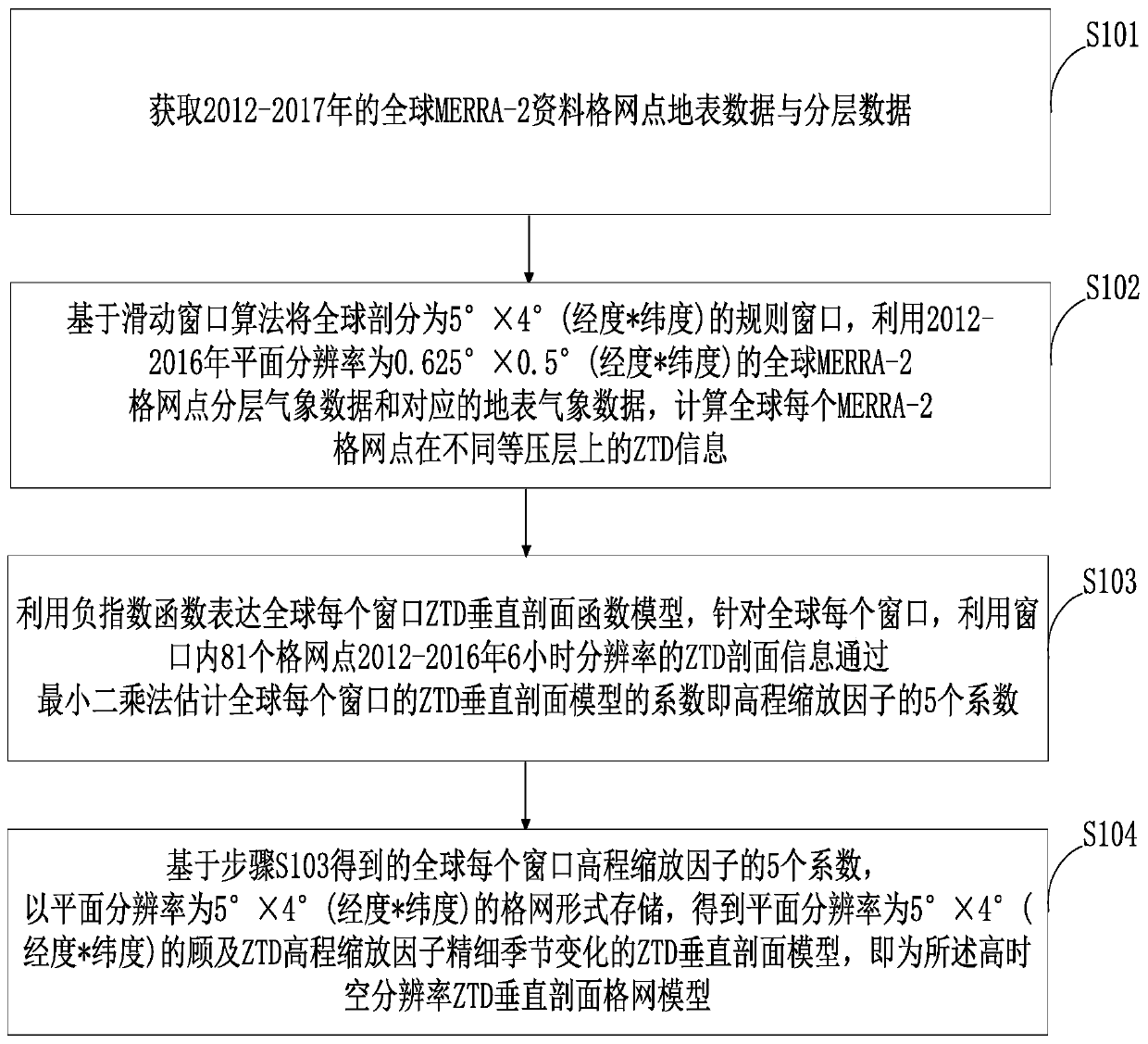
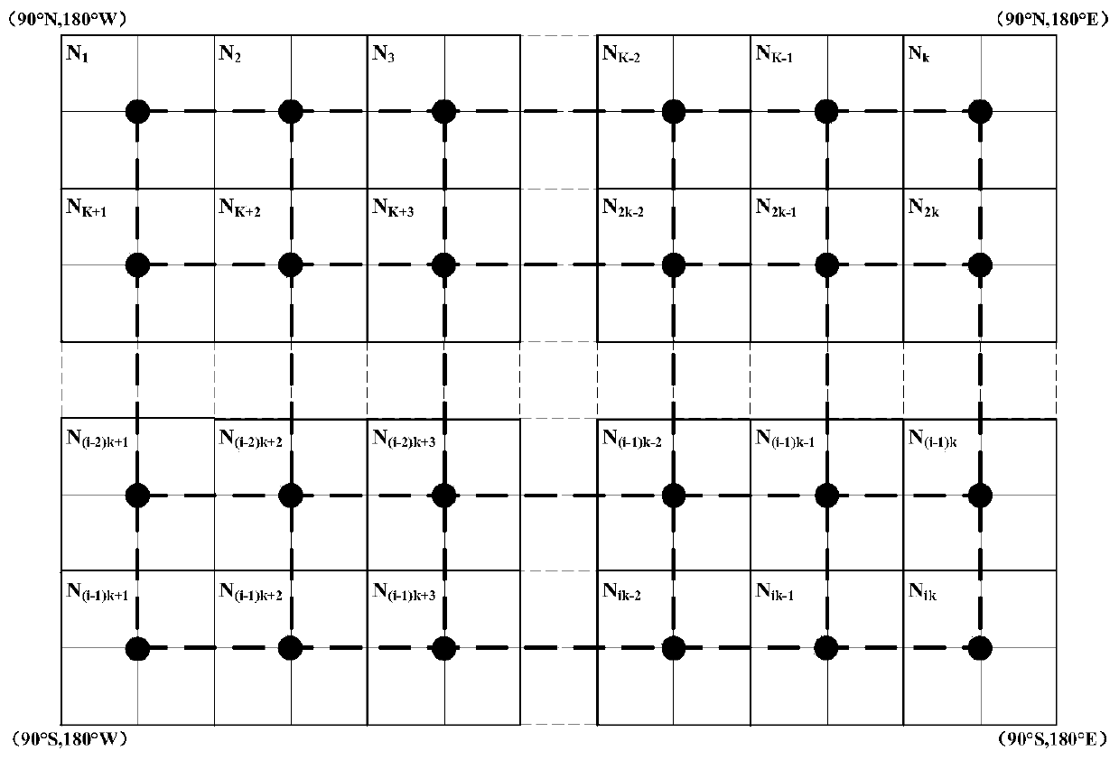
[0099] (1) Data source introduction. The MERRA-2 reanalysis data is used as the data source of the present invention, the horizontal resolution is 0.625°*0.5°, the time resolution is 6h, and the vertical resolution is 42 isobaric layers. Extract the global MERRA-2 data grid point surface data and layered data from 2012 to 2017 (each grid point is 42 layers of data), the layered data includes air pressure, potential height, specific humidity and temperature data, and the surface data includes Surface pressure, surface temperature, surface specific humidity data and corresponding surface elevation.

[0100] (2) Calculation principle of the tropospheric zenith delay (ZTD). ZTD can be obtained by integrating meteorological parameters in the zenith direction. At the same time, the ZTD value of each grid point on different isobaric layers can also be obtained through integral calculation. The integral formula for calculating ZTD is as follows:

[0101]

[0102]

[0103] ...


PUM


Abstract

The invention belongs to the technical field of satellite navigation positioning and meteorological crossing and discloses a novel high-temporal-spatial-resolution global ZTD vertical section grid model construction method. The method comprises the steps of dividing the whole world into regular windows of 5 degrees * 4 degrees based on a sliding window algorithm, expressing a ZTD vertical profilefunction model of each window of the whole world by utilizing a negative exponential function, and estimating a ZTD vertical profile model coefficient of each window of the whole world based on MERRA-2 reanalysis data; and based on the five coefficients of each window beta factor in the world, storing in the form of a grid with the plane resolution of 5 degrees * 4 degrees to obtain a global ZTD vertical section grid model with the plane resolution of 5 degrees * 4 degrees and considering the fine seasonal change of the elevation scaling factor. According to the global ZTD vertical section grid model established by the invention, the model parameters are better optimized, and the practicability of the model is improved.

Description

technical field [0001] The invention belongs to the intersecting technical field of satellite navigation and positioning and meteorology, and in particular relates to a new high temporal and spatial resolution global ZTD vertical section grid model construction method. Background technique [0002] At present, tropospheric delay is one of the main error sources in space geodesy such as Global Navigation Satellite System (GNSS), especially in GNSS real-time precise point positioning (PPP), which greatly affects the convergence time and elevation direction of GNSS PPP accuracy. Commonly used tropospheric delay models can be mainly divided into two categories: models requiring measured meteorological parameters and non-meteorological parameter models (not dependent on measured meteorological parameters). The accuracy of these tropospheric delay models depends largely on the accuracy of their vertical profile models, since the variation of tropospheric delay in elevation is muc...

Claims


Application Information

Patent Timeline
Patent Type & Authority Applications(China)
IPC IPC(8): G06F17/11G06F30/20
CPCG06F17/11G06F30/20
Inventor 黄良珂彭华刘立龙郭立杰康传利谢劭峰
Owner GUILIN UNIVERSITY OF TECHNOLOGY
Why Eureka
Try Eureka