Method and equipment for constructing simulation city model
A city model and construction method technology, applied in the field of simulation modeling, can solve problems such as the inability to realize the urban real scene environment, and the inability of three-dimensional modeling methods to restore the reality simply and effectively, so as to reduce fusion differences, improve aesthetics, and refine effect of structure
- Summary
- Abstract
- Description
- Claims
- Application Information
AI Technical Summary
Problems solved by technology
Method used
Image

Examples
Embodiment Construction
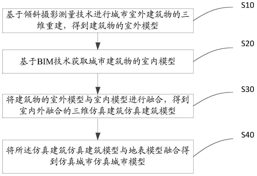
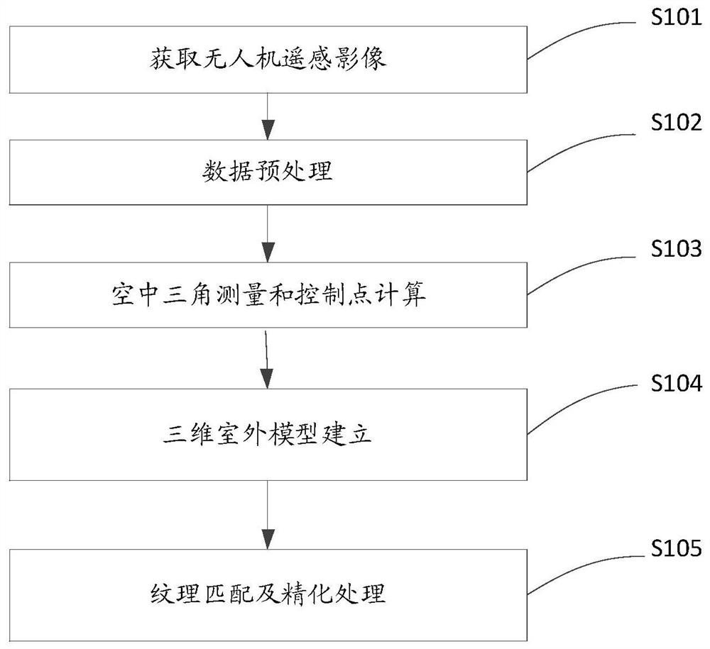
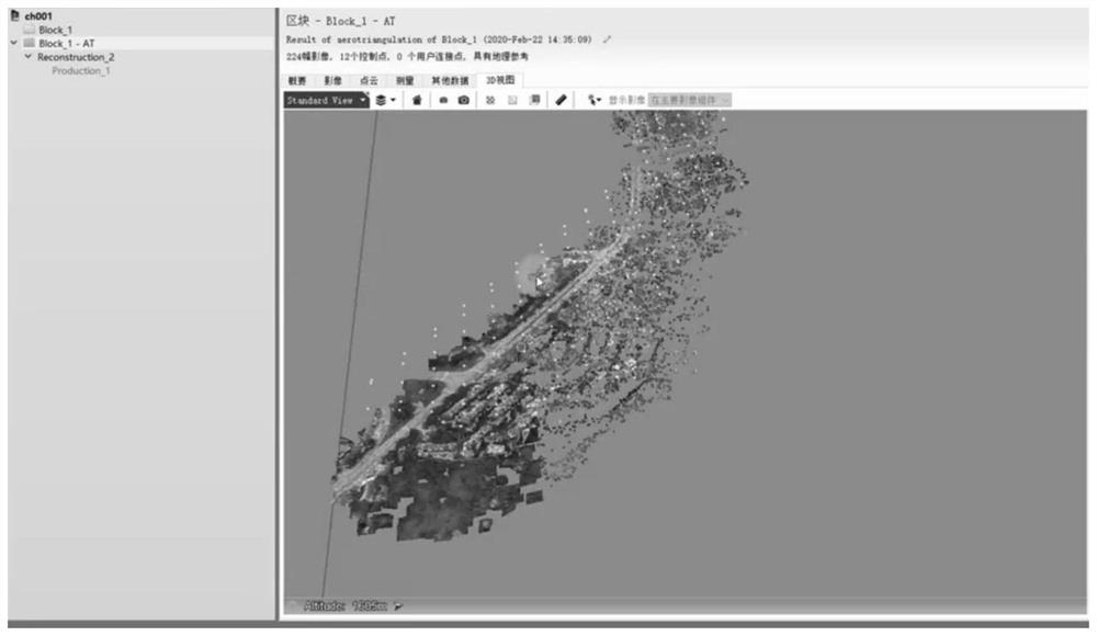
[0058] In order to make the object, technical solution and advantages of the present invention clearer, the present invention will be further described in detail below in conjunction with the accompanying drawings. Obviously, the described embodiments are only some embodiments of the present invention, rather than all embodiments . Based on the embodiments of the present invention, all other embodiments obtained by persons of ordinary skill in the art without making creative efforts belong to the protection scope of the present invention.
[0059] The application scenarios described in the embodiments of the present invention are to illustrate the technical solutions of the embodiments of the present invention more clearly, and do not constitute limitations on the technical solutions provided by the embodiments of the present invention. It appears that the technical solutions provided by the embodiments of the present invention are also applicable to similar technical problems...
PUM
 Abstract
Description
Claims
Application Information