

Flood routing process flooding range measurement method based on deep learning
A technology of inundation range and deep learning, which is applied in the field of inundation range measurement based on the deep learning process of flood evolution. The effect of small recognition error and good accuracy
- Summary
- Abstract
- Description
- Claims
- Application Information
AI Technical Summary
Problems solved by technology
Method used
Image

Examples
Embodiment
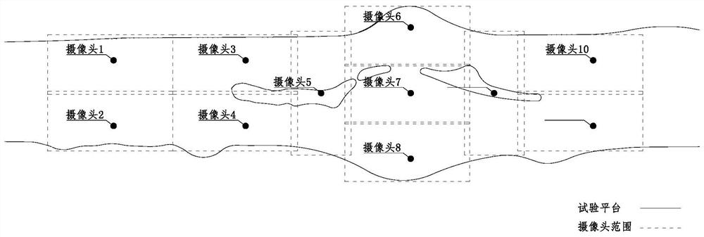
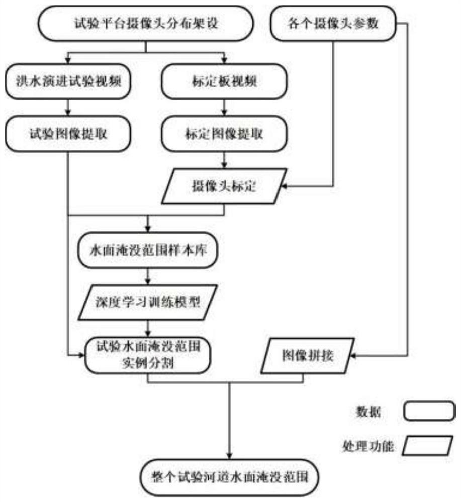
[0100] Step 1, the video data collection of the submerged range of the flood evolution test, a series of monitoring cameras are evenly arranged on the test platform, and the surface of the test platform is irradiated with a frontal perspective to obtain the video data collection during the test. The distribution of cameras should be reasonable, and the irradiation range should have sufficient overlap, such as figure 1 shown.
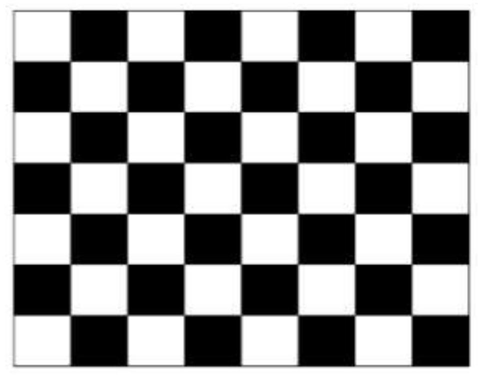
[0101] Step 2, use the checkerboard with alternate black and white squares as the calibration board, such as image 3 As shown, it is used as a calibration object for the camera. By collecting images (at least three images) of the calibration plate at different positions and angles, rich coordinate information of the images is obtained.
[0102] Step 3. According to the basic principle of camera perspective distortion correction, use the coordinate information collected by the calibration board and the built-in parameters of the camera to correct the cam...
PUM
 Abstract
Description
Claims
Application Information