Strip mine mining boundary and mining program collaborative optimization method under complex coal seam conditions
A mining realm and collaborative optimization technology, applied in underground mining, multi-objective optimization, design optimization/simulation, etc., can solve problems such as synchronous collaborative optimization of mining realm and mining program, and inability to synchronize analysis
- Summary
- Abstract
- Description
- Claims
- Application Information
AI Technical Summary
Problems solved by technology
Method used
Image
Examples
Embodiment 1
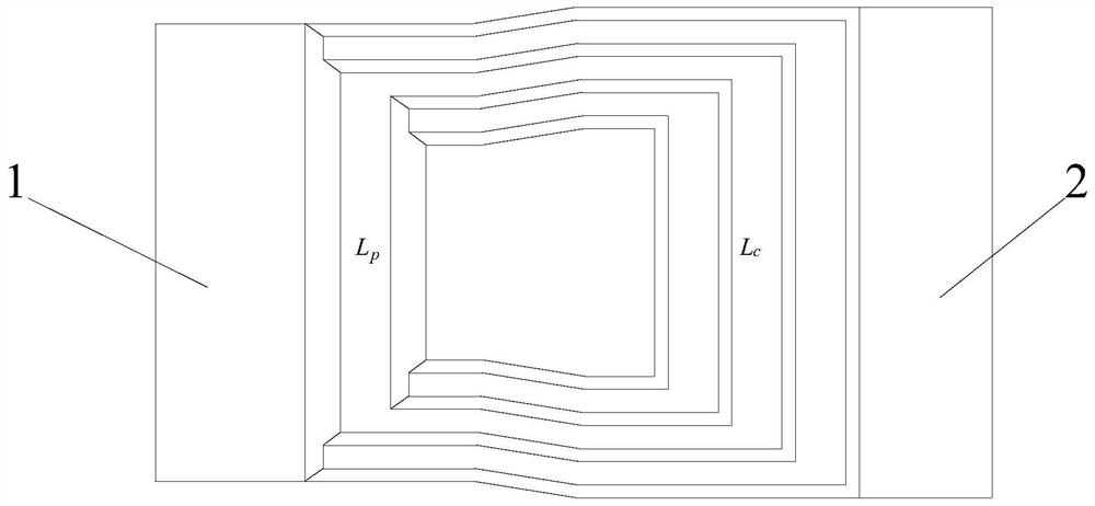
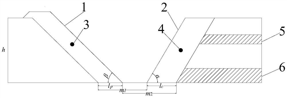
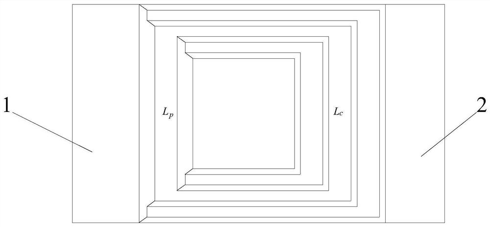
[0117] like Figure 1-9 As shown, the present invention provides a method for collaborative optimization of open-pit mine mining boundary and mining program under complex coal seam conditions, wherein, Figure 1-7 middle:
[0118] β is the side slope angle of the inner dump, °;
[0119] α is stope slope angle, °;
[0120] l c is stope advance distance, m;
[0121] l p is the advancing distance of the inner dump, m;
[0122] m 1 is the tracking distance of the inner row before the development of the inner dump in the stope, m;
[0123] m 2 is the tracking distance of the internal discharge after the development of the internal dump in the stope, m;
[0124] h is the height of the inner dump, m;
[0125] L c is the average working line length of the stope, m;
[0126] L p is the average working line length of the dump, m.
[0127] The optimization method includes the following steps:
[0128] Step S1, constructing the mining boundary model and the boundary model o...
Embodiment 2
[0217] The Huolinhe Coalfield is located in Huolingol City and Jhalut Banner, Inner Mongolia Autonomous Region. It is No. 2 coal with geological reserves of 11.92 billion tons, also known as aged lignite, with an average calorific value of 3100 kcal / kg. From north to south, the coalfield is divided into four exploration areas: the northern census area, the Shaerhure area, the second open-pit area, and the southwestern detailed investigation area. Huolinhe Coalfield No. 1 Open Pit Mine is 10km long from north to south, 3.4km wide from east to west, and has an approved mining surface area of 34.0013km 2 , mining depth from 864m to 432m elevation. The geographical coordinates are: east longitude 119°08′~119°46′, north latitude 45°10′~119°40′.
[0218] The Huolin Henan Open-pit Mine is located in Shaerhure Town. It was developed and constructed on September 1, 1981. The designed annual production capacity is 3 million tons. The scale of t annual output was handed over to produ...
PUM
 Abstract
Description
Claims
Application Information
 - R&D
- Intellectual Property
- Life Sciences
- Materials
- Tech Scout
- Unparalleled Data Quality
- Higher Quality Content
- 60% Fewer Hallucinations
Browse by: Latest US Patents, China's latest patents, Technical Efficacy Thesaurus, Application Domain, Technology Topic, Popular Technical Reports.
© 2025 PatSnap. All rights reserved.Legal|Privacy policy|Modern Slavery Act Transparency Statement|Sitemap|About US| Contact US: help@patsnap.com


