

Satellite remote sensing image color equalization method based on block adjustment
A satellite remote sensing image and regional network adjustment technology, applied in the field of satellite remote sensing image processing, can solve problems such as inability to solve, excessive computational overhead, and difficulty in measuring areas, and achieve the effect of improving the success rate
- Summary
- Abstract
- Description
- Claims
- Application Information
AI Technical Summary
Problems solved by technology
Method used
Image

Examples
Embodiment
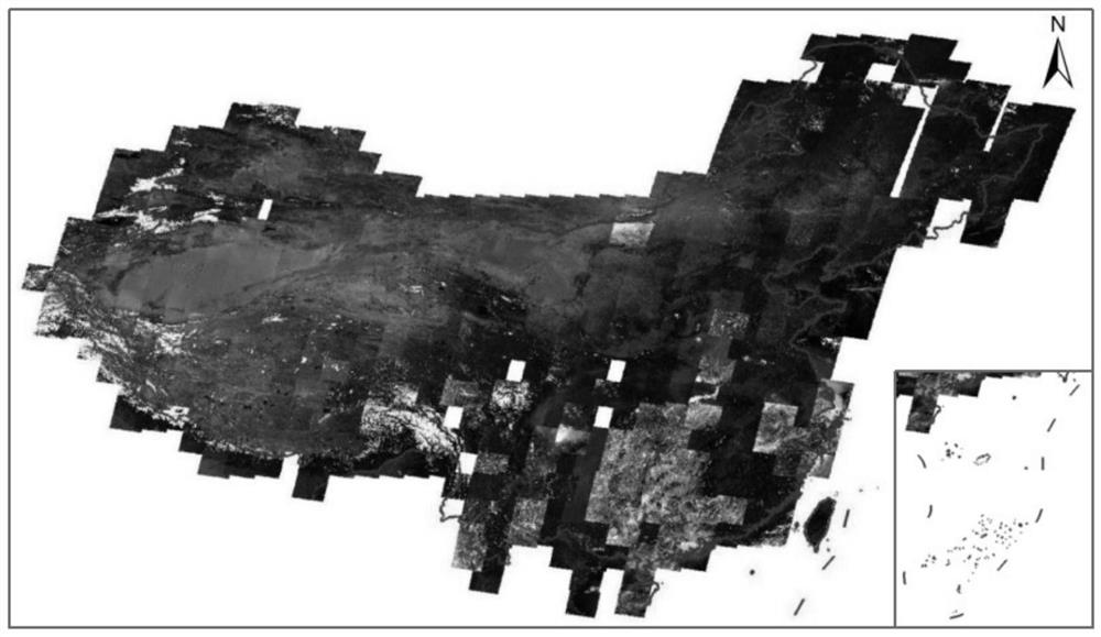
[0140]In this embodiment, a color consistency processing experiment between images based on block adjustment is carried out for Landsat5 satellite remote sensing images (bands B1, B2 and B3) covering mainland China. Due to serious image quality problems in some images, the images in some areas of my country are missing. After screening, there are 513 images left. The size of each image is 7500×8500 pixels, and its ground resolution is 30m. All images have been radiometrically and geometrically corrected between 2010 and 2010. The original image without any image enhancement and uniform light and color processing is as follows: image 3 As shown in the figure, it can be seen from the figure that a large number of images show low contrast, and the image is generally dark, which will inevitably affect the subsequent image uniformity and color uniformity processing of the image, the visual effect is extremely poor, and there are obvious brightness and color inconsistencies between ...
PUM
 Abstract
Description
Claims
Application Information