

High-resolution satellite image data batch preprocessing method
A technology for image data and satellite imagery, applied in image data processing, special data processing applications, still image data retrieval, etc., which can solve the problems of time-consuming and inability to realize batch processing of GF-1 and GF-2 remote sensing data.
- Summary
- Abstract
- Description
- Claims
- Application Information
AI Technical Summary
Problems solved by technology
Method used
Image

Examples
Embodiment Construction
[0028] The specific implementation manners of the present invention will be further described in detail below in conjunction with the accompanying drawings.
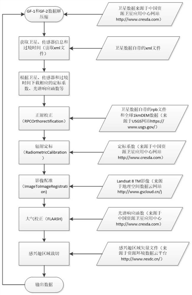
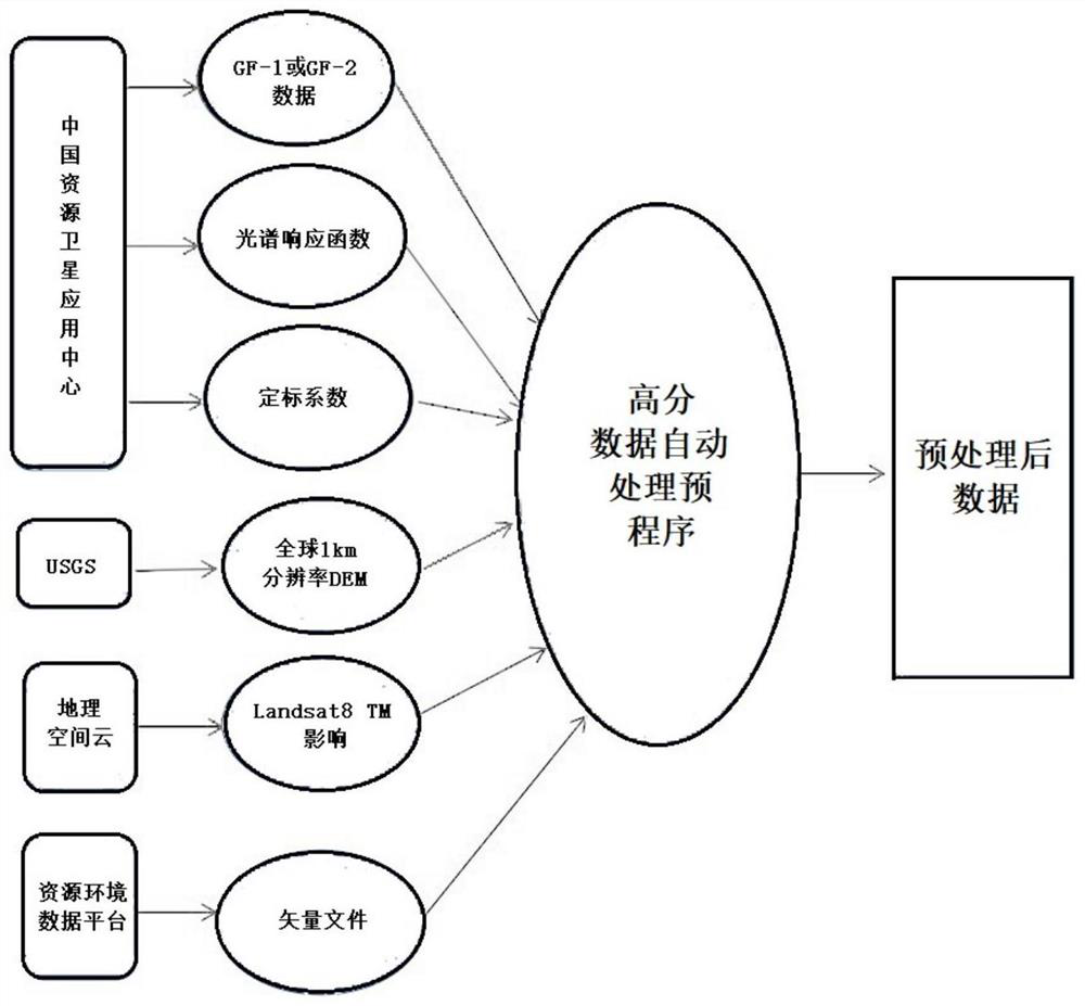
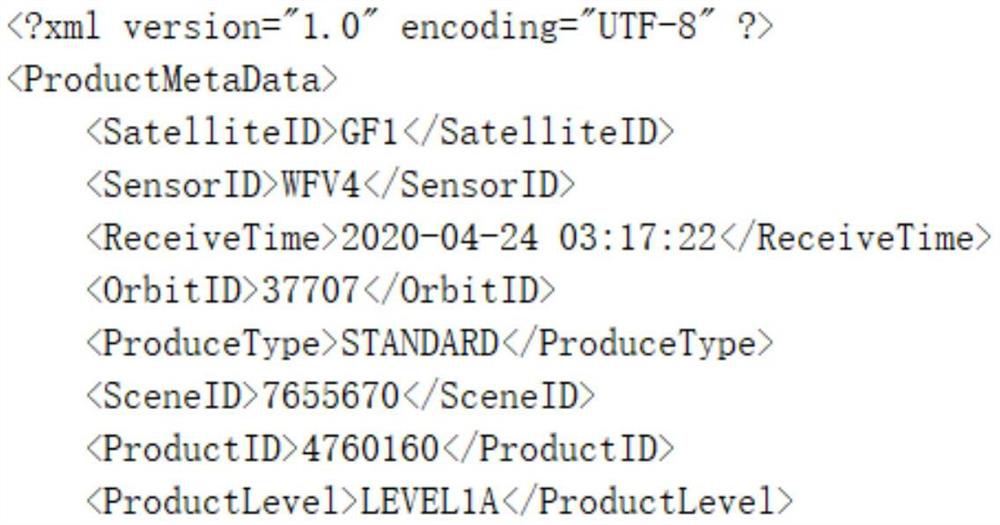
[0029] The present invention designs a batch preprocessing method of high-resolution satellite image data, which is used for preprocessing the high-resolution satellite image compression package storing a single high-resolution satellite image, and obtaining the target area image data of a single high-resolution satellite image. , in practical applications, the high-resolution satellite image includes at least one of the GF-1 high-resolution satellite image and the GF-2 high-resolution satellite image, and the method is specifically performed as follows.
[0030] Firstly, the data obtained from the website of China Resources Satellite Application Center (http: / / www.cresda.com / CN / ) is a compressed file in *.tar.gz format, that is, a high-resolution satellite image is stored in a compressed package. The compressed package ...
PUM
 Abstract
Description
Claims
Application Information