

SAR and optical image fusion method and system for landslide detection
A technology of optical image and fusion method, which is applied in the direction of instruments, scene recognition, calculation, etc., and can solve problems such as large amount of calculation
- Summary
- Abstract
- Description
- Claims
- Application Information
AI Technical Summary
Problems solved by technology
Method used
Image

Examples
Embodiment 1
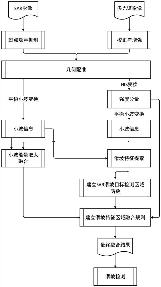
[0081] like figure 1 As shown, the SAR and optical image fusion method for landslide detection according to the embodiment of the present invention includes the following steps:
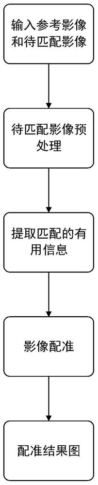
[0082] Step 1. Preprocess SAR image and optical image;
[0083] Step 2. Perform HIS transformation on the optical image to obtain three components I, H and S;
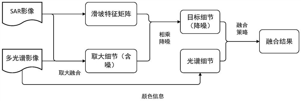
[0084] Step 3, performing stationary wavelet transform on the I component of the SAR image and the optical image and taking large fusion of high frequency component energy;
[0085] Step 4. Perform the characteristic detection of landslides on the low-frequency and high-frequency components of the SAR image and the grayscale information of the image itself, establish a SAR landslide target detection area function, and partition the SAR image;
[0086] Step 5. Establish the landslide feature area fusion rule, and realize image fusion according to the sub-area fusion strategy;
[0087] Step 6: Extract landslide disaster information based on ...
Embodiment 2
[0214] This embodiment provides a landslide detection-oriented SAR and optical image fusion system, which includes:
[0215] Image preprocessing unit, which preprocesses SAR images and optical images;
[0216] The HIS transformation unit performs HIS transformation on the optical image to obtain three components I, H and S;
[0217] The large energy fusion unit performs stationary wavelet transform on the I component of the SAR image and the optical image and the high frequency component energy fusion;
[0218] SAR landslide target detection area function establishment unit, which respectively performs characteristic detection of landslides on the low-frequency and high-frequency components of the SAR image and the grayscale information of the image itself, establishes the SAR landslide target detection area function, and partitions the SAR image;
[0219] The image fusion unit establishes the landslide feature area fusion rules, and realizes the image fusion according to the...
PUM
 Abstract
Description
Claims
Application Information