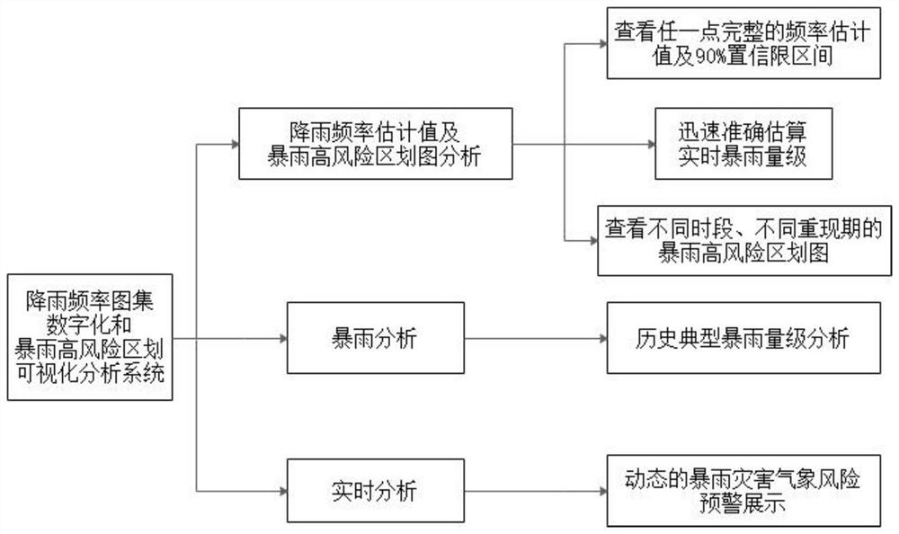
Rainfall frequency atlas digitization and rainstorm high-risk zoning visual analysis system
An analysis system and high-risk technology, applied in the field of digitalization of rainfall frequency atlas and visual analysis system of rainstorm high-risk zoning, can solve problems such as instability, low accuracy, experience, subjectivity, and arbitrariness
- Summary
- Abstract
- Description
- Claims
- Application Information
AI Technical Summary
Problems solved by technology
Method used
Image
Examples
Embodiment Construction
[0088] The specification and claims do not use the difference in name as a way to distinguish components, but use the difference in function of components as a criterion for distinguishing. As mentioned throughout the specification and claims, "comprising" is an open term, so it should be interpreted as "including but not limited to". "Approximately" means that within an acceptable error range, those skilled in the art can solve the technical problem within a certain error range and basically achieve the technical effect.
[0089] 1. System establishment
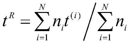
[0090] The digitization of the rainfall frequency atlas and the visual analysis system of the rainstorm high-risk zoning are based on the "regional linear moment method" of the hydrometeorological approach. On this basis, the spatial interpolation technique is used to obtain the spatial distribution of the maximum rainfall intensity in rainfall events of different durations and frequencies (return periods) in the study area...
PUM
 Abstract
Description
Claims
Application Information
 - R&D
- Intellectual Property
- Life Sciences
- Materials
- Tech Scout
- Unparalleled Data Quality
- Higher Quality Content
- 60% Fewer Hallucinations
Browse by: Latest US Patents, China's latest patents, Technical Efficacy Thesaurus, Application Domain, Technology Topic, Popular Technical Reports.
© 2025 PatSnap. All rights reserved.Legal|Privacy policy|Modern Slavery Act Transparency Statement|Sitemap|About US| Contact US: help@patsnap.com


