

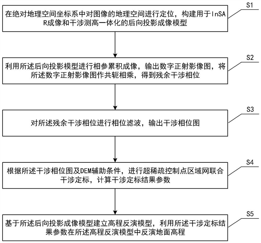
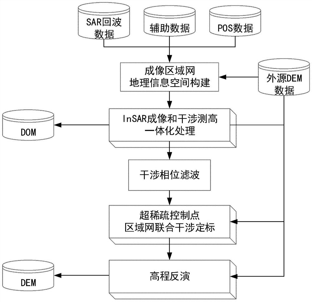
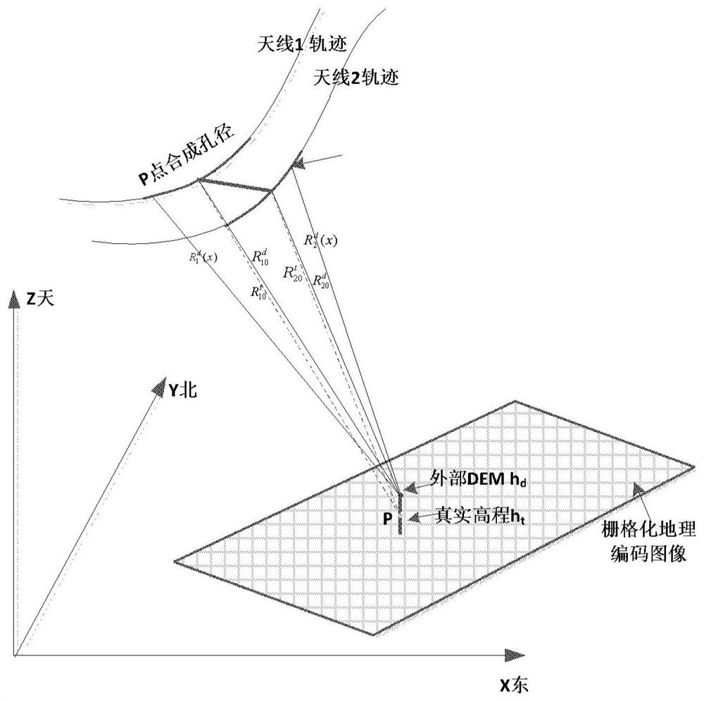
InSAR imaging and interference integrated processing method
A processing method, imaging interference technology, applied in the direction of radio wave reflection/re-radiation, using re-radiation, measuring devices, etc., can solve the problem of not fully utilizing the potential of DEM auxiliary processing, DEM auxiliary information is not covered, and filtering has not yet been seen. Issues such as phase unwrapping can avoid DEM and SAR data matching, motion compensation and phase maintenance with high precision, and avoid multi-view image stitching
- Summary
- Abstract
- Description
- Claims
- Application Information
AI Technical Summary
Problems solved by technology
Method used
Image

Examples
Embodiment Construction
[0036] In order to make the object, technical solution and advantages of the present invention clearer, the present invention will be described in further detail below in conjunction with specific embodiments and with reference to the accompanying drawings.
[0037] In this disclosure, the terms "include" and "comprising" and their derivatives mean to include but not to limit; the term "or" is inclusive, meaning and / or.
[0038] In this specification, the various embodiments described below to describe the principles of the present disclosure are illustrative only and should not be construed in any way to limit the scope of the disclosure. The following description with reference to the accompanying drawings is provided to assist in a comprehensive understanding of exemplary embodiments of the present disclosure as defined by the claims and their equivalents. The following description includes numerous specific details to aid in understanding, but these should be considered as...
PUM
 Abstract
Description
Claims
Application Information