River hydrographic survey method and device
A hydrological measurement and river technology, applied in the direction of measuring devices, fluid velocity measurement, liquid/fluid solid measurement, etc., can solve the problems of flow influence, river bottom shape change, inaccurate measurement results, etc., and achieve the effect of ensuring accuracy
- Summary
- Abstract
- Description
- Claims
- Application Information
AI Technical Summary
Problems solved by technology
Method used
Image
Examples
Embodiment 1
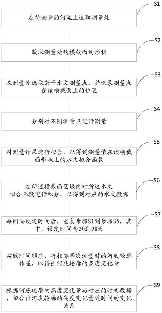
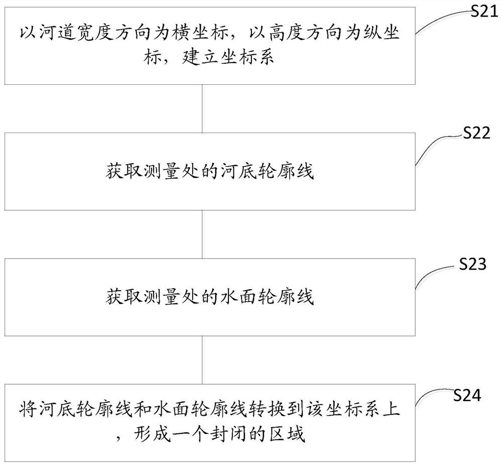
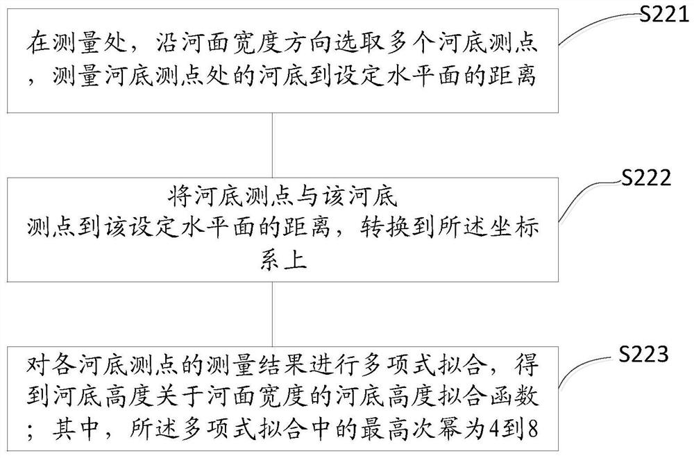
[0064] Please refer to Figure 1 to Figure 4 , This embodiment proposes a river hydrological measurement method, wherein, the method is used to measure rivers with a river surface width of 3-50 meters.
[0065] Specifically, this embodiment includes the following steps:
[0066] Please refer to figure 1 , S1, select the measurement location on the river to be measured. When choosing a measurement point, it is better to choose a place with flat river bank and relatively slow water flow. At the same time, when measuring, try to choose weather with lower wind speed as much as possible.
[0067] S2. Obtain the shape of the cross-section at the measurement location; specifically, the shape of the cross-section referred to here refers to the shape of the cross-section of the river water at the measurement location. That is, the cross-sectional shape of the water flow from the water level to the bottom of the river. The water surface caused by the unequal current velocity is not...
Embodiment 2
[0118] This embodiment proposes a river hydrological measurement device, including a cableway installed horizontally on the river, a water flow velocity measuring instrument, a sediment concentration detector and a water level gauge hoisted on the cableway; wherein, the water flow velocity measuring instrument, the sediment concentration detection instrument Instrument and water level gauge are all prior art, no longer explain separately here.
[0119] It also includes a fixed pile fixedly arranged on the river bank, and a horizontal laser instrument is arranged on the fixed pile, and the horizontal laser instrument is used to form a reference surface. The function of the fixed pile is to facilitate the placement of the horizontal laser, and to ensure that the horizontal laser planes produced by the horizontal laser are equal during different measurements, so as to eliminate errors caused by different reference surfaces.
[0120] Both the water velocity meter and the sand conc...
PUM
 Abstract
Description
Claims
Application Information
 - R&D
- Intellectual Property
- Life Sciences
- Materials
- Tech Scout
- Unparalleled Data Quality
- Higher Quality Content
- 60% Fewer Hallucinations
Browse by: Latest US Patents, China's latest patents, Technical Efficacy Thesaurus, Application Domain, Technology Topic, Popular Technical Reports.
© 2025 PatSnap. All rights reserved.Legal|Privacy policy|Modern Slavery Act Transparency Statement|Sitemap|About US| Contact US: help@patsnap.com


