Soil layering information identification method and device based on ground penetrating radar
A ground-penetrating radar and soil layering technology, applied in the field of agricultural informatization, can solve the problem of insignificant differences in soil texture
- Summary
- Abstract
- Description
- Claims
- Application Information
AI Technical Summary
Problems solved by technology
Method used
Image

Examples
Embodiment Construction
[0062] In order to make the objectives, technical solutions and advantages of the embodiments of the present invention clearer, the present invention will be further described in detail below with reference to the embodiments. Obviously, the described embodiments are some, but not all, embodiments of the present invention. Based on the embodiments of the present invention, all other embodiments obtained by those of ordinary skill in the art without creative efforts shall fall within the protection scope of the present invention.
[0063] The technical solution of the present invention is further described below by taking the comprehensive land improvement project area located in Quzhou County, Hebei Province as an example.
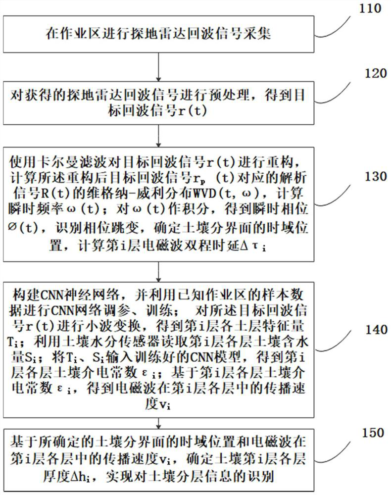
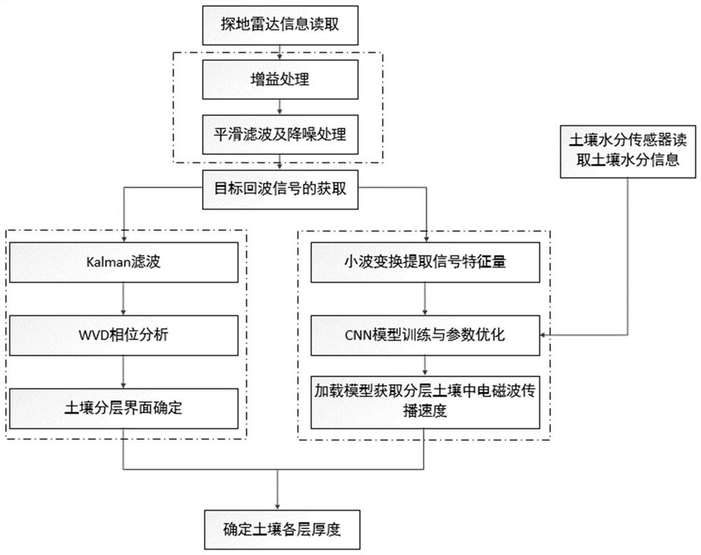
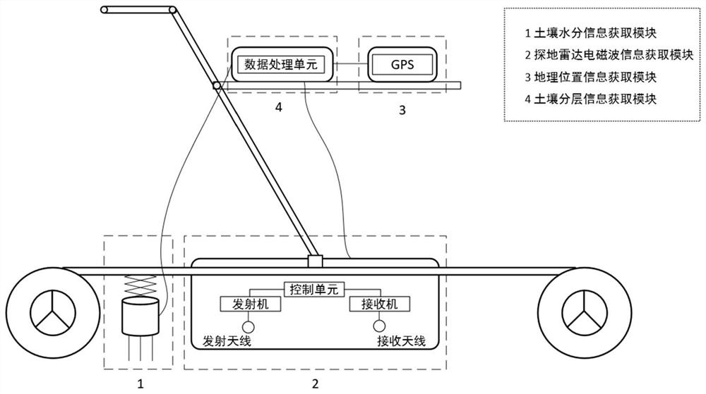
[0064] In one embodiment, for a schematic flowchart of the method for identifying soil stratification information based on the ground penetrating radar of the present invention, please refer to the appendix. figure 1 and figure 2 , the ground penetratin...
PUM
 Abstract
Description
Claims
Application Information