

Railway bridge geological graph digital storage and application method
A geological and railway technology, applied in special data processing applications, geographic information databases, database indexes, etc., can solve the problems of design efficiency and design accuracy need to be improved, and the amount of geological data is large, so as to improve the labor efficiency of employees and reduce labor. Strength, the effect of speeding up the design progress
- Summary
- Abstract
- Description
- Claims
- Application Information
AI Technical Summary
Problems solved by technology
Method used
Image

Examples
Embodiment 1
[0065] According to the engineering geological conditions of the whole line, the formation index database of the whole line is established, and the geotechnical index table and engineering classification table in the library are shown in Table 1 and Table 2 respectively.
[0066] Table 1 Stratigraphic index database of the whole line - rock and soil index table
[0067]
[0068]
[0069] Table 2 Stratigraphic index library of the whole line - industrial economic classification table
[0070]
[0071] The brackets in the "Basic Bearing Capacity" column in Table 2 indicate the range of bearing capacity.
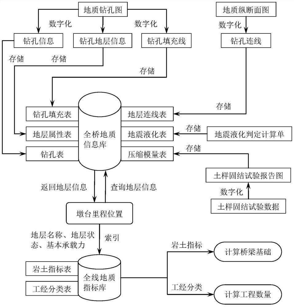
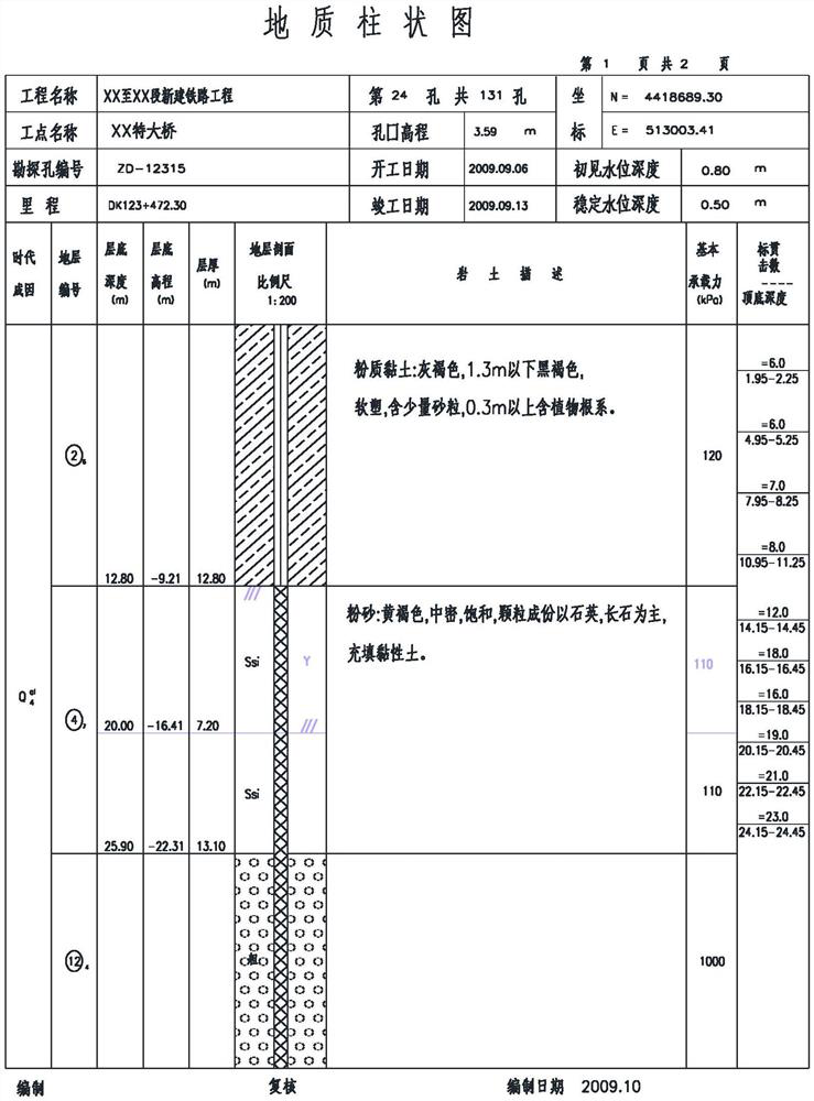
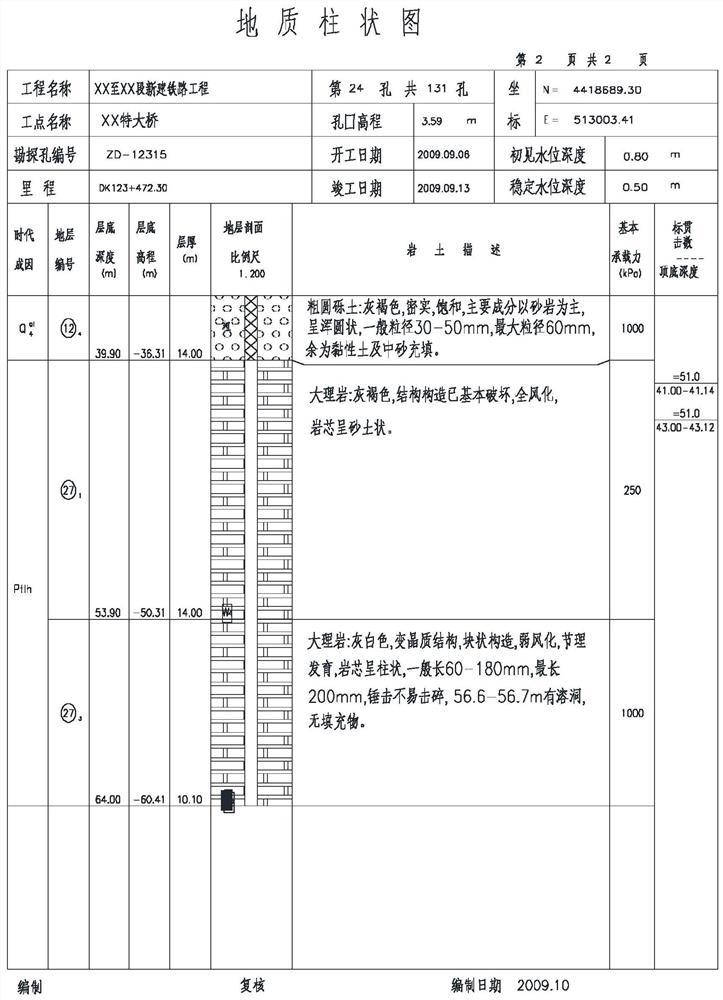
[0072] Analyzing the basic features of geological borehole maps, see figure 2 , summarize the characteristic parameter table, see Table 3, according to the digitization method of the present invention, obtain borehole table, stratum attribute table, borehole filling table and see Table 4, Table 5, Table 6 respectively.
[0073] Table 3 Characteristic parameter list ...
PUM
 Abstract
Description
Claims
Application Information