
Drainage basin flood control visualization method and system based on digital twinning

A watershed, twinning technology, applied in climate change adaptation, image data processing, still image data indexing, etc., can solve the problem of the inability to achieve timely update of watershed flood control images, stepless smooth and smooth scaling, affecting the visualization effect of watershed flood control, and unfavorable promotion and use, etc. problems, to achieve the effect of improving visualization, improving data utilization, and facilitating promotion and use

Active Publication Date: 2022-07-29
浙江远算科技有限公司
View PDF18 Cites 0 Cited by
  • Summary
  • Abstract
  • Description
  • Claims
  • Application Information

AI Technical Summary

Problems solved by technology

[0005] Especially for watershed flood control scenarios, the water environment may change greatly in a short period of time, and real-time updates are required. If the above scheme is adopted, the amount of data in the watershed will be too large, and it will not be possible to update the flood control image in time and achieve stepless smoothness Scaling affects the visual effect of flood control in the river basin, and the user experience is poor, which is not conducive to promotion and use

Method used


Image

  • Drainage basin flood control visualization method and system based on digital twinning
  • Drainage basin flood control visualization method and system based on digital twinning

Examples


specific Embodiment

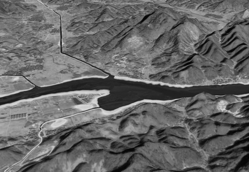
[0078] A digital twin-based visualization method for watershed flood control, including the following steps:

[0079] The first step is to obtain the latitude and longitude of a basin and surrounding landforms;

[0080] In the second step, according to the latitude and longitude in the first step, the watershed vector data is obtained;

[0081] The third step is to slice the watershed vector data in the second step to obtain watershed tiles;

[0082] The fourth step is to split the watershed tiles in the third step to obtain the water area image index and the water area tile image;

[0083] The water area image index and the water area tile image are associated through views, and several water area tile image indexes point to the same water area image, thereby greatly reducing redundant storage of solid-color water area images, improving disk utilization and water area image retrieval efficiency;

[0084] In the fifth step, the watershed map is obtained according to the wate...


PUM


Abstract

The invention discloses a drainage basin flood control visualization method and system based on digital twinning, and belongs to the technical field of drainage basin flood control. In an existing watershed flood control visualization technology, the watershed data size is too large, and the watershed flood control visualization effect is affected. According to the digital twinning-based drainage basin flood control visualization method, drainage basin tiles are obtained through drainage basin vector data; splitting the drainage basin tiles to obtain a water area image index and a water area tile image; the water area image indexes and the water area tile images are associated in a view mode, and the multiple water area tile image indexes point to the same water area image, so that redundant storage of the pure-color water area images is greatly reduced, the data utilization rate and the water area image retrieval efficiency are improved, the data size of drainage basin data is effectively reduced, and the water area image retrieval efficiency is improved. The drainage basin fusion image can be updated in real time conveniently, the drainage basin flood control visualization effect is improved, the user experience is good, and application and popularization are facilitated.

Description

technical field [0001] The invention relates to a digital twin-based visualization method and system for flood control in river basins, and belongs to the technical field of flood control in river basins. Background technique [0002] Chinese Patent (Announcement No.: CN 113593051B) discloses a real scene visualization method, including the construction of a simulation model and the construction of a scene model. The construction method of the scene model includes the following steps: the first step is to input coordinates or place names, select a model area, and generate a texture map for the selected model area; in the second step, obtain the height information of the geographic information system GIS for the selected model area, optimize the processing of the elevation value, and generate a 3D topographic map; the third step, convert the texture in the first step The map is pasted on the surface of the 3D topographic map in the second step to generate a scene model; after...

Claims


Application Information

Patent Timeline
IPC IPC(8): G06T17/20G06T19/20G06T17/05G06T5/50G06F16/53G06F16/51
CPCG06T17/20G06T17/05G06T5/50G06T19/20G06F16/51G06F16/53G06T2207/20221Y02A10/40
Inventor 甘振文闵皆昇梁兵吴健明
Owner 浙江远算科技有限公司
Learn More