Treating method for land investigation information data

A technology for data processing and land survey, applied in electrical digital data processing, special data processing applications, data collection and recording, etc. The effect of reducing labor intensity and improving work efficiency

Inactive Publication Date: 2005-03-02
SOUTHEAST UNIV
View PDF0 Cites 22 Cited by
  • Summary
  • Abstract
  • Description
  • Claims
  • Application Information

AI Technical Summary

Problems solved by technology

[0006] a. Absolute positioning is not possible. When measuring the inflection point of ground features, a reference object is required, and field personnel are required to have good measurement expertise;
[0007] b. Mainly manual work, which takes a long time, slow speed, many steps, complicated procedures and high labor intensity;
[0008] c. The information obtained

Method used


Image

  • Treating method for land investigation information data
  • Treating method for land investigation information data
  • Treating method for land investigation information data

Examples


Embodiment Construction

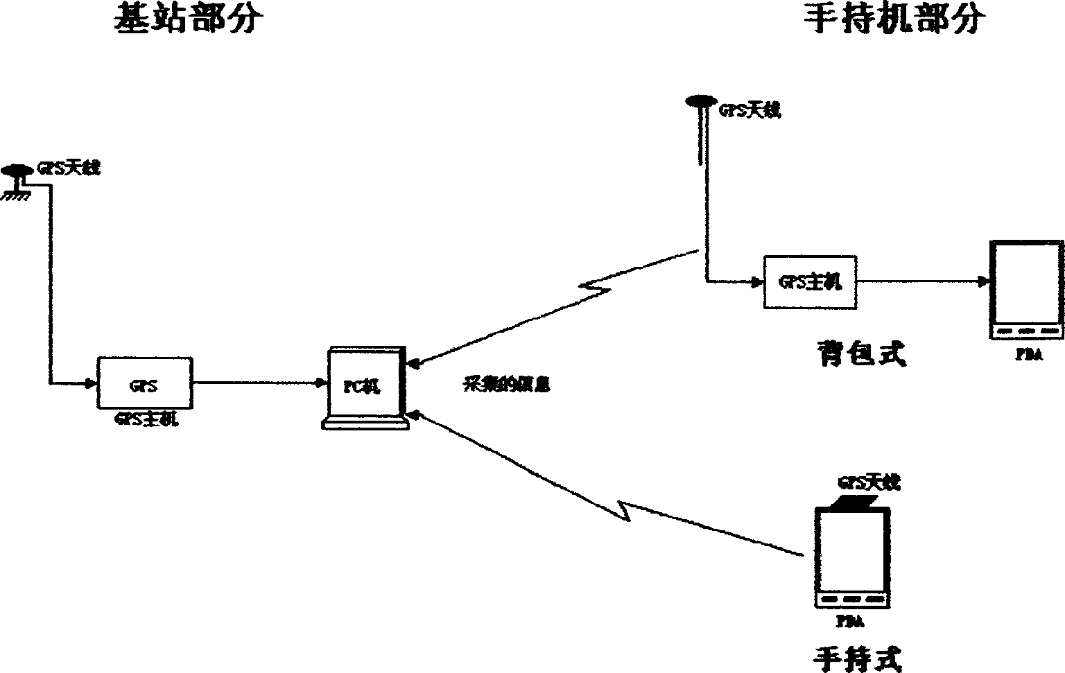
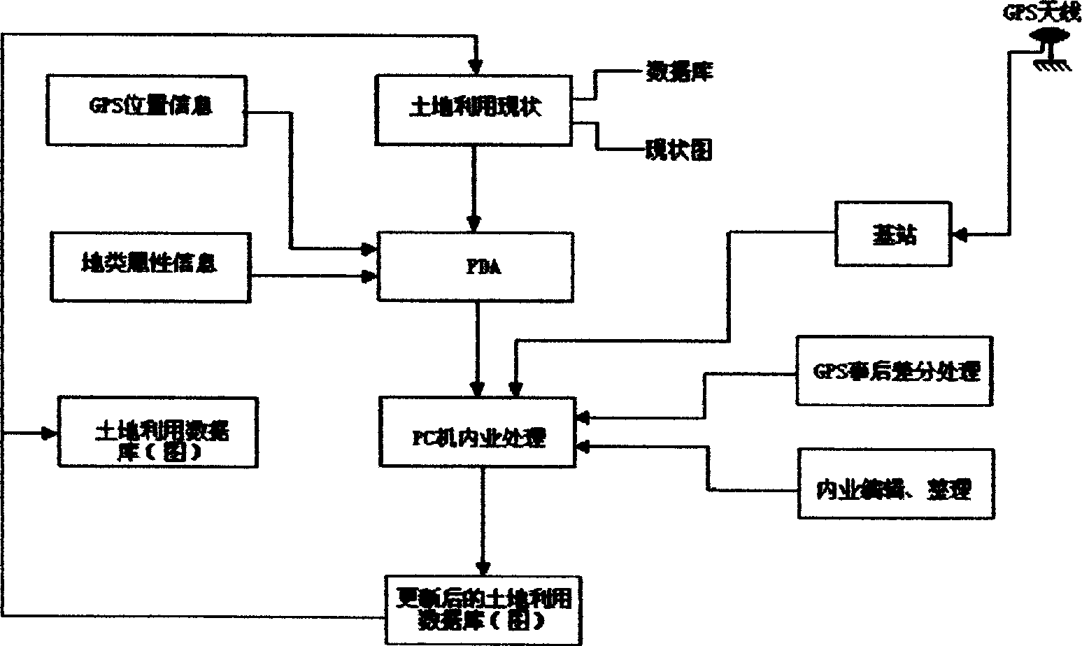
[0057] The system consists of the following parts (such as figure 1 ),

[0058] 1. Base station part: GPS and other hardware can use general GPS host, no special requirements;

[0059] 2. Handheld PDA: PDA includes handheld computer, digital mobile terminal, tablet computer; operating system includes WindowsCE, Linux, Palm and other embedded operating systems;

[0060] 3. Backpack GPS host: single-frequency (including pseudorange, carrier phase output) GPS motherboard, dual-frequency (L1 and L2) GPS motherboard, and other forms of GPS motherboard.

[0061] Another patent protection of this system;

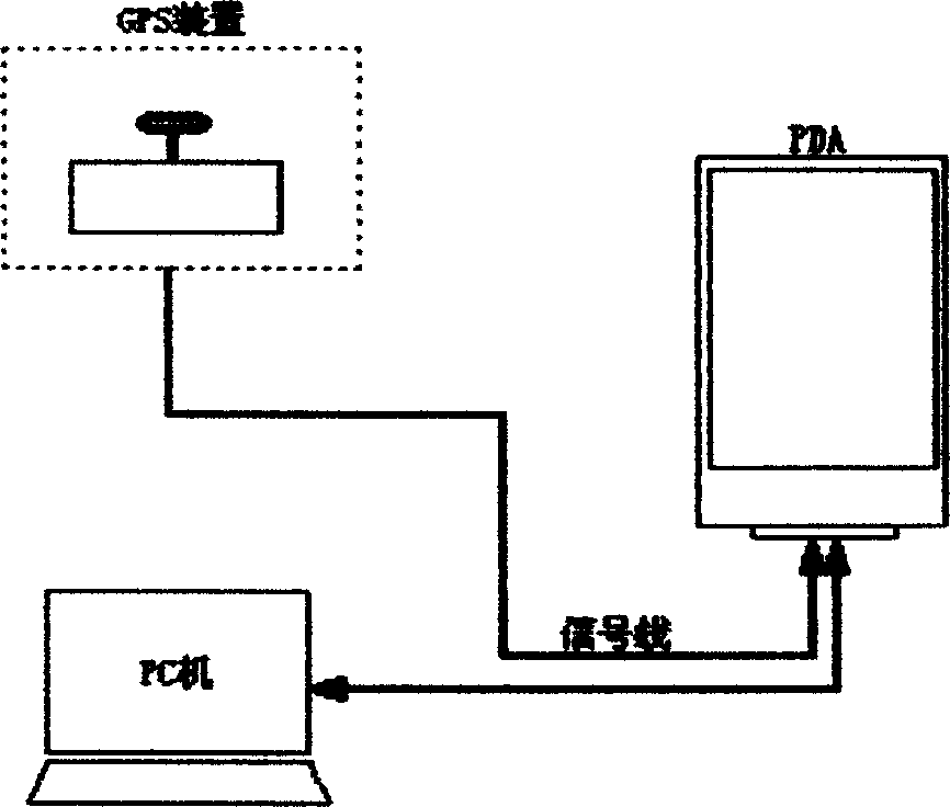
[0062]4. Handheld GPS+PDA: Built-in or external GPS antenna, GPS host is placed in the PDA host, GPS host has pseudo-range, carrier phase output or only pseudo-range output or dual-frequency carrier phase output, but must have position Data output in real time.

[0063] Such as figure 1 In the base station, the GPS antenna and the GPS host computer are used to receive the posi...


PUM


Abstract

The land investigating data processing method is one solution for land investigating operation system. In field operation, the land utilizing state vector diagram, compressed remote sensing image diagram and linear programming diagram are led into PDA; GPS receiver is used to receive satellite data, the received data are software analyzed in PDA to extract information and the information after coordinate conversion and matching with original diagram is displayed on the PDA screen. By means of the special software in PDA, the GPS locating points, the points in the vector diagram, the points in the screen or distance joining points are selected to constituted into investigating graph. The land investigating information of the graph is registered, and the graphic and attribute information is maintained. Through indoor operations including introducing the field collected information, etc., the land utilizing data base may be updated.

Description

technical field [0001] The present invention is a land survey system solution that uses portable equipment to collect, record and display land survey information in the field, and processes the data collected in the field to update the original data in the office. It belongs to electronic information and its corresponding processing. The technical field of the method. Background technique [0002] The current status of land survey methods in the land management industry is: [0003] a. Field survey: Investigators take the paper-based land use status map and video map, go to the site to use tape measure, total station and other equipment to conduct surveying and mapping, and draw sketches by hand: [0004] b. In-house processing: In-house operators draw graphics on the original land use status map according to the data and sketch information in the field, and update the original maps or databases. [0005] The current problems with this approach are:...

Claims


Application Information

Patent Timeline
IPC IPC(8): G06F17/00G06F17/40
Inventor 王庆王慧青裴凌关增社
Owner SOUTHEAST UNIV
Why Eureka
Try Eureka