

Aerial in-flight alignment method for SINS/GPS combined navigation system
A technology of integrated navigation system and GPS antenna, which is applied in the field of air maneuver alignment of SINS/GPS integrated navigation system, which can solve the problems of decreased system accuracy, no improvement of navigation system accuracy, system divergence, etc., and achieve the effect of improving accuracy
- Summary
- Abstract
- Description
- Claims
- Application Information
AI Technical Summary
Problems solved by technology
Method used
Image

Examples
Embodiment Construction
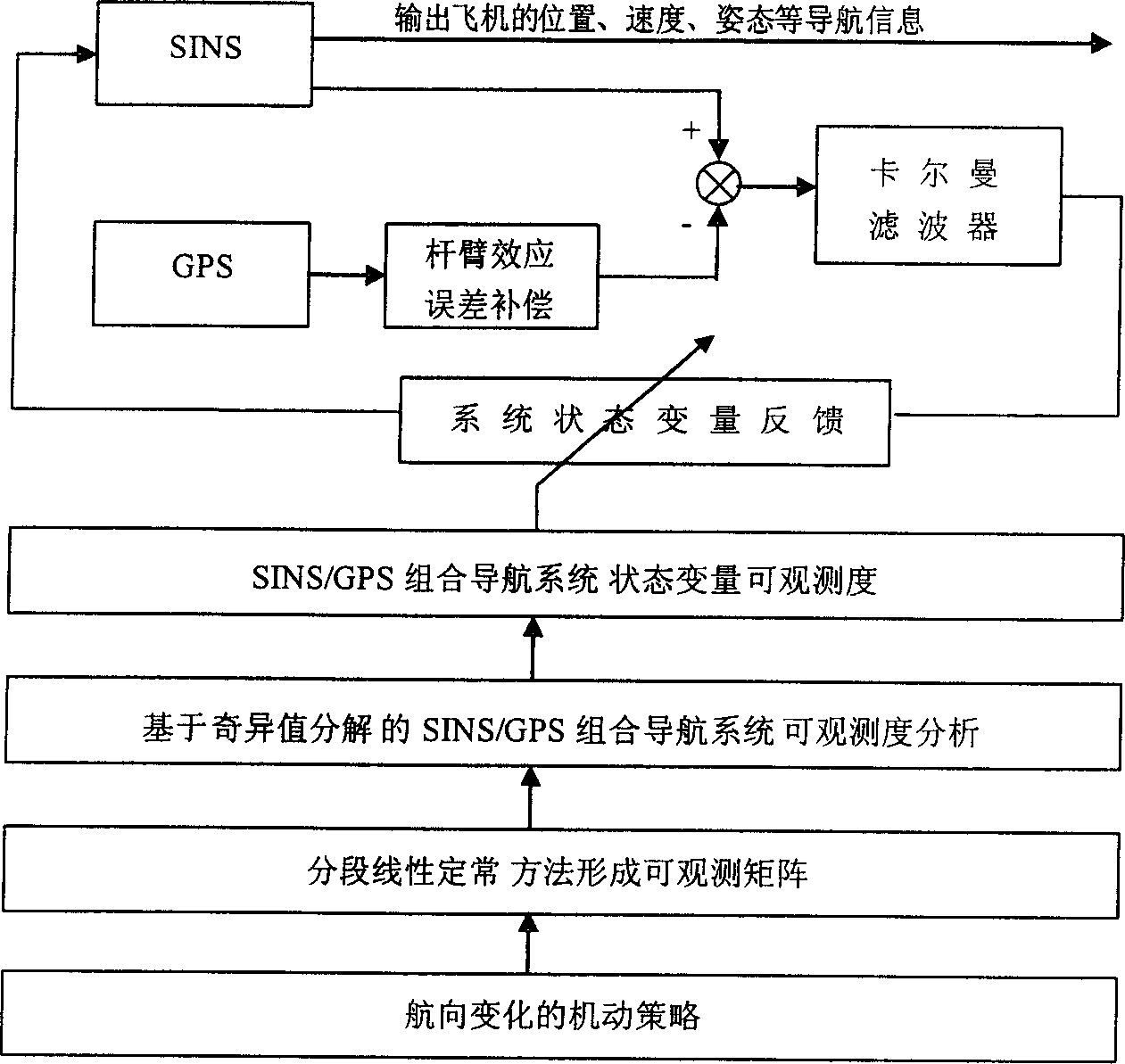
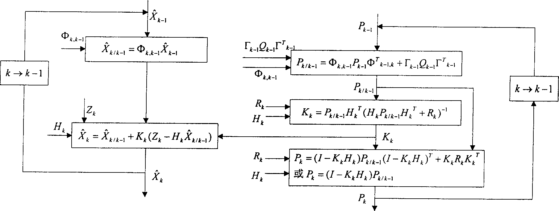
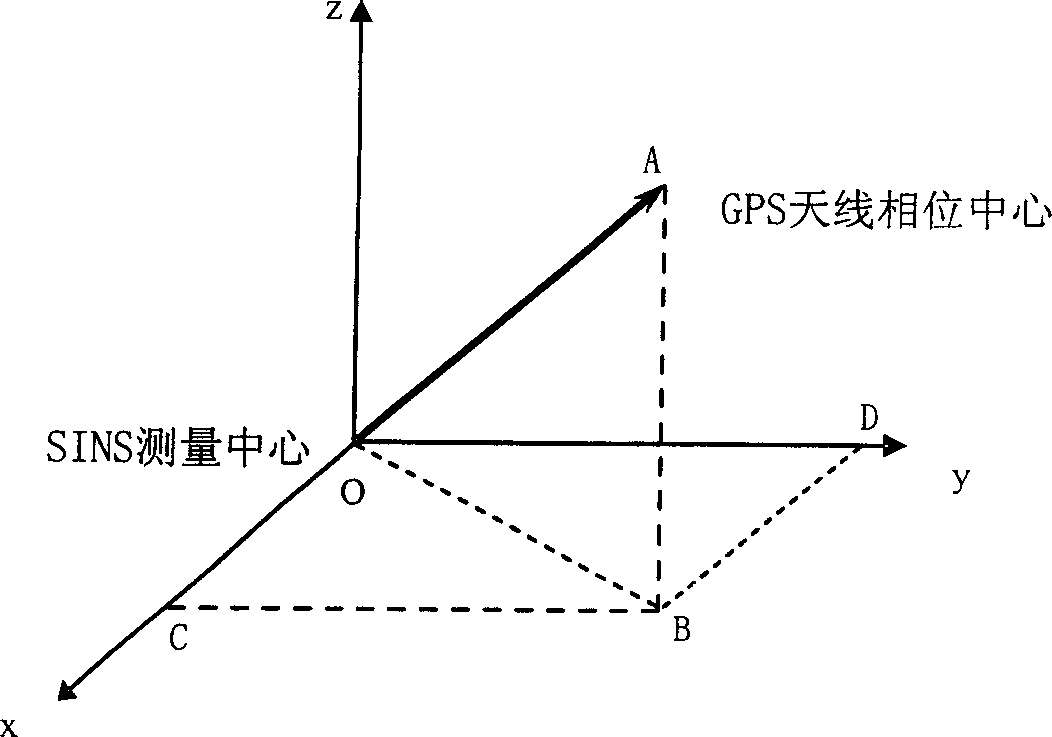
[0035] Such as figure 1 , 2 , Shown in 3, concrete method of the present invention is as follows:
[0036] (1) The establishment of the mathematical model of the SINS / GPS integrated navigation system, including the system state equation and measurement equation, as shown in formula 1 and formula 2 respectively.
[0037] System state equation:
[0038] x & =FX+GW (1)
[0039] Among them, X is the system state vector, W is the system noise vector, F is the system transfer matrix, and G is the noise transfer matrix:
[0040] X=[φ x φ y φ z δv x δv y δv z δL δλ δh ε x ε y ε z x y z ] T
[0041]
[0042] F = F INS F S O 6 × ...
PUM
 Abstract
Description
Claims
Application Information