

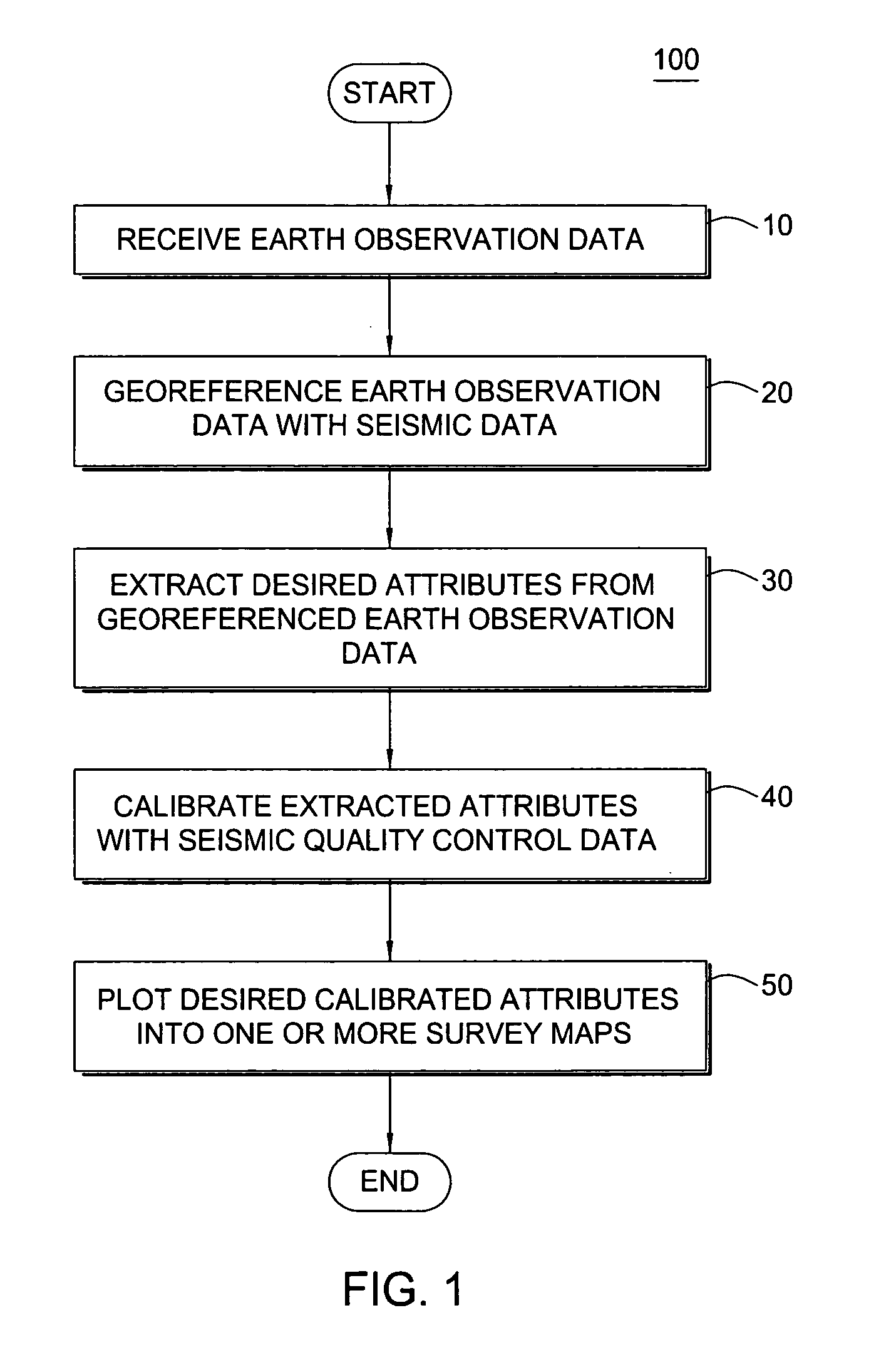
Survey design using earth observation data
a technology of earth observation and seismic data, applied in the field of seismic survey design, can solve the problems of poor signal being transmitted into the ground, low quality of source signal, and often affecting the quality of seismic data at the receiver
- Summary
- Abstract
- Description
- Claims
- Application Information
AI Technical Summary
Benefits of technology
Problems solved by technology
Method used
Image

Examples
Embodiment Construction
[0013] Estimation of surface characteristics from earth observation data (or satellite imagery) is an emerging technology. Earth observation data is useful for various purposes, including mapping of surface mineral deposits, flood monitoring and infrastructure planning. Satellites are typically equipped with sensors that measure reflected energy in visible-to-infrared wavelengths, radiated thermal infrared energy, and radar backscatter information about the earth's surface. Combining these data allows characterization of different types of surfaces. The algorithms for extracting certain surface characteristics are well known in the art.
[0014] Table 1 below gives an overview of the information that can be obtained from satellite imagery.
TABLE 1Wave type and bandWavelengthSurface featureVisible bands (VIS)0.40-0.75mInfrastructure, digitalelevation model (DEM),water featuresNear infrared bands (NIR)0.75-1.20mVegetationMid infrared bands (MIR)1.20-2.0mSurface featuresShort-wave infra...
PUM
 Abstract
Description
Claims
Application Information