

Map drawing method, map drawing system, navigation apparatus and input/output apparatus
- Summary
- Abstract
- Description
- Claims
- Application Information
AI Technical Summary
Benefits of technology
Problems solved by technology
Method used
Image

Examples
Embodiment Construction
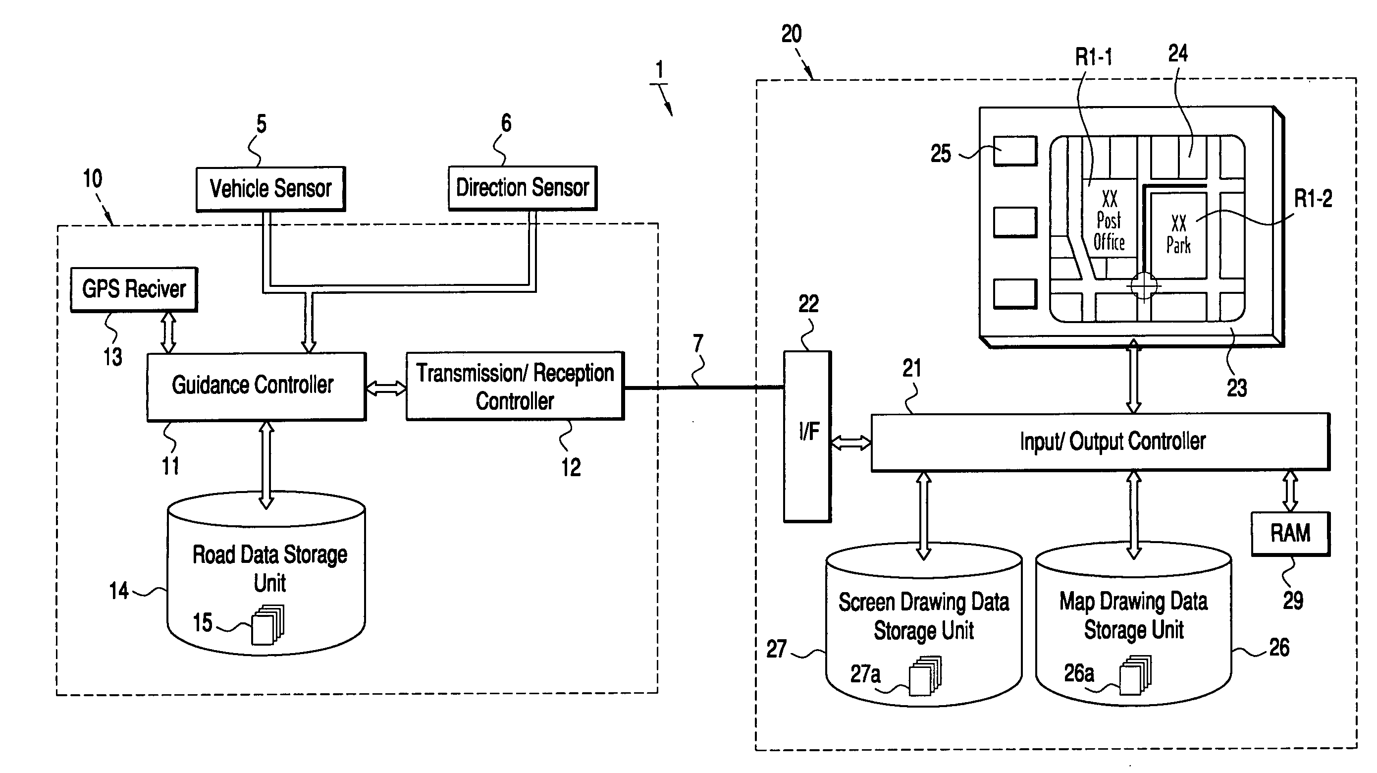
[0035] The present invention will now be further described with reference to FIGS. 1 to 10.
[0036] As shown in FIG. 1, the route guidance system 1, which is the embodiment of a map drawing system in accordance with the present invention, includes a navigation apparatus 10 installed in a vehicle and an input / output apparatus 20. The navigation apparatus 10 has a guidance controller 11 including vehicle location detection means 11-1, first transmission means 11-2, search means 11-3, second transmission means 11-4, proximity determination means 11-5 and third transmission means 11-6. The guidance controller 11 is a guidance module including a CPU for searching for a route and a RAM as hardware and software including a search program, a vehicle location display program, an enlarged map display program, and an enlarged map update program.
[0037] The navigation apparatus 10 includes a transmission / reception control unit 12 serving as reception control means and transmission control means....
PUM
 Abstract
Description
Claims
Application Information