Mobile Bearing Calculator and Bearing Correction Method

a bearing calculator and bearing technology, applied in the field of mobile bearing calculator and bearing correction method, can solve the problems of difficult generalization in the car navigation system, easy to understand the map display of the heading up display, etc., and achieve the effect of high precision

Inactive Publication Date: 2008-07-17
KYOCERA CORP
View PDF10 Cites 16 Cited by
  • Summary
  • Abstract
  • Description
  • Claims
  • Application Information

AI Technical Summary

Benefits of technology

[0019]According to the present invention, it is possible to use a geomagnetic sensor to find a bearing is found with a high precision and to correct a geographical bearing in accordance with an event whereby the operation of a mounted electronic part changes.

Problems solved by technology

Initially, mobile cellular phones equipped with map information display processing functions lacked a device for measuring the bearing, therefore a map display easily understood by the user such as a heading up display (display rotating the map so that an advancing direction was directed toward the top of a screen) which was generally performed in a car navigation system was difficult.

Method used


Image

  • Mobile Bearing Calculator and Bearing Correction Method
  • Mobile Bearing Calculator and Bearing Correction Method
  • Mobile Bearing Calculator and Bearing Correction Method

Examples


Embodiment Construction

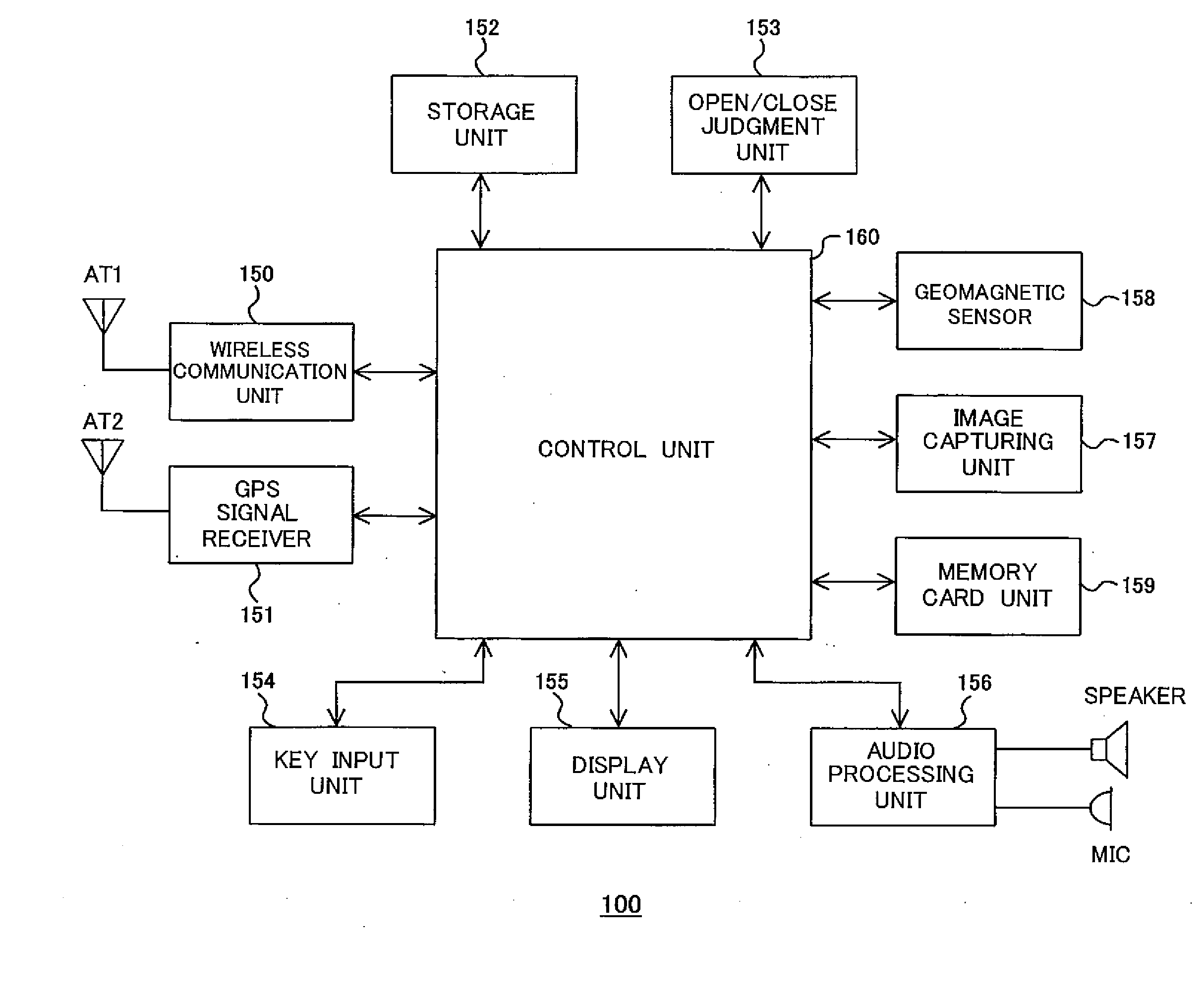
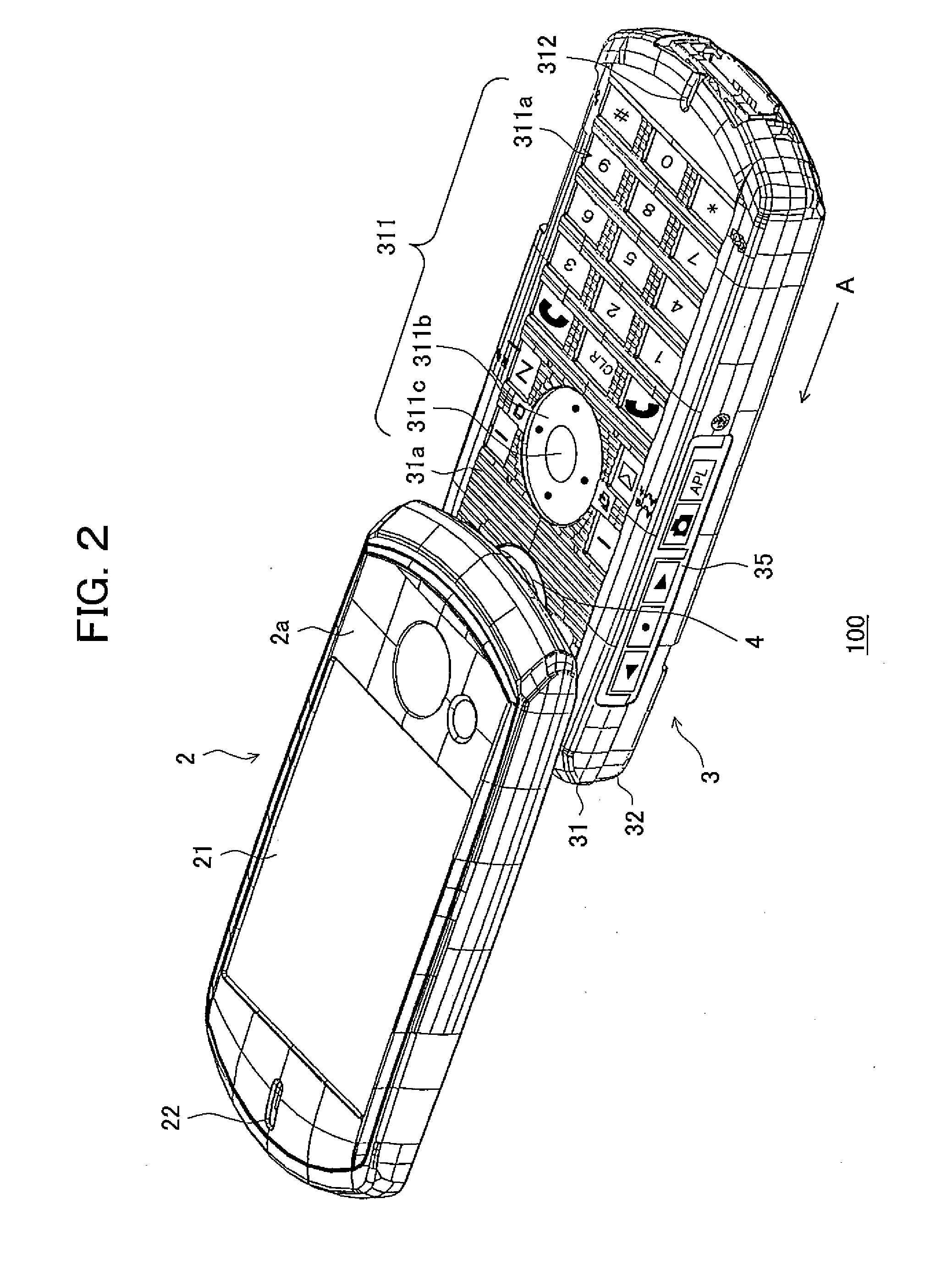
[0053]Below, an embodiment of a case where the present invention is applied to a multi-function type movable and portable cellular phone having a map information display processing function and image capturing function and able to display map information considering the bearing (hereinafter referred to as a “mobile cellular phone”) will be explained with reference to the drawings.

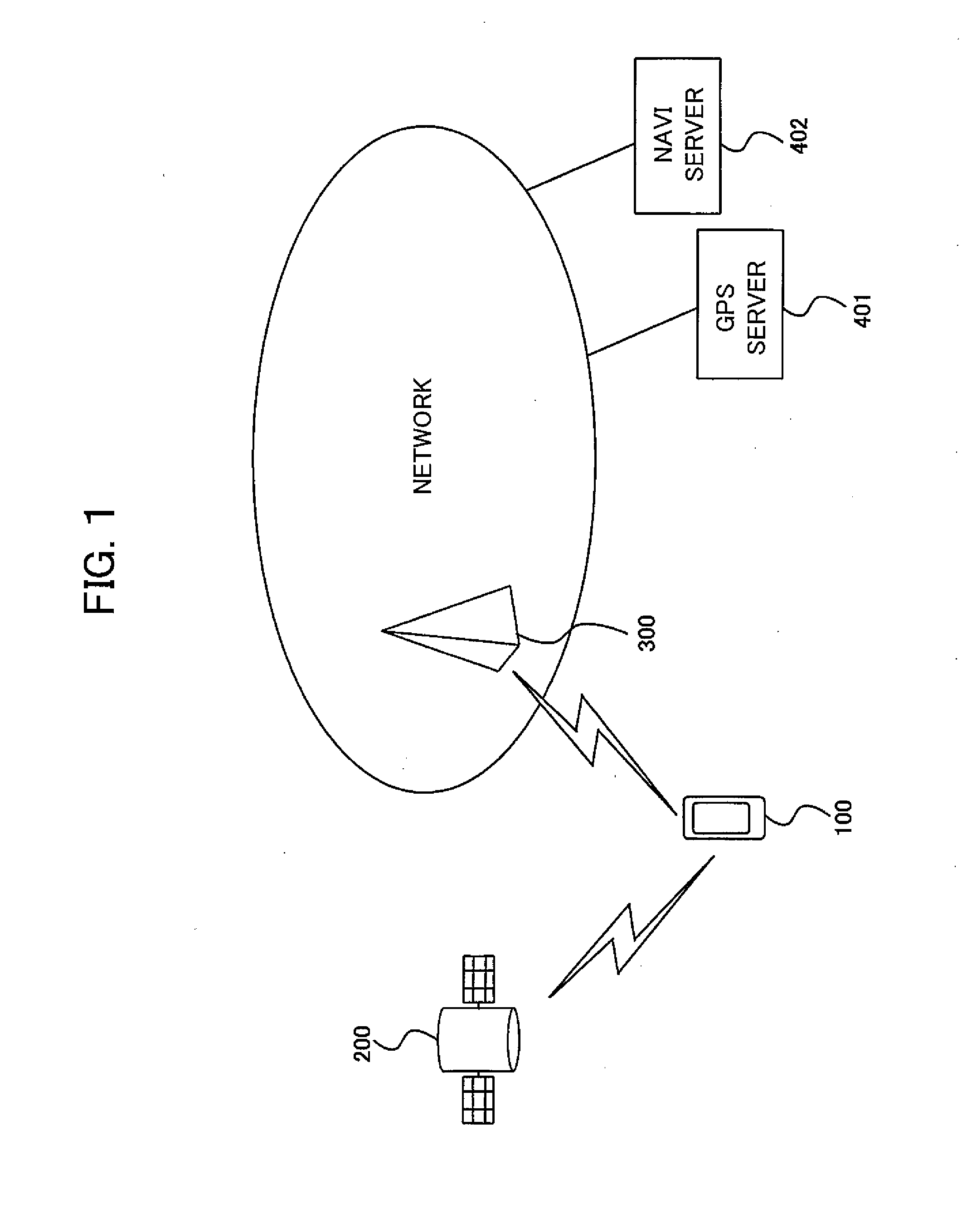
[0054]FIG. 1 is a block diagram showing an example of the configuration of a system for acquiring a geographical location and map information in a cellular phone 100 according to an embodiment of the present invention.

[0055]The cellular phone 100 receives GPS signals transmitted from three or more GPS use satellites 200 circling the globe on known orbits. Then, the cellular phone 100 transmits the information concerning the received GPS signals from a base station 300 through a communication network to a GPS server system 401, as one example of the position finding means of the present invention, and acquir...


PUM


Abstract

A mobile bearing calculator having a geomagnetic sensor for detecting earth-magnetism and a control unit for calculating a geographical bearing based on detection values of the geomagnetic sensor. The control unit monitors for an event such as a change of operation of electronic parts mounted on the mobile bearing calculator and corrects the geographical bearing in accordance with the occurrence of the event.

Description

TECHNICAL FIELD[0001]The present invention relates to a movable communication apparatus such as a mobile phone provided with a geomagnetic sensor for measuring the geographical bearing and a method for correcting the geomagnetic sensor.BACKGROUND ART[0002]Conventionally, there has been a demand for a device to confirm the geographical location of a present position and provide guidance on the route to a target position by a map. As a device satisfying such demand, car navigation systems are known (for example Patent Document 1, Patent Document 2, and Patent Document 3).[0003]In general, a car navigation system calculates the geographical location of the present position by receiving and processing signals transmitted from a plurality of GPS (global positioning system) satellites (hereinafter described as “GPS signals”), reads out map data on the surroundings of this present position from a database stored in a storage unit (DVD, hard disc, etc.) in the system, and displays it on a d...

Claims


Application Information

Patent Timeline
Patent Type & Authority Applications(United States)
IPC IPC(8): G01C17/38G01C21/00G01S5/00G06F3/048G01C21/28G09B29/00G08G1/005
CPCG01C17/38G01C21/28G09B29/008G09B19/0061G09B19/003
Inventor OKEYA, SHIGEO
Owner KYOCERA CORP
Why Eureka
Try Eureka