

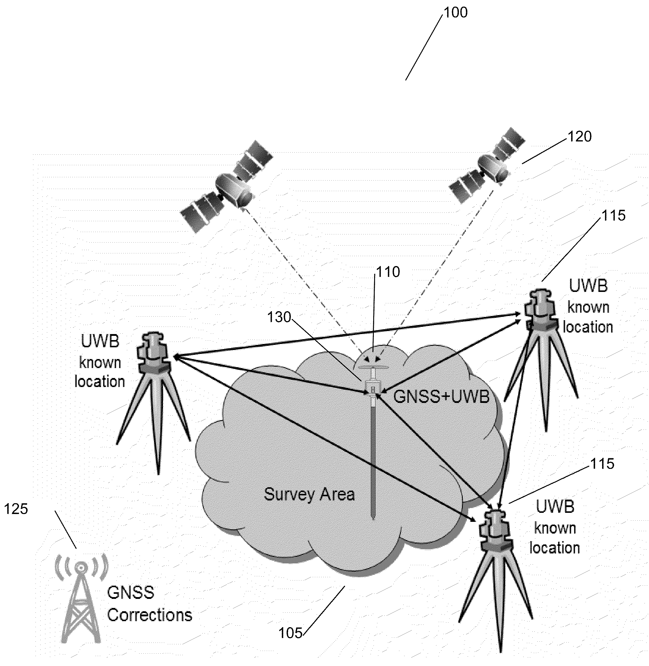
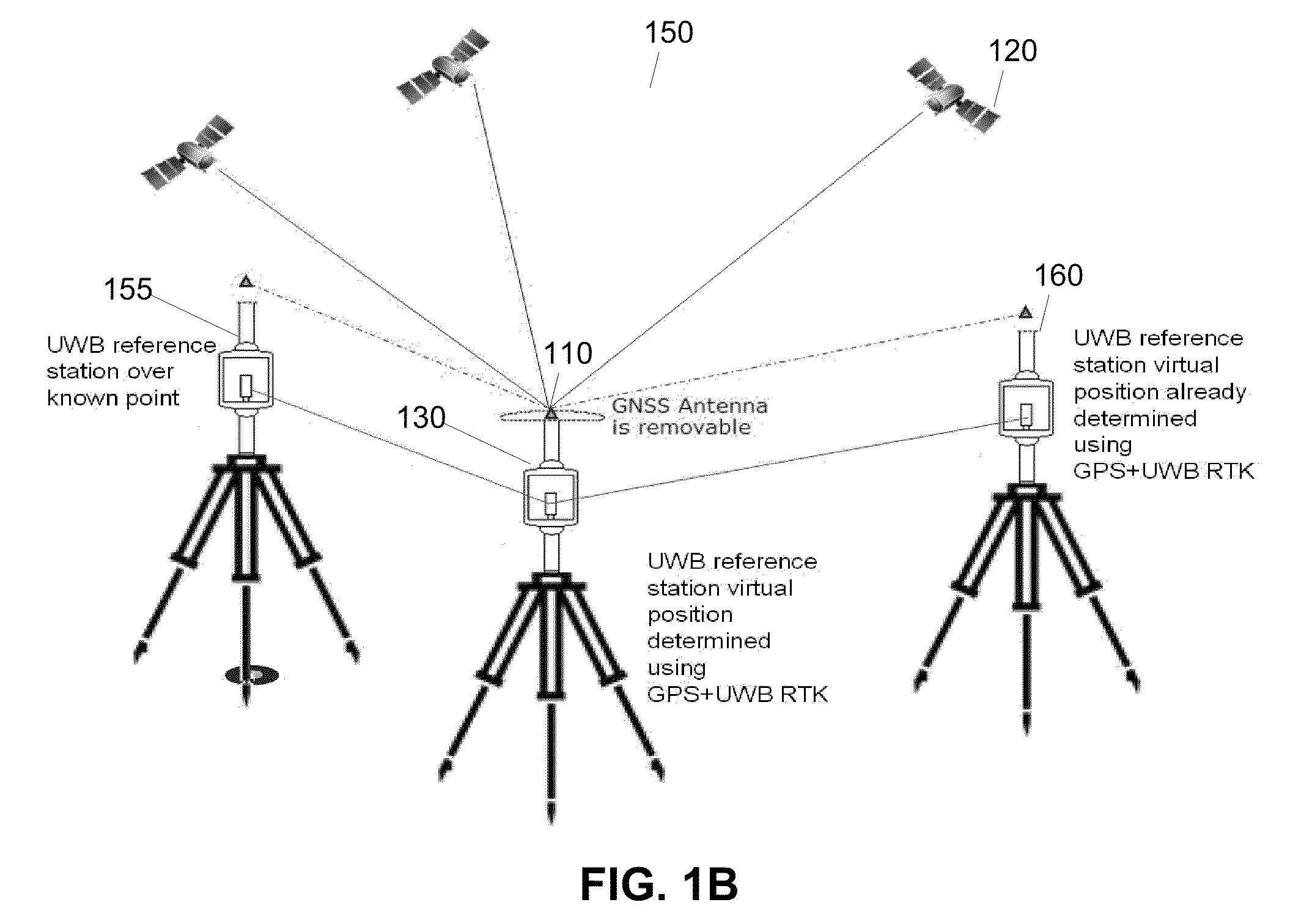
System and Methods for Real Time Kinematic Surveying Using GNSS and Ultra Wideband Ranging
a real-time kinematic and ultra-wideband ranging technology, applied in wave based measurement systems, instruments, position fixation, etc., to achieve the effect of robust performance and fine ranging precision
- Summary
- Abstract
- Description
- Claims
- Application Information
AI Technical Summary
Benefits of technology
Problems solved by technology
Method used
Image

Examples
Embodiment Construction
[0024]Those of ordinary skill in the art will realize that the following detailed description of the present invention is illustrative only and is not intended to be in any way limiting. Other embodiments of the present invention will readily suggest themselves to such skilled persons having the benefit of this disclosure. It will be apparent to one skilled in the art that these specific details may not be required to practice the present invention. In other instances, well-known computing systems, electric circuits and various data collection devices are shown in block diagram form to avoid obscuring the present invention. In the following description of the embodiments, substantially the same parts are denoted by the same reference numerals.
[0025]In the interest of clarity, not all of the features of the implementations described herein are shown and described. It will, of course, be appreciated that in the development of any such actual implementation, numerous implementation-spe...
PUM
 Abstract
Description
Claims
Application Information