
Location based system utilizing geographical information from documents in natural language

a geographic information and location technology, applied in surveying, navigation, instruments, etc., can solve the problems of not being able to handle a limited set of data providers, taking a lot of effort, and usually not being able to provide data at all

Inactive Publication Date: 2010-07-15
ROBERT BOSCH GMBH
View PDF3 Cites 59 Cited by
  • Summary
  • Abstract
  • Description
  • Claims
  • Application Information

AI Technical Summary

Benefits of technology

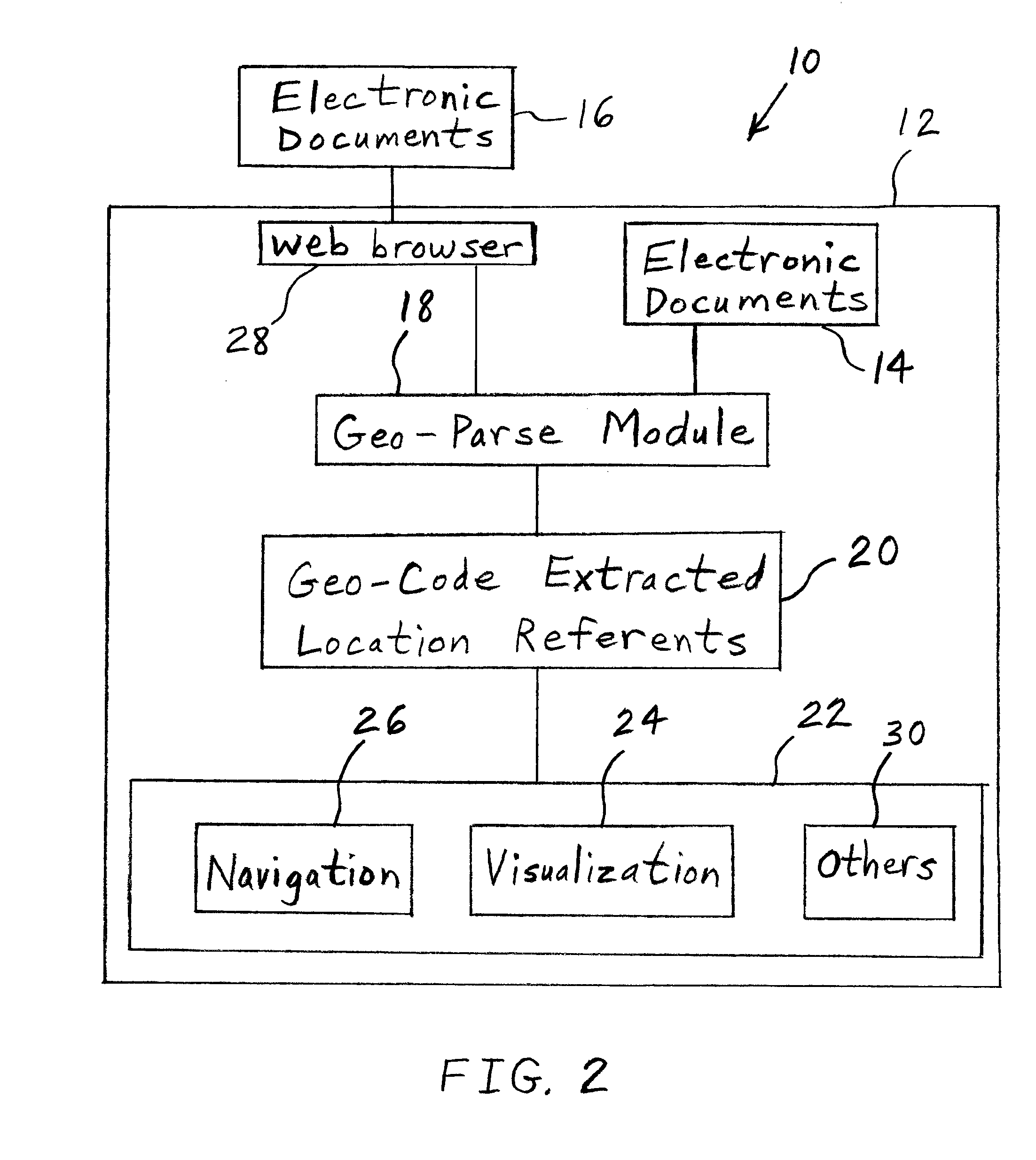
The present invention provides a navigation system that can access various types of geographic information from unstructured textual documents such as web pages. This invention allows for the automatic extraction and use of location information from unstructured data, making it possible to offer location-based services to users. The invention can extract all geographic information from unstructured data and use it for providing location-based services. This approach opens up a great range of additional content to location-based systems. The invention can identify and extract geographic information from unstructured text, such as address information or reference to points of interest, and use it in a navigation system or mobile phone. The invention can also allow users to manually select or identify geographic information from unstructured text. Overall, the invention bridges the gap between unstructured content and location-based services, enabling the utilization of many sources of unstructured geographical information.

Problems solved by technology

Such systems can handle only a limited set of data providers and are inflexible in the respect that they cannot handle location data residing in a range of different and changing formats.
This might take a lot of effort, and, for devices in the field, it is usually not possible at all.
Although this technology introduces flexibility in handling structured data formats, it does not address location information that exists in unstructured form, such as in text documents or internet pages with content and structure that is unknown to the systems.
But those systems are not suited for location-based services because most of them only recognize locations of a geographic resolution on continent, country, state, and (major) city level.
There is no system that allows the recognition of both coarse-grained geographic information, such as countries, states, etc., and fine-grained location information on street and address level at the same time.
Unstructured content can be found everywhere on the internet, but cannot be autonomously accessed by location-based services and devices with the current state of the art.
For this reason, a range of applications such as travel planning that would rely on access to information sources with rich but unstructured geographic content cannot be realized with the current state of the art.

Method used


Image

  • Location based system utilizing geographical information from documents in natural language
  • Location based system utilizing geographical information from documents in natural language
  • Location based system utilizing geographical information from documents in natural language

Examples


Embodiment Construction

[0025]The embodiments hereinafter disclosed are not intended to be exhaustive or limit the invention to the precise forms disclosed in the following description. Rather the embodiments are chosen and described so that others skilled in the art may utilize its teachings.

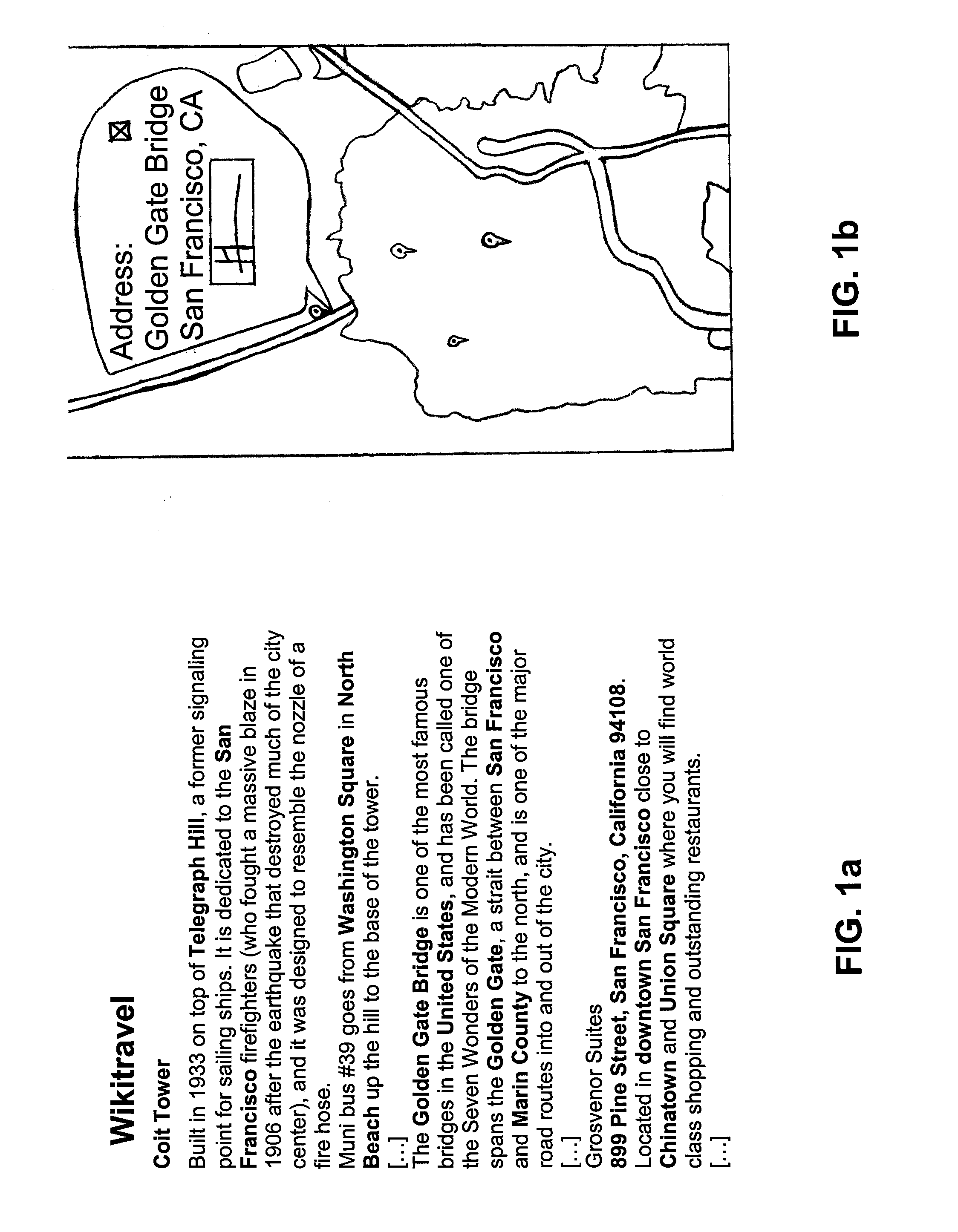
[0026]Sources of geographical information that may be used by the invention are, among others, online travel guides, travel reports, yellow pages, as well as business and private home pages that show (contact) addresses, etc. In addition, the invention makes it possible to process geographical information contained in emails and personal messages. FIG. 1a depicts an extract of a travel guide with valuable geographic information in bold font. FIG. 1a is a sample of a geo-parsed travel- and tourist-related text from the internet web site wikitravel.org. References recognized by the present invention as location references are depicted in bold font for illustration purposes herein. However, it is to be understood that th...


PUM


Abstract

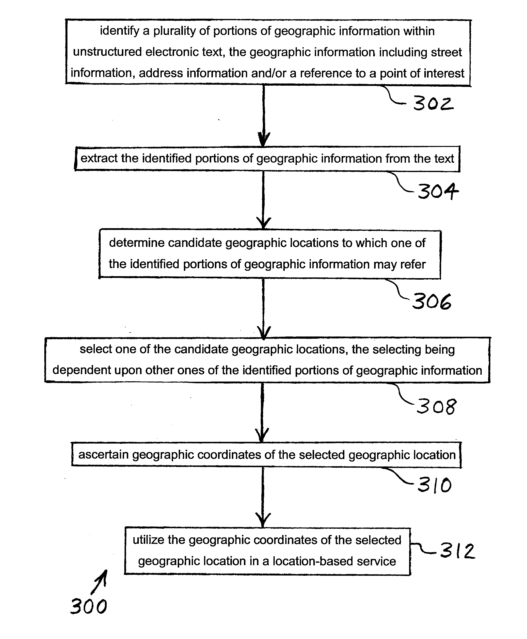
A method of operating a location-based system includes identifying geographic information within unstructured electronic text. The identified geographic information, which includes street information, address information, or names of locations is extracted. Candidate geographic locations to which the identified geographic information may refer are determined. One of the candidate geographic locations is selected. An alphanumeric representation of the selected geographic location is utilized in a location-based service. The invented system performs each of the preceding steps. The system supports the extraction of all locations mentioned in the unstructured text, applying the steps mentioned above.

Description

COPYRIGHT NOTICE[0001]Portions of this document are subject to copyright protection. The copyright owner does not object to facsimile reproduction of the patent document as it is made available by the U.S. Patent and Trademark Office. However, the copyright owner reserves all copyrights in the software described herein and shown in the drawings. The following notice applies to the software described and illustrated herein: Copyright© 2008, Robert Bosch GmbH, All Rights Reserved.BACKGROUND[0002]1. Field of the Invention[0003]The present invention relates to apparatuses and methods for providing data to a location-based system.[0004]2. Description of the Related Art[0005]A typical location-based system may receive location data and use the data to create a display on an electronic map or to provide route guidance information within a vehicle. There are systems available today that are able to connect to the internet, access a limited number of internet data sources, such as web servic...

Claims


Application Information

Patent Timeline
Patent Type & Authority Applications(United States)
IPC IPC(8): G01C21/00
CPCG06F17/3087G06F16/9537
Inventor FAENGER, JENSFIECHTNER, GEORG
Owner ROBERT BOSCH GMBH
Learn More