Method and apparatus for position determination with hybrid sps orbit data

a position determination and hybrid technology, applied in the field of satellite positioning systems, can solve the problems of time-consuming and laborious, requiring moderately strong signal levels, and the relatively long time needed for standalone signal acquisition, so as to improve the accuracy of the clock bias of the predicted orbit data and improve the accuracy of the mobile fix

Inactive Publication Date: 2010-08-05
QUALCOMM INC
View PDF71 Cites 53 Cited by
  • Summary
  • Abstract
  • Description
  • Claims
  • Application Information

AI Technical Summary

Benefits of technology

[0013]The method and system described herein provides flexibility and improves accuracy in a mobile fix. Satellite orbit data from different sources can be dynamically combined by the

Problems solved by technology

However, the typical process of searching for and acquiring satellite signals, reading the ephemeris data transmitted by the satellites, and computing the location of the receiver from this data is time consuming and requires moderately strong signal levels.
As stated, one disadvantage of such a system is the relatively long time needed to

Method used


Image

  • Method and apparatus for position determination with hybrid sps orbit data
  • Method and apparatus for position determination with hybrid sps orbit data
  • Method and apparatus for position determination with hybrid sps orbit data

Examples


Embodiment Construction

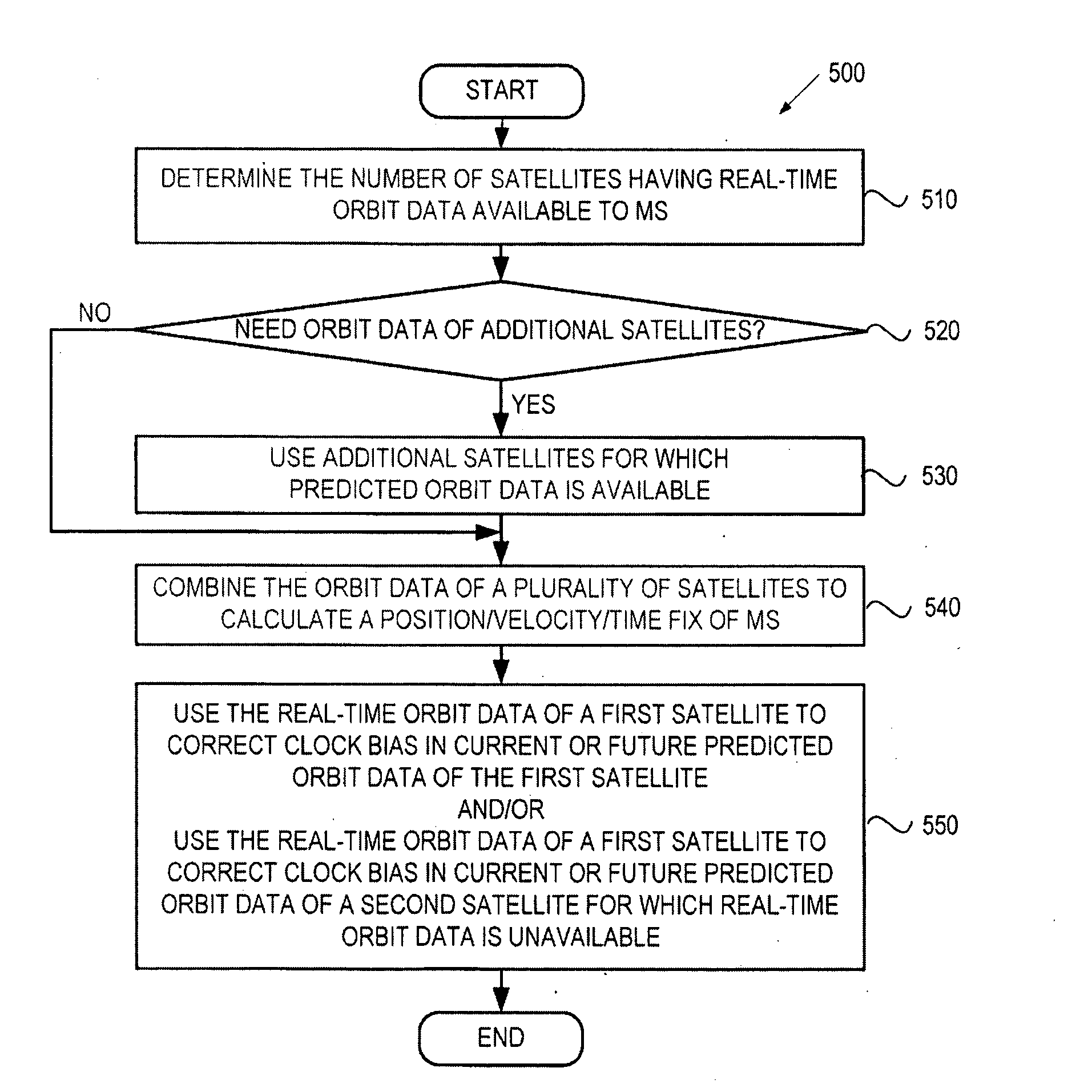
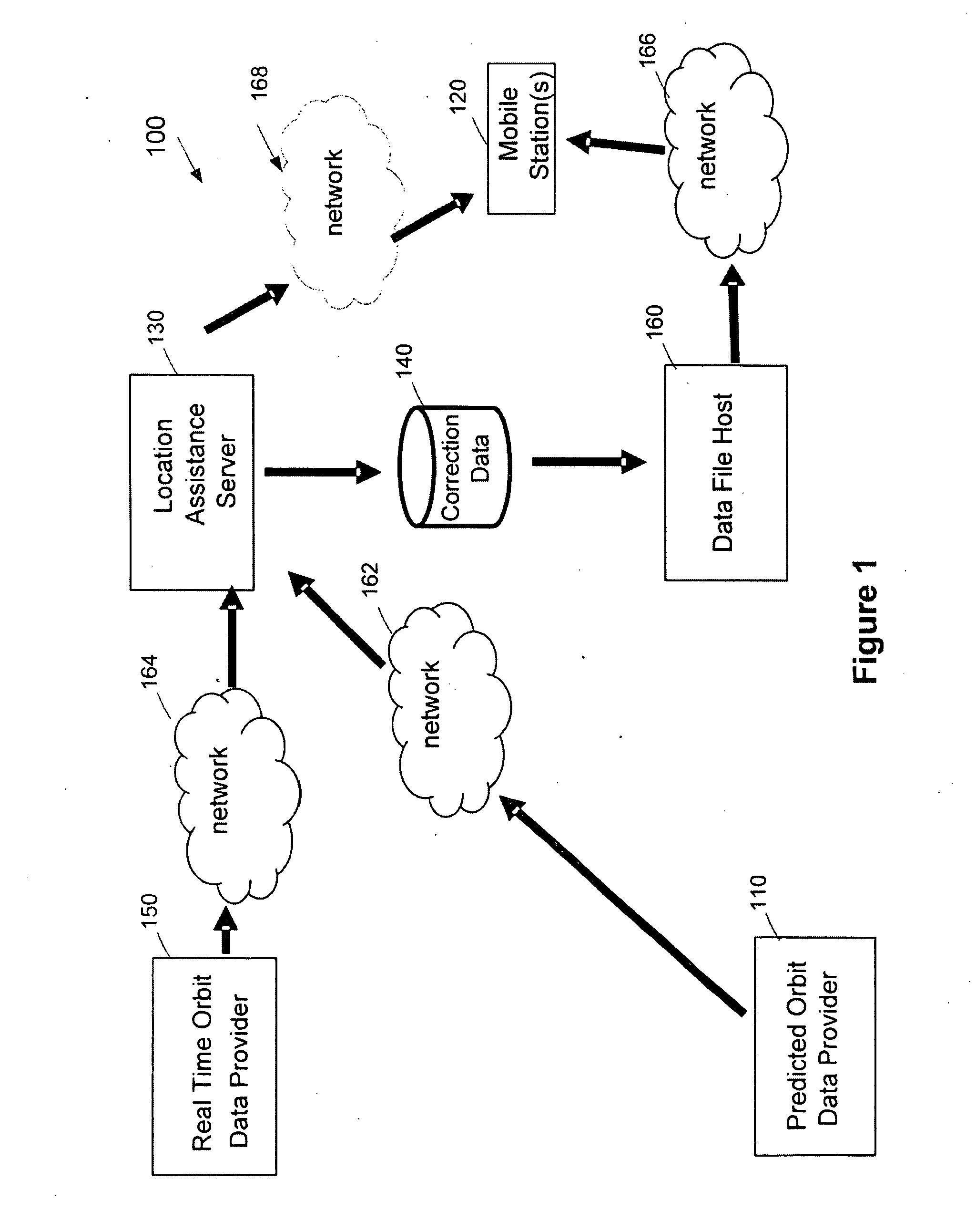
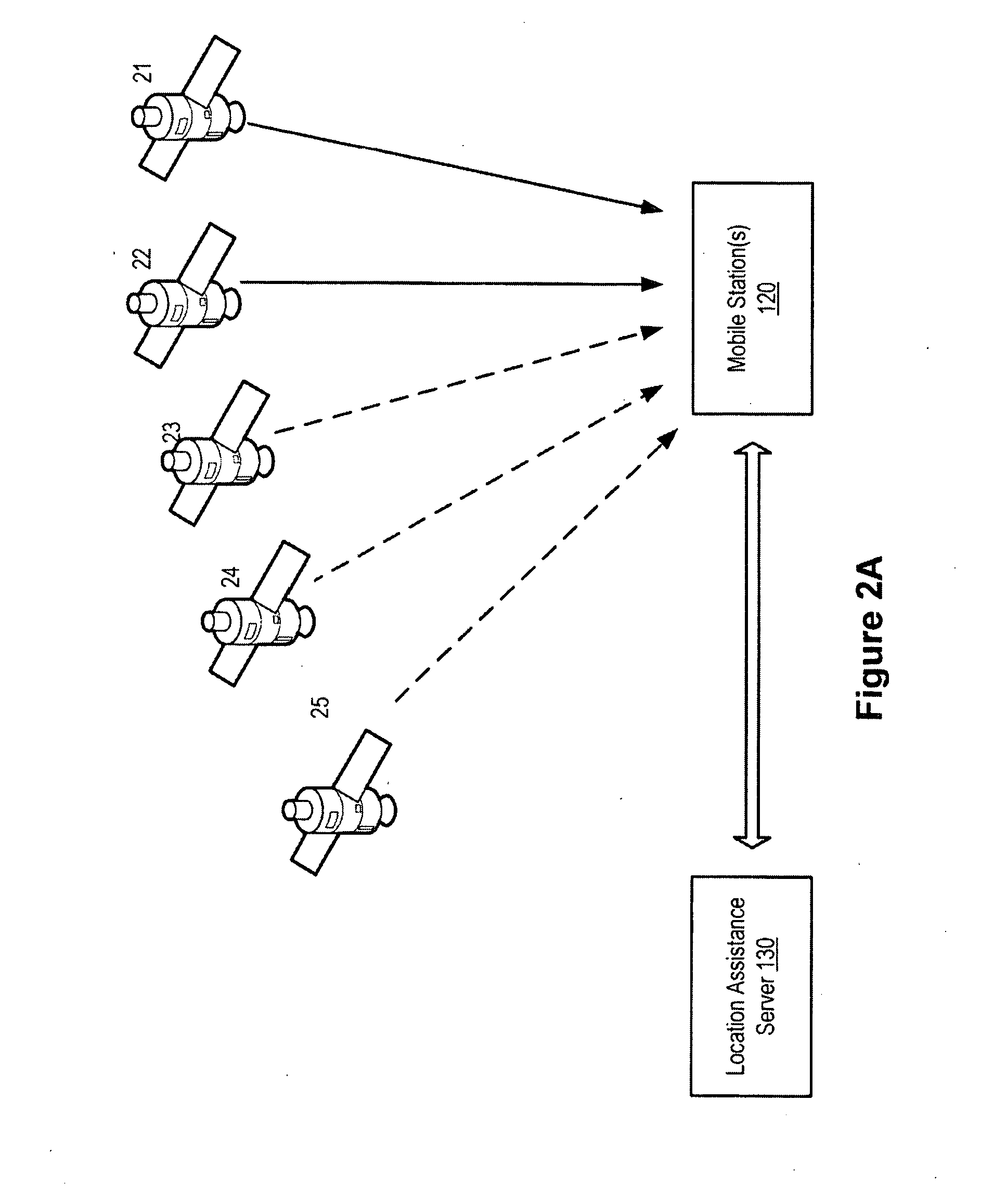
[0024]A method and system for assisting a mobile station to determine its position (or velocity) and time (referred to as “a fix”) is described. The method and system also improves the precision of satellite clock bias. Satellite clock bias, as described herein, refers to the difference of satellite clock's time estimate from a master clock, such as a Global Positioning System (GPS) master clock. From the positions and clock bias of multiple satellites, a mobile station can determine its own position and time. In one aspect of the invention, the position and clock bias of each satellite may be provided to the mobile station from a variety of sources with different degrees of precision. Generally, real-time orbit data (e.g., ephemeris) has the highest accuracy, but may not be available all the time. A “hybrid” technique is introduced herein to enable a mobile station to combine the real-time orbit data with other satellite orbit information, such as predicted orbit data, in the calcu...


PUM


Abstract

A method and system for a mobile station to determine its position (or velocity) and time using a hybrid combination of satellite orbit data. In one aspect, the mobile station combines predicted orbit data from one satellite and real-time orbit data from another satellite in the determination of a fix. The combination can be made to the satellites in the same or different satellite systems. The mobile station can use the real-time orbit data of a satellite at one time period and the predicted orbit data of the same satellite at another time period. In another aspect, the mobile station can use the real-time orbit data to correct the clock bias in the predicted orbit data. The correction to the clock bias can be made to the same satellite that provides the real-time orbit data, or to a different satellite in the same or in another satellite system.

Description

BACKGROUND[0001]1. Field[0002]The present invention relates generally to a satellite positioning system (SPS), and more particularly, to assisting a mobile station to determine its position and time using SPS orbit information.[0003]2. Background Information[0004]A satellite positioning system (SPS) receiver normally determines its position by computing times of arrival of signals from multiple satellites. These satellites transmit, as part of their messages, both satellite positioning data and satellite clock timing data. The satellite positions, velocity and clock timing typically are represented by almanac and ephemeris data. The ephemeris data refers to the content of subframes 1, 2 and 3 of the messages transmitted from a satellite. The ephemeris provides an extremely accurate estimate (˜1 meter error) orbit (satellite positions, clock and clock bias). However, the typical process of searching for and acquiring satellite signals, reading the ephemeris data transmitted by the sa...

Claims


Application Information

Patent Timeline
IPC IPC(8): G01S1/00
CPCG01S19/23G01S19/258G01S19/42G01S19/33G01S19/27
Inventor BIACS, ZOLTAN F.SHEYNBLAT, LEONIDGUM, ARNOLD JASON
Owner QUALCOMM INC
Why Eureka
Try Eureka