Systems and methods for obtaining and using traffic flow information

a technology of traffic flow and information, applied in the field of methods and systems for determining the lane level speed information for road sections, can solve the problems of increasing the stress level of drivers, increasing the risk of dangerous situations developing, and limited information provided, so as to increase the ease of negotiation of road sections, accurately estimate durations, and increase the time available

Inactive Publication Date: 2013-10-24
TOMTOM NAVIGATION BV
View PDF10 Cites 125 Cited by
  • Summary
  • Abstract
  • Description
  • Claims
  • Application Information

AI Technical Summary

Benefits of technology

[0026]It has been found that vehicle probe data may be advantageously used in this context, as it may provide the ability to determine vehicle speeds to a high level of definition enabling accurate and useful lane level information to be obtained.
[0051]While the invention could be used to determine historical lane speed profiles for lanes over the entire lengths of roads, it is particularly applicable to determining historical lane speed profiles for specific road sections, for example where congestion is known to be problematic, where the lane arrangement is complex, in the vicinity of interchanges, exits, etc. The road section may be a section which is only temporarily problematic e.g. being a road section in the region of road works. The road section may fall within these criteria at all times, or only at a time to which the lane speed profile relates. Applying the techniques of the invention to specific road sections may provide a balance between determining useful lane level information which may provide benefits when applied in the manners discussed below, and conserving processing power. The road section or sections may be selected as being road sections where it would be desirable for a navigation apparatus to be able to provide lane information to a user.
[0061]In some embodiments the lane information may be information regarding the expected speeds of travel along different lanes of the road section based on the historical lane speed profiles. The method may comprise displaying information regarding the expected speeds of travel along the different lanes of the road section. This may be in the form of information regarding absolute lane speeds or relative speeds between the lanes. The method may comprise displaying the information on a display of the navigation apparatus. In some embodiments the method may comprise using the information to enhance a displayed digital map. The information may, for example, be superimposed on a display of the lane structure of the road section. The user may then make their own decision as to whether to change lanes. For example, the user may be in slow moving traffic in the vicinity of an interchange. The displayed lane speed information may reassure the user that their current lane is likely to be the fastest once the interchange has been passed. Simply providing information to the user regarding the likely traffic flow speeds in each lane may help to reduce driver stress, and reduce the number of unnecessary lane manoeuvres performed, providing the potential to improve overall traffic flow. In these embodiments, the lane information preferably includes lane information at least for the region which lies ahead of the current position of the user.
[0064]In some preferred embodiments the lane guidance comprises a lane selection which is determined to provide the quickest expected route through the road section while minimizing the number of lane changes. The method may then comprise using the historical lane speed profiles to determine a lane selection providing the quickest expected route through at least a part of the road section while minimizing the number of lane changes. Such embodiments are useful in improving overall traffic flow by reducing the number of lane changes performed by drivers, which are known to have a negative impact on traffic flow.
[0071]Another example might be that historical lane speed profiles suggest that the lane speed in a current lane is likely to be low up to and including the point where a lane change is required, e.g. a lane change to an exit lane. The timing may then be a timing intended to increase the time available for the user to perform the lane change. This may increase ease of negotiation of the road section.
[0072]The methods of the present invention may provide the ability to more accurately estimate durations for calculated routes. The method may further comprise using the historical lane speed profiles to determine an estimated duration for a calculated route including at least a part of the road section. It will be appreciated that it may be known which lane a user must follow in at least parts of the road section to follow a particular route, or due to certain lane prohibitions which might mean that the user has to travel in certain lanes. The duration may be communicated to a user via the navigation apparatus.

Problems solved by technology

However, the information provided is limited to information regarding the appropriate exit lane for a given destination.
It is known that it is undesirable for overall traffic flow for drivers to repeatedly change lane, and such behaviour may increase the risk of dangerous situations developing, and increase the stress level of drivers.
When negotiating an interchange, the driver may not know the best lane to use to reach the exit of the interchange, particularly when there is congestion.

Method used


Image

  • Systems and methods for obtaining and using traffic flow information
  • Systems and methods for obtaining and using traffic flow information
  • Systems and methods for obtaining and using traffic flow information

Examples


Embodiment Construction

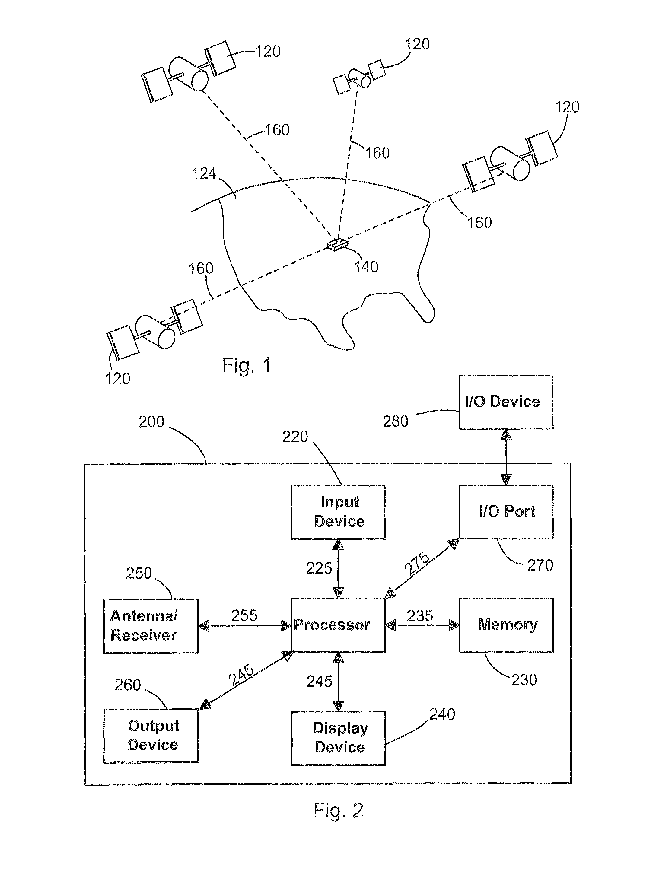
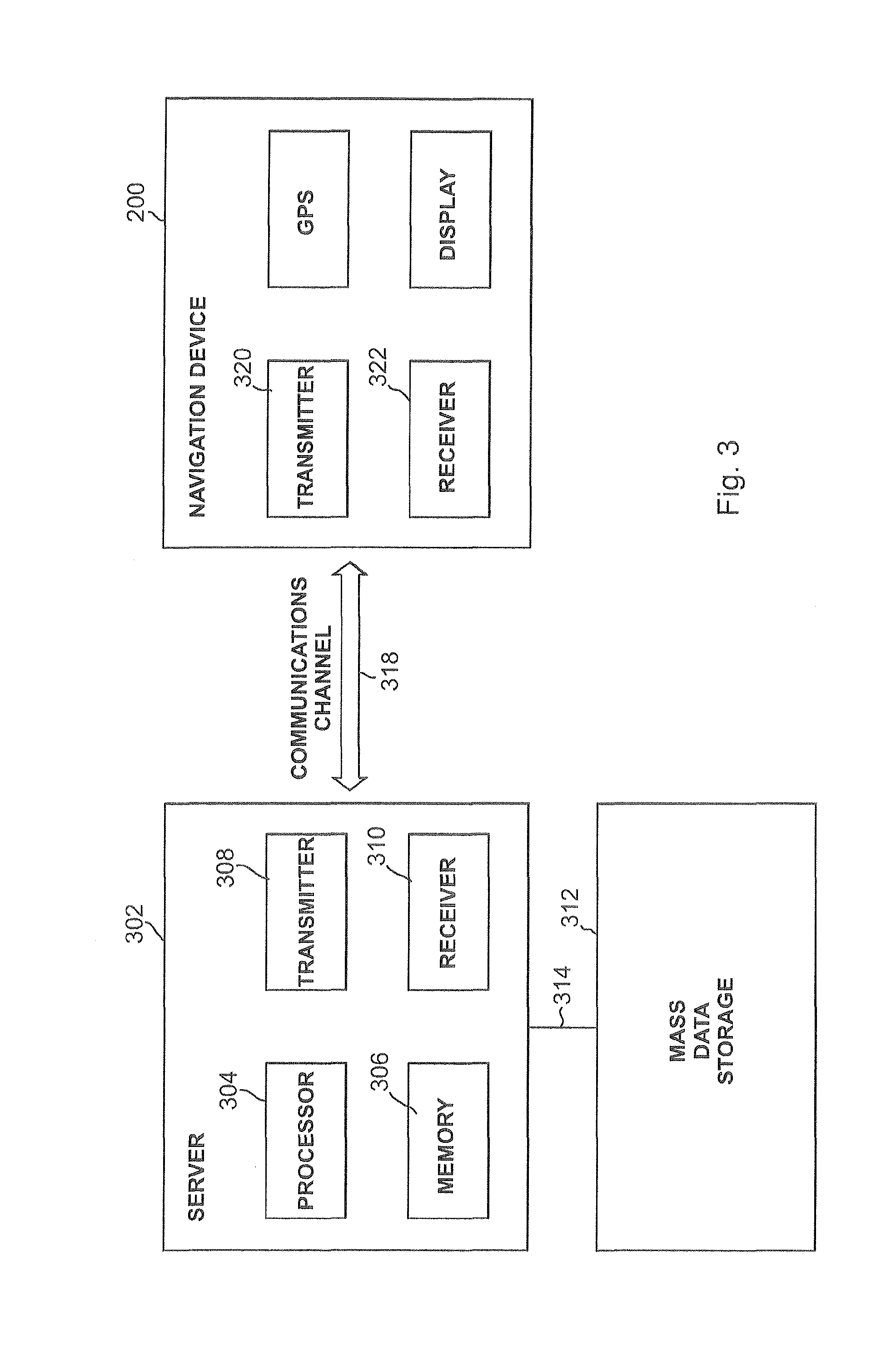
[0094]Some preferred embodiments of the invention will now be described by way of example only, and with reference to FIGS. 1-6. The description with respect to FIGS. 1-4B provides background information to facilitate understanding of the invention in its various embodiments. The embodiments of the invention are described by reference to FIG. 5 onward.

[0095]Preferred embodiments of the present invention will now be described with particular reference to a PND. It should be remembered, however, that the teachings of the present invention are not limited to PNDs but are instead universally applicable to any type of processing device that is configured to execute navigation software so as to provide route planning and navigation functionality. It follows therefore that in the context of the present application, a navigation device is intended to include (without limitation) any type of route planning and navigation device, irrespective of whether that device is embodied as a PND, a nav...


PUM


Abstract

A method of determining historical lane speed profiles for each of a plurality of individual lanes of a multi-lane road section is described. The plurality of individual lanes are lanes for the same given direction of travel. The method involves collecting vehicle probe data relating to the movement of individual vehicles on the road section for a specific time of day, and using the probe data to derive an aggregate speed profile for travel along each lane at the relevant time. The method may involve using the historical lane speed profiles to provide lane guidance instructions to the user of a navigation apparatus.

Description

FIELD OF THE INVENTION[0001]This invention relates to methods and systems for determining lane level speed information for road sections. More specifically, the invention relates to methods and systems for obtaining historical lane speed profiles for road sections. The invention also extends to methods and systems of using the lane speed information in a navigation system, including providing lane information and / or guidance to users of navigation apparatus. Illustrative embodiments of the invention relate to the use of lane speed information in a navigation system including portable navigation devices (so-called PNDs), in particular PNDs that include Global Positioning System (GPS) signal reception and processing functionality, and to systems and methods involving such devices. The invention is also applicable to the use of lane level speed information in a navigation system including a navigation apparatus which forms part of an integrated navigation system, e.g. an in-vehicle nav...

Claims


Application Information

Patent Timeline
Patent Type & Authority Applications(United States)
IPC IPC(8): G01C21/34
CPCG01C21/3492G01C21/3658G08G1/167G08G1/052G08G1/096827G08G1/0104G08G1/0112G08G1/0129G08G1/0145
Inventor BASTIAENSEN, EDWINT'SIOBBEL, STEPHEN
Owner TOMTOM NAVIGATION BV
Why Eureka
Try Eureka