
Ground Planes for Reducing Multipath Reception by Antennas

a multi-path reception and ground plane technology, applied in the field of antennas, can solve problems such as errors in time delay measurements and carrier phase measurements, errors in position determination, and errors in correction

Active Publication Date: 2015-01-15
TOPCON POSITIONING SYST INC
View PDF3 Cites 2 Cited by
  • Summary
  • Abstract
  • Description
  • Claims
  • Application Information

AI Technical Summary

Benefits of technology

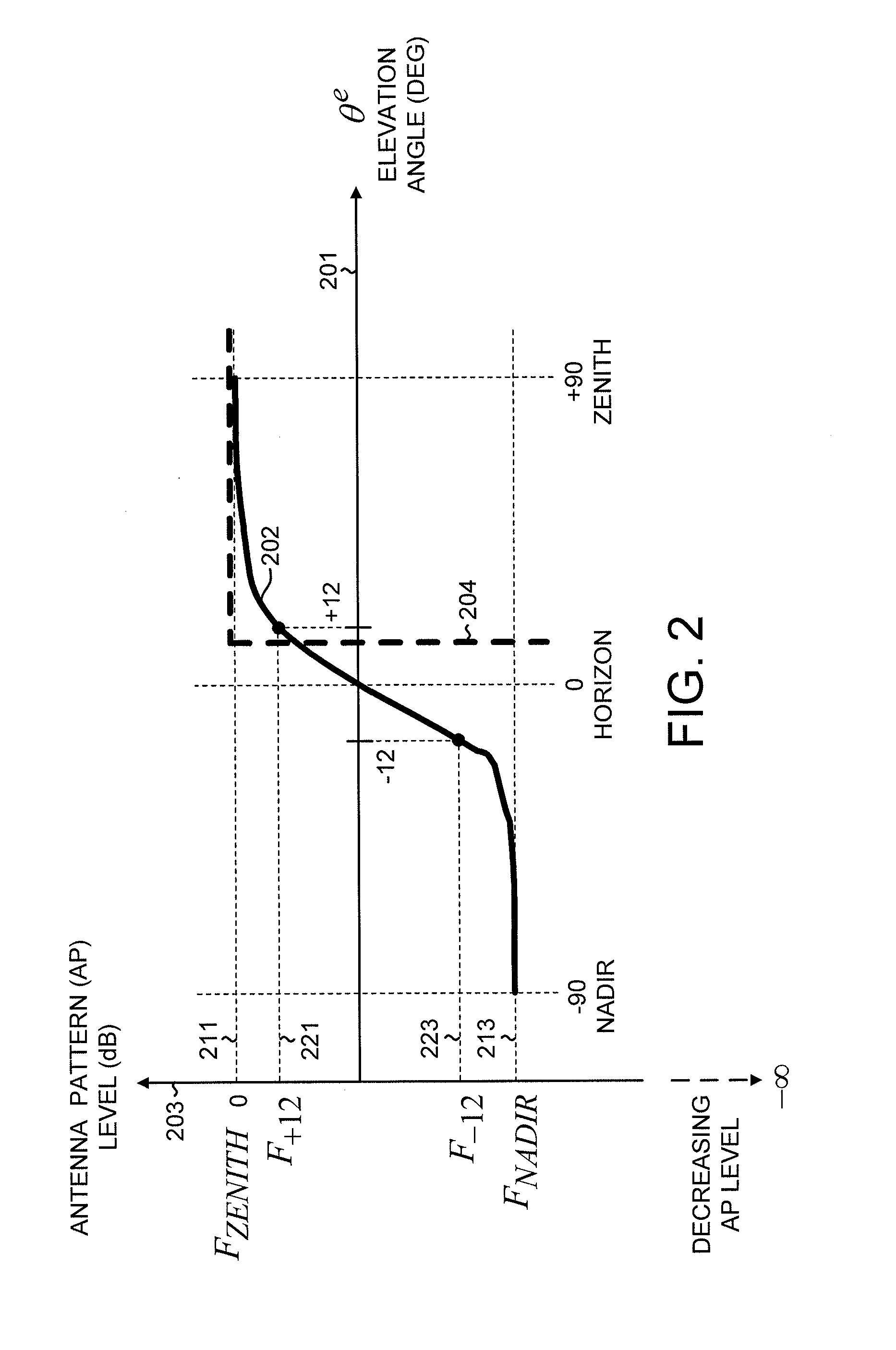
The patent is about an antenna system that can receive signals from multiple satellites in a global navigation system. It has a high capacitive impedance surface and an antenna positioned above it. The system has a user-defined maximum value for the ratio of its down / up ratio in the nadir direction. The ground plane has a selected lateral dimension to achieve a maximum ratio at a set elevation angle for low-elevated satellites. The antenna is positioned to achieve a minimum pattern level at the elevation angle. This design helps optimize the performance of the antenna system for navigation applications.

Problems solved by technology

A major source of the uncorrected errors is multipath reception by the receiving antenna.
The reflected signals are processed along with the direct signals and cause errors in the time delay measurements and errors in the carrier phase measurements.
These errors subsequently cause errors in position determination.
Multipath reception, in particular, can be a major source of error for accurately determining the position of a reference base station by GNSS.

Method used


Image

  • Ground Planes for Reducing Multipath Reception by Antennas
  • Ground Planes for Reducing Multipath Reception by Antennas
  • Ground Planes for Reducing Multipath Reception by Antennas

Examples


Embodiment Construction

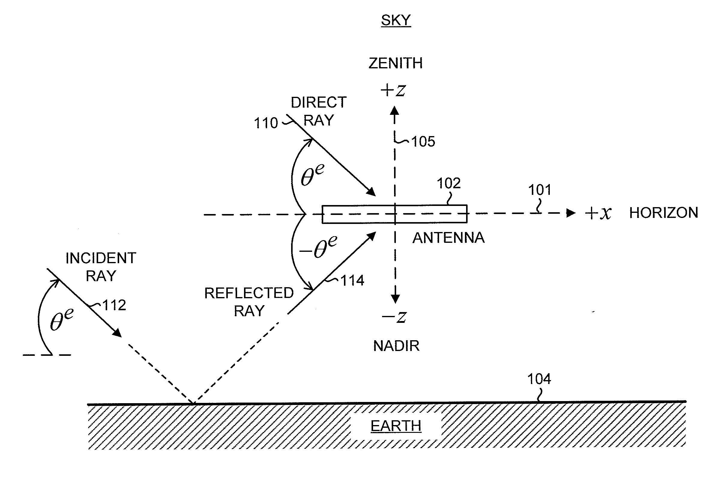
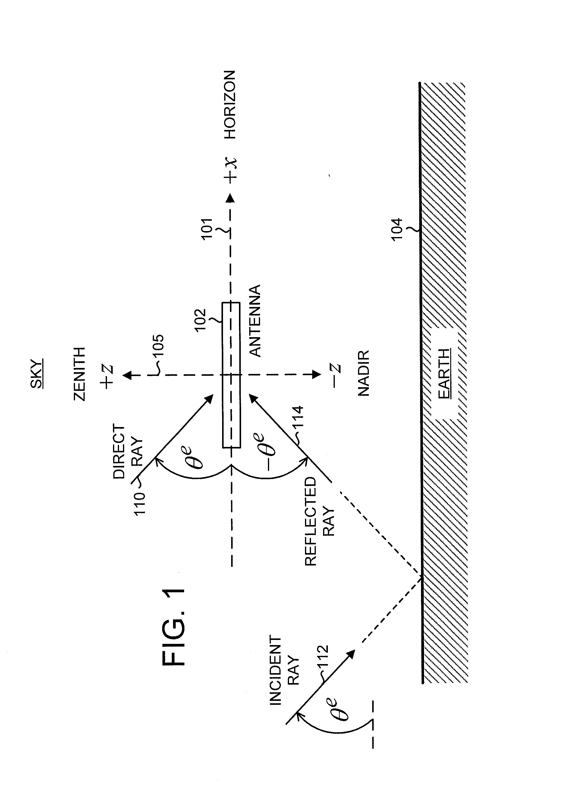
[0029]FIG. 1 shows a schematic of an antenna 102 positioned above the Earth 104. Herein, the term Earth includes both land and water environments. To avoid confusion with “electrical” ground (as used in reference to a ground plane), “geographical” ground (as used in reference to land) is not used herein. To simplify the drawing, supporting structures for the antenna are not shown. Shown is a reference Cartesian coordinate system with x-axis 101 and z-axis 105. The y-axis (not shown) points into the plane of the figure. In an open-air environment, the +z (up) direction, referred to as the zenith, points towards the sky, and the −z (down) direction, referred to as the nadir, points towards the Earth. The x-y plane lies along the local horizon plane.

[0030]In FIG. 1, electromagnetic waves are represented by rays with an elevation angle θe with respect to the horizon. The horizon corresponds to θe=0 deg; the zenith corresponds to θe=+90 deg; and the nadir corresponds to θe=−90 deg. Rays ...


PUM


Abstract

An antenna system for a global navigation satellite system reference base station is disclosed.The antenna system includes an antenna positioned above a high capacitive impedance surface (HCIS) ground plane.Over a specific range of the lateral dimension of the HCIS ground plane and the height of the antenna above the HCIS ground plane, a high level of multipath suppression and high sensitivity for low-elevated satellites can be simultaneously maintained.The HCIS ground plane can be fabricated as a flat conducting plate with an array of conducting elements such as pins, pins with expanded tips, or mushroom structures. Alternatively, the HCIS can be fabricated as a flat conducting plate with a concentric series of choke rings.The antenna system can provide a positioning accuracy of + / −1 mm, an order of magnitude improvement over previous designs.

Description

BACKGROUND OF THE INVENTION[0001]The present invention relates generally to antennas, and more particularly to ground planes for reducing multipath reception by antennas.[0002]Global navigation satellite systems (GNSSs) can determine locations with high accuracy. Currently deployed global navigation satellite systems are the United States Global Positioning System (GPS) and the Russian GLONASS. Other global navigation satellite systems, such as the European GALILEO system, are under development. In a GNSS, a navigation receiver receives and processes radio signals transmitted by satellites located within a line-of-sight of the receiver. The satellite signals comprise carrier signals modulated by pseudo-random binary codes. The receiver measures the time delays of the received signals relative to a local reference clock or oscillator. Code measurements enable the receiver to determine the pseudo-ranges between the receiver and the satellites. The pseudo-ranges differ from the actual ...

Claims


Application Information

Patent Timeline
Patent Type & Authority Applications(United States)
IPC IPC(8): H01Q1/48
CPCH01Q1/48H01Q15/14H01Q19/10H01Q15/0006H01Q3/00H01Q3/44
Inventor TATARNIKOV, DMITRY V.ASTAKHOV, ANDREY V.
Owner TOPCON POSITIONING SYST INC
Learn More