

Method and system for GPS enabled model and site interaction and collaboration for BIM and other design platforms
a technology of global positioning system and enabled model, applied in the field of three-dimensional models, can solve the problems of lack of standardization, long-held belief in poor bim software interoperability, and $15.8 billion lost annually by the u.s. capital facilities industry
- Summary
- Abstract
- Description
- Claims
- Application Information
AI Technical Summary
Benefits of technology
Problems solved by technology
Method used
Image

Examples
Embodiment Construction
Exemplary Cloud Electronic Information Storage and Retrieval System
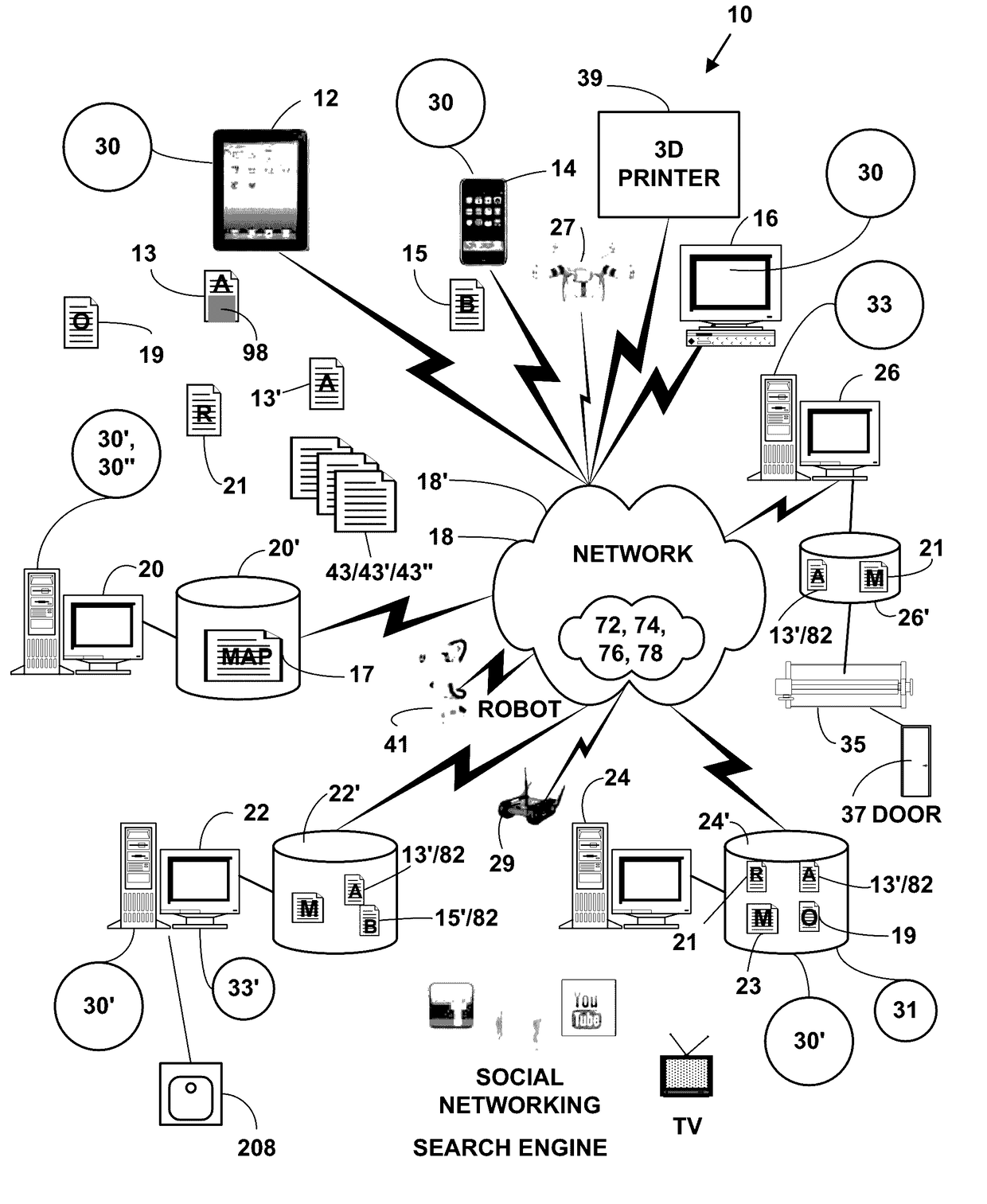
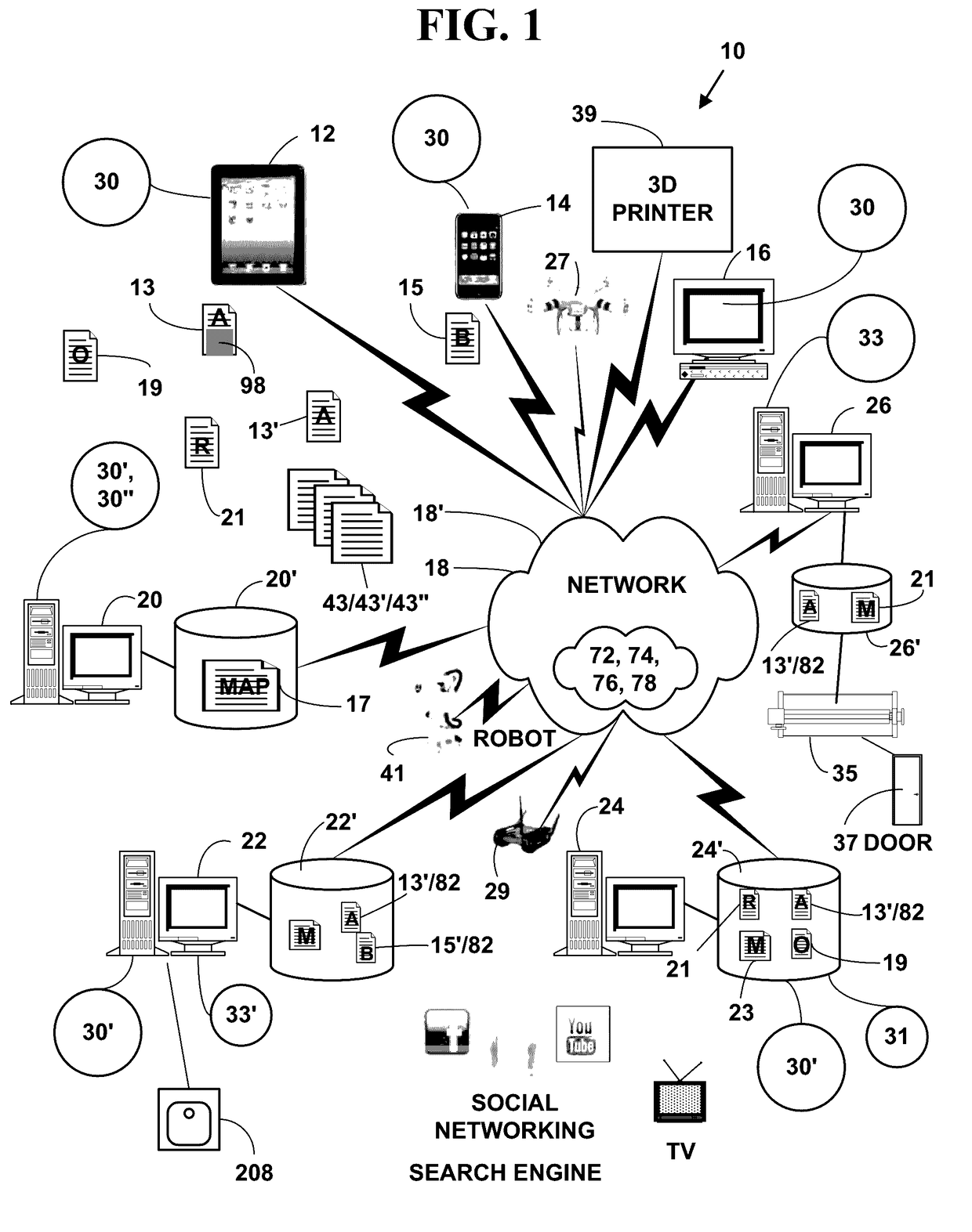
[0063]FIG. 1 is a block diagram illustrating an exemplary electronic information display system 10. The exemplary electronic system 10 includes, but is not limited to, one or more target network devices 12, 14, 16 (only three of which are illustrated) each with one or more processors and each with a non-transitory computer readable medium.
[0064]The one or more target network devices 12, 14, 16 include, but are not limited to, multimedia capable desktop and laptop computers, tablet computers, facsimile machines, mobile phones, non-mobile phones with and / or without displays, three-dimensional (3D) printer, robots, smart phones, Internet phones, Internet appliances, personal digital / data assistants (PDA), two-way pagers, digital cameras, portable game consoles (Play Station Portable by Sony, Game Boy by Sony, Nintendo DSI, etc.), non-portable game consoles (Xbox by Microsoft, Play Station by Sony, Wii by Nintendo, etc.)...
PUM
 Abstract
Description
Claims
Application Information