
Collaborative improvement of a vehicle's positioning

a positioning system and collaborative technology, applied in the field of collaborative positioning systems for vehicles, can solve the problems of difficult to mitigate in a consistent and efficient manner, poor precision of pvt calculation, and some native limitations of gnss, and achieve the effects of low size, weight and power, and not costly to implement or deploy

Active Publication Date: 2018-04-26
CENT NAT DETUD SPATIALES C N E S
View PDF3 Cites 30 Cited by
  • Summary
  • Abstract
  • Description
  • Claims
  • Application Information

AI Technical Summary

Benefits of technology

The invention provides processes to assess the reliability of GNSS measurements and makes use of multiple GNSS constellations and augmentation systems to increase accuracy and redundancy. It can be easily integrated into existing devices and doesn't require significant cost or technical expertise. The invention also allows rovers to share data with other rovers and process it locally, improving navigation in urban environments. In combination with improvements like accounting for traffic history, accidents, and local data, the invention can provide even more precise and reliable navigation information.

Problems solved by technology

But GNSS has some native limitations that will be discussed below, specifically in urban environments.
It is more difficult to mitigate in a consistent and efficient manner some errors which depend on the position of the receiver, notably when this position is environed by a number of objects which reflect the navigation RF signals and / or mask a number of the satellites which should be in line of sight (LOS) at a moment in time.
In such conditions, the precision of the calculation of the PVT may be quite poor, all other causes of errors being equal, both at the time of acquiring a GNSS signal and at the time of tracking said signal.
In urban canyons (i.e. streets in between skyscrapers) or on roads along trees, plantings or reflective structures, multipath will not only increase the error in the determination of the pseudo-range of a satellite (User Equivalent Range Error or UERE), but also the (Geometric) Dilution Of Precision, (GDOP or DOP), because the field of view of the antenna will be narrower thus limiting the increase in precision due to the use of additional satellites.
The correlation functions will be corrupted by multipath and the satellite may be not correctly acquired or may be lost.
Even if signal tracking is still achievable, signal impairments will affect the correlation function's shape, thus degrading the pseudo-range estimation, and the UERE.
Moreover, the true challenge may indeed be to maintain these levels of precision in all environments, including those heavily affected by multipath reflections like urban canyons.
Notably, they do not allow provision with off-the shelf equipment of a predictable confidence interval of the precision of the positions that they determine.

Method used


Image

  • Collaborative improvement of a vehicle's positioning
  • Collaborative improvement of a vehicle's positioning
  • Collaborative improvement of a vehicle's positioning

Examples


Embodiment Construction

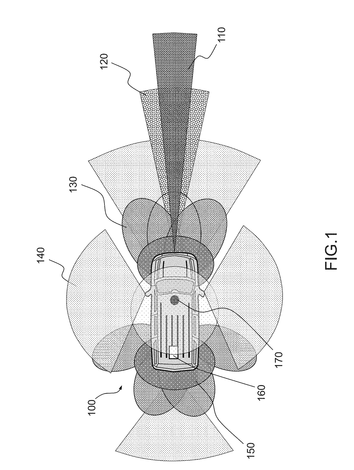
[0050]FIG. 1 represents a schematic of a vehicle enabled to implement various positioning technologies according to the prior art.

[0051]Credit for this schematic is given to Novatel™, the GNSS equipment maker. Even if it is still theoretical—no car with all the sensors and functions depicted on the schematic seems to be currently on the market—it does illustrate the importance of sensors in future automotive vehicles. And sensors mean signal processing and data fusion. The annual famous Consumer Electronics Show of Las Vegas, a long standing must for component and device makers is now becoming a “place to be” for most automotive platform and equipment manufacturers. Concept cars presented there are replete with radars, cameras, LIDARS, ultrasound sensors used to position the car in its close environment, detect obstacles and provide navigation and / or driving assistance to the driver or directly control the vehicle. Technologies that have been used for long on aerospace or marine tra...


PUM


Abstract

The invention discloses a positioning device configured to acquire its own GNSS position, the GNSS positions of rovers in an area around the positioning device and the relative positions of the positioning device to the rovers. The positioning device is configured to calculate a best-fit position based on this data and their confidence indexes. The positioning devices may communicate directly or through a navigation assistance centre. The best-fit position may be provided with indexes of confidence, availability and integrity. In some embodiments, the positioning device of the invention may be robust enough to generate commands to the driving controls of an autonomous vehicle.

Description

FIELD OF THE INVENTION[0001]The invention relates to a collaborative positioning system for vehicles. More specifically, according to the invention, a plurality of vehicles acquire and exchange their relative positions and absolute GNSS positioning data to improve their own absolute positioning.BACKGROUND[0002]More and more vehicles (cars, motorcycles, buses, etc.) are equipped with GNSS receivers, either natively mounted by the vehicle manufacturer, or in the form of a detachable device brought in by the operator of the vehicle.[0003]More and more applications rely on localization data, notably on-board vehicles, either for professional use or for leisure use. For instance, assisted navigation such as near-real time route planning and monitoring is more and more important to optimize transportation of persons and / or delivery of goods. Different types of vehicles may be used for transportation: buses, trucks, cars, motorcycles, or in a number of use cases, other mobile ground—such a...

Claims


Application Information

Patent Timeline
Patent Type & Authority Applications(United States)
IPC IPC(8): G08G1/16G01C21/30G01S19/51
CPCG08G1/163G01C21/30G01S19/51H04W4/046G08G1/09675H04L67/26G01S19/48G01S5/0072H04W4/027G01S19/20H04W4/38H04W4/44H04W4/024H04W4/46H04L67/55
Inventor MARMET, FRANCOIS-XAVIERRIES, LIONELCAPET, NICOLAS
Owner CENT NAT DETUD SPATIALES C N E S
Learn More