
Method for matching geographic information with recorded images

a technology of geographic information and recorded images, applied in the field of automatic method of matching geographic information with recorded images, can solve the problems of labor-intensive process and easy errors, and achieve the effects of low cost, convenient location, and simple operation

Inactive Publication Date: 2005-06-07
RED HEN SYSTEMS
View PDF27 Cites 196 Cited by
  • Summary
  • Abstract
  • Description
  • Claims
  • Application Information

AI Technical Summary

Benefits of technology

"The present invention is a method for matching images taken by a digital camera with geographic information recorded by a GPS receiver. The method uses a GPS log file to create a unique index for each image, linking them to the GPS receiver's location at the time the image was recorded. The method allows for wireless operation, with no cable required between the GPS receiver and the camera. It is simple to operate and compatible with low-cost GPS receivers. The method can also account for errors in the camera's clock and can interpolate between GPS epochs to obtain better positioning information. The invention provides a way to accurately match image files with GPS log files, even if there are errors in the GPS positioning or time recording."

Problems solved by technology

This can occur because of processing delays associated with formatting the image for recording on the digital storage medium.
A problem with one or more of the above systems is the extensive nature in which the process is labor-intensive and, consequently, prone to errors.

Method used


Image

  • Method for matching geographic information with recorded images
  • Method for matching geographic information with recorded images
  • Method for matching geographic information with recorded images

Examples


Embodiment Construction

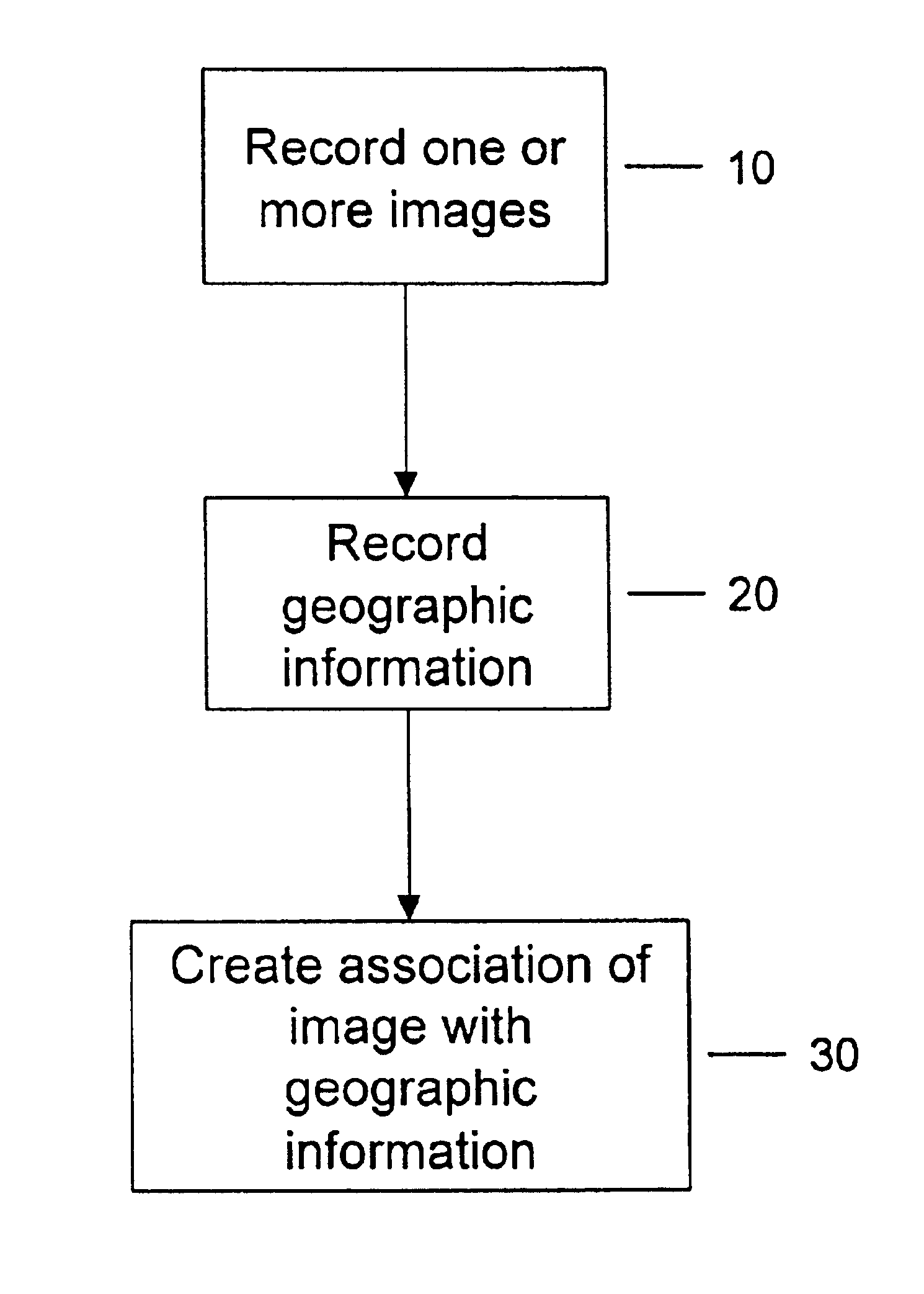
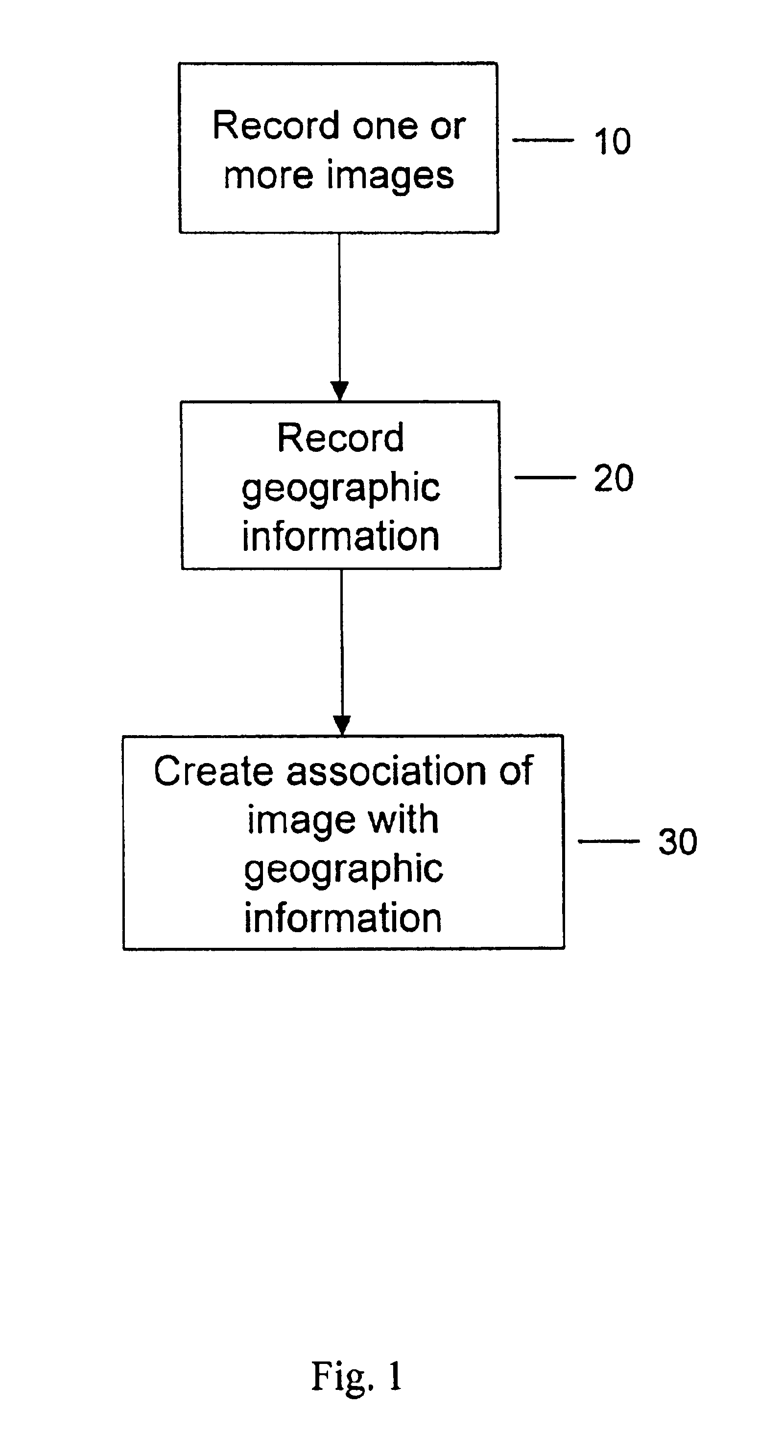
[0025]FIG. 1 is a flow chart of the overall decision logic for automatically matching images with its geographic information, in accordance with a preferred embodiment of the present invention.

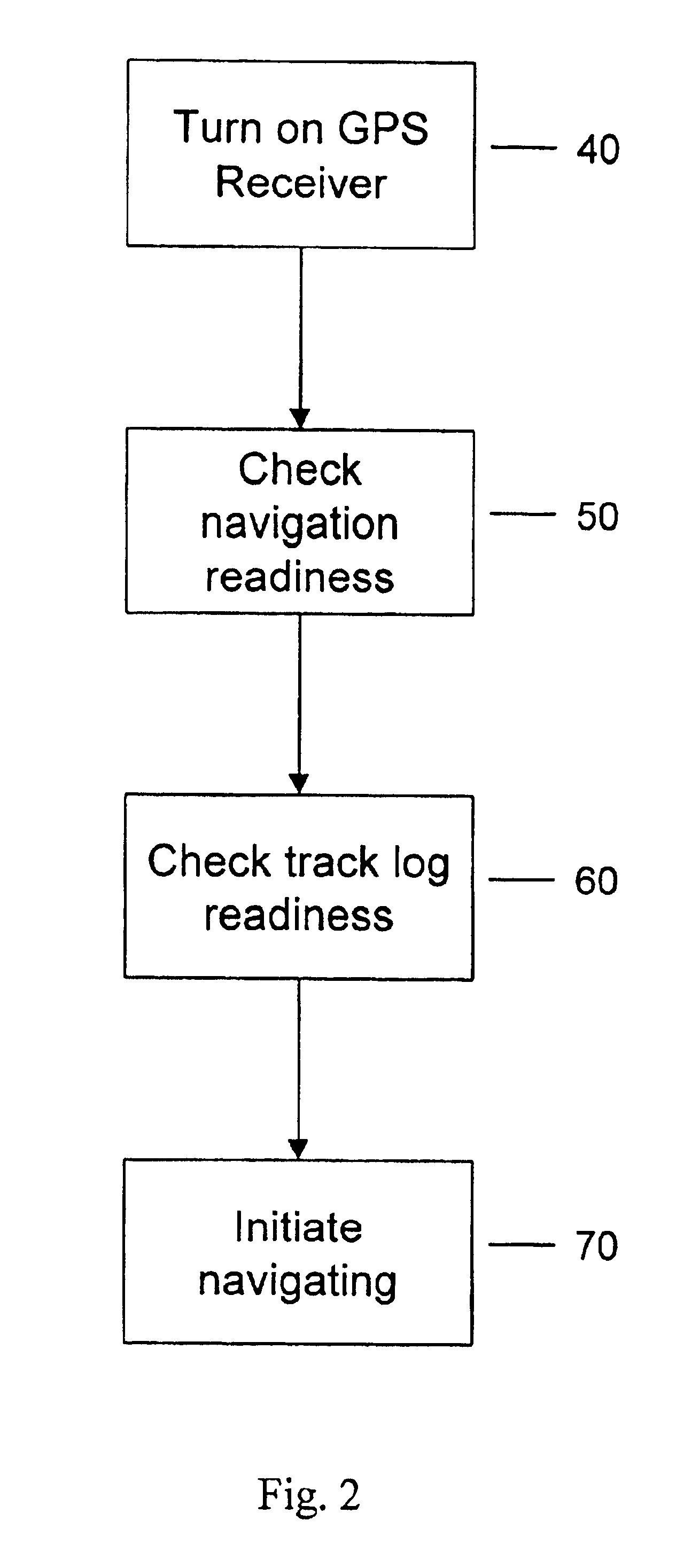
[0026]FIG. 2 is a flow chart describing in more detail an exemplary step of recording geographic information, as shown in FIG. 1.

[0027]FIG. 3 is an illustration of a time display screen of the receiver.

[0028]FIG. 4 is a flow chart describing in more detail an exemplary step of creating an association of an image with its geographic information, as shown in FIG. 1.

[0029]FIG. 5 shows an exemplary screen shot of the GPS display screen.

DETAILED DESCRIPTION OF EMBODIMENTS

[0030]The present invention relates to a method for automatically matching recorded images with geographic information corresponding to the geographic location that the image was recorded. Referring now to the figures, wherein like reference numerals indicate like elements / steps, in FIG. 1, there is a shown a flow chart of the deci...


PUM


Abstract

A method for matching a recorded image with geographic data substantially corresponding to a geographic location where the image was recorded, is disclosed. In a preferred embodiment, global positioning system data logs are time matched with other data collected, including image data, for the purpose of spatially mapping the collected data. Two important underpinnings of the present invention are that first, the real time of the data acquisition is recorded along with the data acquired; and second, that the offset time between the data logging clock and the world standard time is accurately determined. A primary advantage of the present invention is its wireless functionality; no information transmitters, receivers, special interfaces or power suppliers are required. In addition, a wide variety of off-the-shelf equipment may be used with the present invention as system components.

Description

RELATED APPLICATION[0001]This application claims the benefits of U.S. Provisional Application Ser. No. 60 / 241,666, entitled “Method for Matching Geographic Information with Recorded Images”, filed Oct. 18, 2000, which is hereby incorporated by reference.FIELD OF INVENTION[0002]The present invention relates to an automated method for matching geographic information with recorded images, and more particularly, to a method for digitally cross-referencing information of the geographic location where and when an image is recorded, with the digital representation of the recorded image.BACKGROUND OF INVENTION[0003]A data collection device, such as a digital camera, is capable of recording images onto a digital storage medium. Typically, a user of a digital camera will record multiple images on the storage medium. The recorded images may be viewed by using the digital camera's viewfinder, or may be viewed using a computer, such as a personal computer. If a computer is used to view the image...

Claims


Application Information

Patent Timeline
Patent Type & Authority Patents(United States)
IPC IPC(8): G06F17/30G01S5/14G01S19/14G01S19/48
CPCG06F17/30241G01S19/14G06F16/29
Inventor BURGESS, KEN L.
Owner RED HEN SYSTEMS
Learn More