Self-calibrating interferometric synthetic aperture radar altimeter

Active Publication Date: 2007-05-15
RADIANT GEOSPATIAL SOLUTIONS LLC +1
View PDF7 Cites 33 Cited by
  • Summary
  • Abstract
  • Description
  • Claims
  • Application Information

AI Technical Summary

Benefits of technology

[0011]To achieve accurate cross-track position measurements the system and method exploit a combination of modes based on a novel antenna pattern combination. The unique arrangement of the antenna patterns allows the radar to process terrain elevation measurements in three independent modes, namely, Time-Delay Response (TDR), Amplitude Monopulse (AM) and Phase Monopulse (P

Problems solved by technology

A problem with this technique is that it produces a position ambiguity.
Actual echo returns can only come from areas illuminated by the transmissions, so that the return areas are further limited to the solid angle cone of the antenna.
Still

Method used


Image

  • Self-calibrating interferometric synthetic aperture radar altimeter
  • Self-calibrating interferometric synthetic aperture radar altimeter

Examples


Example

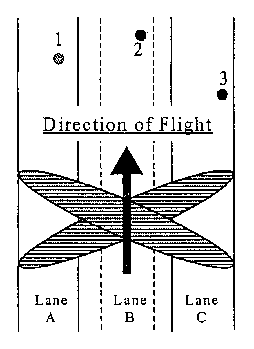
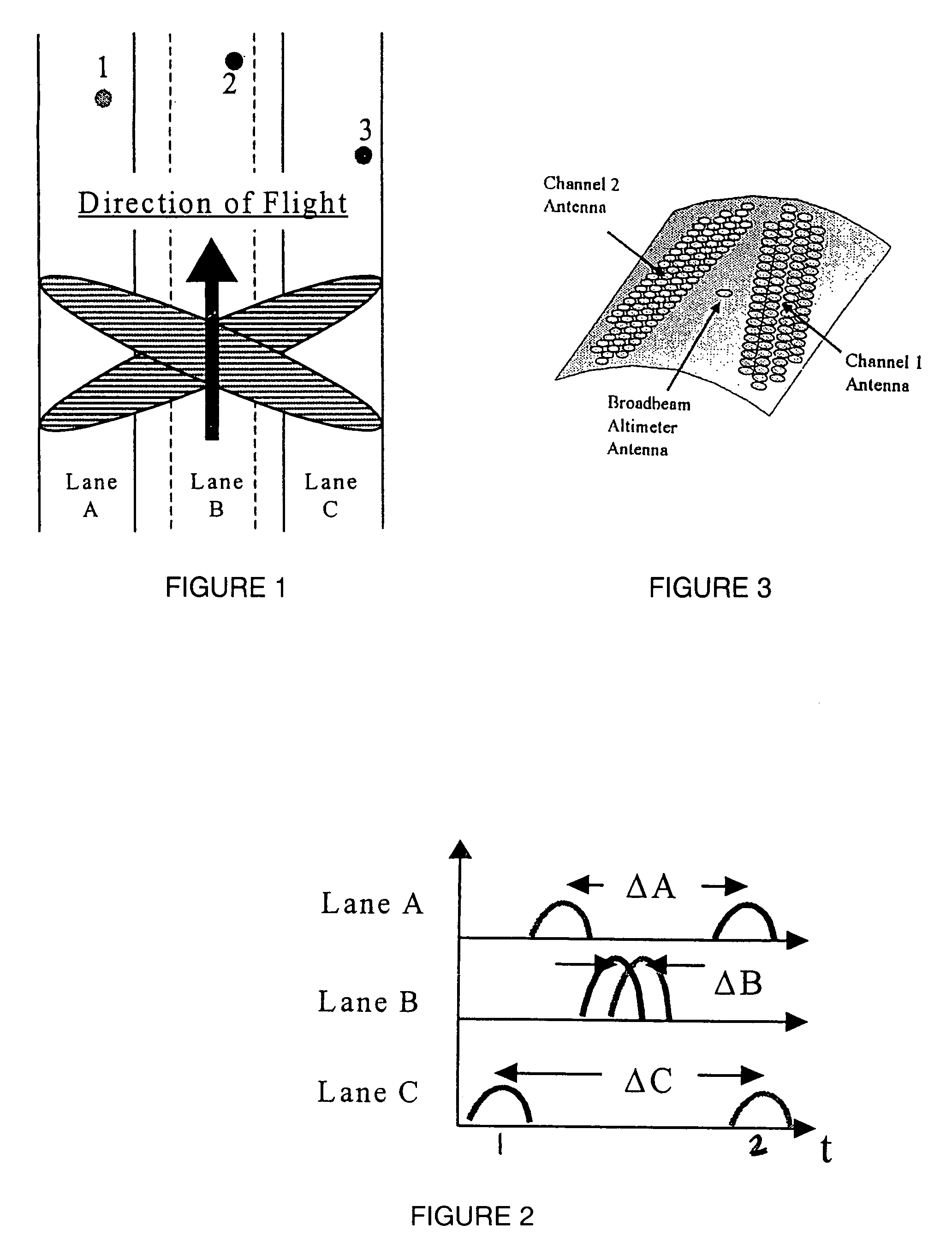
[0016]As discussed in the Background, this invention is directed to a radar system using RF bandwidth and Doppler beam sharpening interferometric synthetic aperture radar (IFSAR) principles to develop fine altitude and along-track resolutions, with resolutions on the order of ˜1 m or better anticipated. To assist the reader, the following glossary should prove beneficial:[0017]DEM: Digital Elevation Model[0018]DTED: Digital Terrain Elevation Data[0019]ECM: Electronic Countermeasures[0020]GPS: Global Positioning System[0021]IFSAR: Interferometric Synthetic Aperture Radar[0022]INS: Inertial Navigation Sensor[0023]MMW: Millimeter Wave (typically 35 and 94 GHz)[0024]SAR: Synthetic Aperture Radar[0025]SCISAR: Self-Calibrating Interferometric Synthetic Aperture Radar[0026]SNR: Signal to Noise Ratio

[0027]In addition, the following table will be used to review the features and benefits of various altimeter approaches. The inventive approach is called the SCISAR (Self-Calibrating Interferome...


PUM


Abstract

A synthetic aperture radar system uses RF bandwidth and Doppler beam sharpening principles to develop fine altitude and along-track resolutions. To achieve accurate cross-track position measurements the system and method exploit a combination of modes based on a novel antenna pattern combination. The unique arrangement of the antenna patterns allows the radar to process terrain elevation measurements in three independent modes, namely, time-delay response (TDR), amplitude monopulse (AM) and phase monopulse (PM). The additional modes address the interfering scatter problem and the calibration issues required for practical and cost effective operation. The approach also maximizes the number of terrain measurements made per look, thereby reducing the impact of errors and noise through averaging and “voting” (i.e., the comparison of measurements and discarding of “outliers”).

Description

FIELD OF THE INVENTION[0001]This invention relates generally to remote sensing and, in particular, to a radar system using a novel antenna pattern and multiple operational modes to develop an accurate location of a radar platform through three-dimensional terrain measurement and comparison to reference terrain data.BACKGROUND OF THE INVENTION[0002]In synthetic aperture radar (SAR), the relative motion between a platform such as an aircraft and a scene of interest is exploited to achieve greater angular resolution than that obtainable in a non-SAR system. The motion of the aircraft permits formation of a synthetic antenna that is larger in size than the real antenna. This large synthetic antenna has an angular resolution corresponding to the angular resolution of an equally large physical antenna. The aircraft flies in a predetermined path and repeatedly transmits a radar signal. It is typical for this radar signal to be directed to the side of the flight path via a small antenna. Th...

Claims


Application Information

Patent Timeline
IPC IPC(8): G01S13/08G01S7/40G01S13/88G01S13/90
CPCG01S7/4004G01S13/9023G01S13/882G01S2007/4091G01S2013/9047G01S13/9047G01S13/9092G01S7/4091
Inventor VANDENBERG, NORMAN
Owner RADIANT GEOSPATIAL SOLUTIONS LLC
Why Eureka
Try Eureka