Private, auditable vehicle positioning system and on-board unit for same
a vehicle positioning system and vehicle positioning technology, applied in the field of global navigation satellite system, can solve the problems of affecting the commercial and personal productivity of businesses and people living in the vicinity of surrounding congested areas, affecting the ability of road authorities to design pricing signals that could be used, and affecting the safety of users, etc., so as to improve the position estimate, and improve the position estimate
- Summary
- Abstract
- Description
- Claims
- Application Information
AI Technical Summary
Benefits of technology
Problems solved by technology
Method used
Image
Examples
case 1
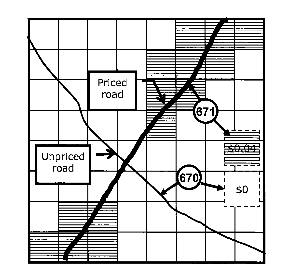
[0190] Cells that have temporal overlaps (one of the cells is “touched” twice within a very short time span). In FIG. 6.2, the journey passed through cell B then A, then back through B. If the toll is a lump sum per cell (touch), then B would be charged twice. If the toll is related to duration in the zone, B would be overcharged. If related to distance within the cell (as intended by this invention), then B would be correctly charged. The tendency of multipath error to sometimes exaggerate distance traveled can be countered by using the Douglas-Peucker process to smooth the journey. (For example, a 2005 report by Siemens showed a 7.5% error in distance calculation in one built-up area; similar errors were common in a battery of 2006 tests executed by Transport for London in the UK). As an alternative, such a study for each municipality can derive a discount map related to the degree of local distance error, but this is not likely necessary.)
case 2
[0191] A journey that hovers on the edge of two cells (FIG. 6.3). This is a degenerate instance of Case 1. This can be treated in as Case 1, but may be unfair if the pricing for cell A is very different than that in cell B. Rather, it would be seen as fairer if all of the duration and distance were assigned to the cell with the smaller charge.
[0192]It is possible to distinguish Case 1 and Case 2 by noting that in Case 1 the duration for one cell is considerably less than that for the other 621, while in Case 2 the durations are nearly coincident 631. A method to distinguish these is trivial.
[0193]Since these cells are relatively small, it is not difficult to design the price map to minimize the likelihood of case 2 happening in a circumstance where A and B are differently priced.
case 3
[0194] As a more difficult case, FIG. 6.4 represents a trip that touched the same cells several times (such as “circling” for parking or lost in an urban context, or on a mountain switchback in a rural context). This is handled by summing all data in the same cell (location) that occurs within a time threshold. Theoretically this could happen in the OBU, but that may be too inflexible. Performed at the data center, this could be made flexible (e.g., a jurisdiction may wish to charge more for “circling” but not for the spatial circumstances of a switchback) and would be the first step and would compress Qj to the degree that a motorist was circling or otherwise driving around in a small area. Since a zonelog begins and ends with a parking episode, it is not possible for the cells to sum across trips (say on the two journeys to and from the store). Note that this step of data compression effectively loads a single cell with multiple touches and exaggerates the length of time the vehic...
PUM
 Abstract
Description
Claims
Application Information
 - R&D
- Intellectual Property
- Life Sciences
- Materials
- Tech Scout
- Unparalleled Data Quality
- Higher Quality Content
- 60% Fewer Hallucinations
Browse by: Latest US Patents, China's latest patents, Technical Efficacy Thesaurus, Application Domain, Technology Topic, Popular Technical Reports.
© 2025 PatSnap. All rights reserved.Legal|Privacy policy|Modern Slavery Act Transparency Statement|Sitemap|About US| Contact US: help@patsnap.com


