Method and apparatus for identification and position determination of planar objects in images

a technology of image and position determination, applied in image data processing, photogrammetry/videogrammetry, instruments, etc., can solve problems such as deformation of objects in image spa

Active Publication Date: 2012-10-02
TOMTOM GLOBAL CONTENT
View PDF3 Cites 14 Cited by
  • Summary
  • Abstract
  • Description
  • Claims
  • Application Information

AI Technical Summary

Benefits of technology

[0017]A mobile mapping vehicle which drives over the surface of the earth, records surface collected geo-positioned image sequences with terrestrial based cameras. Some of said images include planar vertical objects in front of the vehicle along the side of the road. However, even on a road straight-away, the camera is not moved along its looking axis. The position and orientation of the camera with respect to the vehicle is known, and the position and orientation of the vehicle is accurately known with respect to a geographic coordinate reference system, including the gravity vector because of the accurate position and orientation sensors integrated into the mobile mapping vehicle. Then by means of trigonometry, the source images can be transformed into images which represent images that have been captured by moving a camera along the looking axis. When a radial logarithmic space transformation is performed on said images a straight line starting from the looking axis in image space is transformed to a straight horizontal line in radial logarithmic space. From the above, we have learned that pixels of an object having a planar surface which is perpendicular to the looking axis will travel its exact straight line in the image space. Consequently, said object will have similar size and shape in the radial logarithmic images. This feature enables the engineer to perform a simple matching algorithms on two images to detect areas in said images having objects with similar size and characteristics. The detected areas correspond to objects having a planar surface approximately perpendicular to the looking axis of the first and second intermediate images.
[0063]offset—horizontal displacement between object locations in radial logarithmic image space. These features enable us to determine the distance between the camera and the object.

Problems solved by technology

This results in deformation of the object in the image space.

Method used


Image

  • Method and apparatus for identification and position determination of planar objects in images
  • Method and apparatus for identification and position determination of planar objects in images
  • Method and apparatus for identification and position determination of planar objects in images

Examples


Embodiment Construction

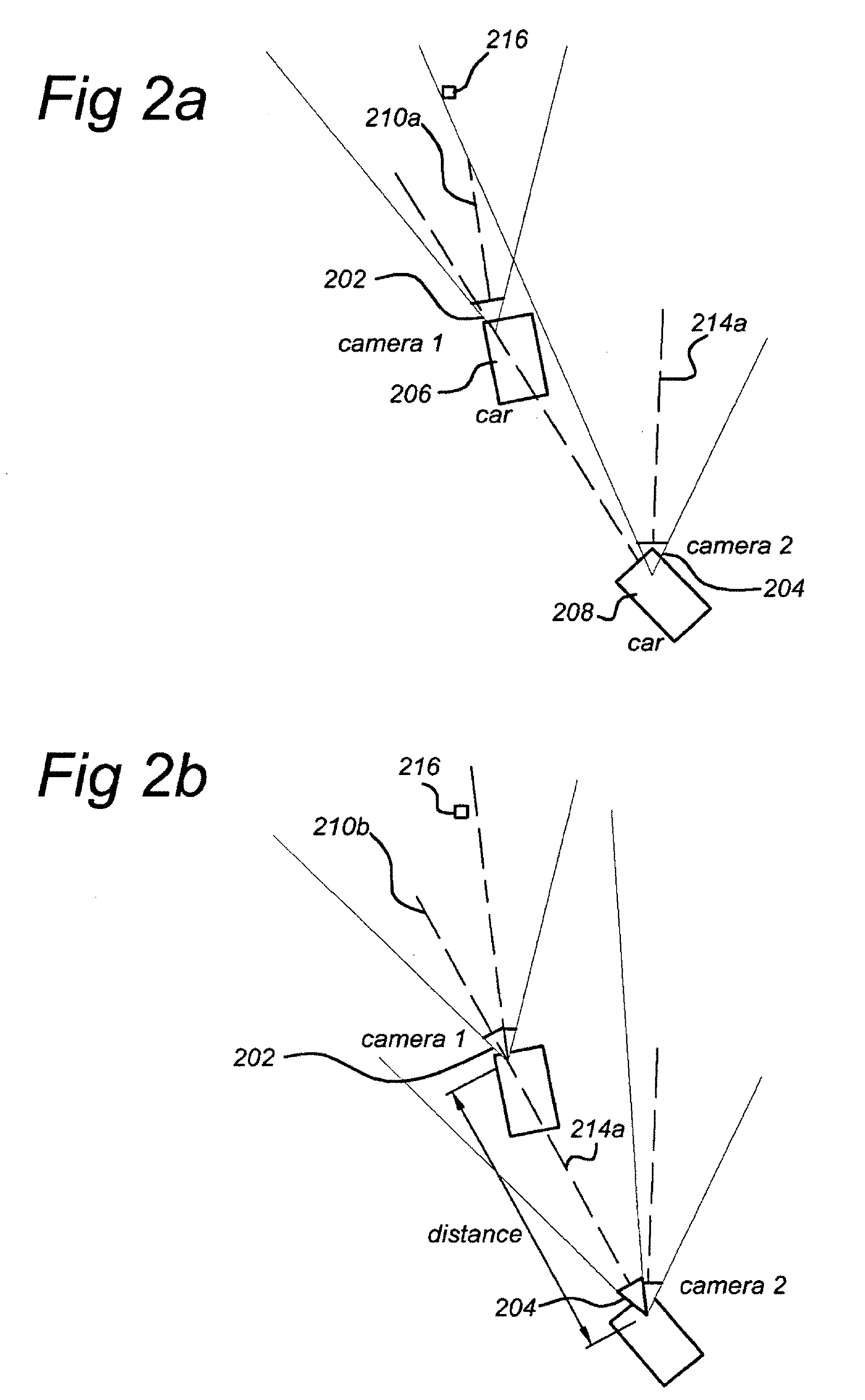
[0082]FIG. 14 shows a MMS system that takes the form of a van 21. The van 21 is provided with one or more cameras 29(i), i=1, 2, 3, . . . I and one or more laser scanners 23(j), j=1, 2, 3, . . . J. The looking angle or the one or more cameras 29(i) can be in any direction with respect to the driving direction of the van 21 and can thus be a front looking camera, a side looking camera or rear looking camera, etc. The viewing window(s) of the camera(s) 29(i) cover(s) the whole road surface in front the vehicle. Preferably, the angle between the driving direction of the van 21 and the looking angle of a camera is within the range of −45 degree −45 degree on either side. The van 21 can be driven by a driver along roads of interest.

[0083]The van 21 is provided with a plurality of wheels 22. Moreover, the van 21 is provided with a high accuracy position determination platform. As shown in FIG. 14, the position determination platform comprises at least some of the following components:

[008...


PUM


Abstract

A method of identifying a planar object in source images is disclosed. In at least one embodiment, the method includes: retrieving a first source image obtained by a first terrestrial based camera; retrieving a second source image obtained by a second terrestrial based camera; retrieving position data associated with the first and second source image; retrieving orientation data associated with the first and second source image; performing a looking axis rotation transformation on the first and second source image by use of the associated position data and orientation data to obtain first and second intermediate images, wherein the first and second intermediate images have an identical looking axis; performing a radial logarithmic space transformation on the first and second intermediate images to obtain first and second radial logarithmic data images; detecting an area in the first image potentially being a planar object; comparing the potential planar object having similar dimensions in the second radial logarithmic data image and similar rgb characteristics; and finally, identifying the area as a planar object and determining its position. At least one embodiment of the method enables the engineer to detect very efficiently planar perpendicular objects in subsequent images.

Description

FIELD OF THE INVENTION[0001]The present invention relates to a method of identifying a planar object in source images. The invention further relates to an apparatus for identifying and determining the position of a planar object from source images for use in a map database.PRIOR ART[0002]There is a need to collect a large number of “vertical” road information e.g. road signs, speed limits, direction signposts, bill boards etc. for digital map databases used in navigation systems and the like. The term “vertical” indicates that an information plane of the road information is generally parallel to the gravity vector. The vertical road information, e.g. STOP on a stop sign, is normally written on a planar sign, usually a metallic plate mounted on a post. Therefore, a characteristic of “vertical road information” is that they could be extracted from a planar plane. Nowadays, vertical road information can be obtained by analysing and interpreting vertical picture images and other data co...

Claims


Application Information

Patent Timeline
Patent Type & Authority Patents(United States)
IPC IPC(8): G06K9/00
CPCG01C11/00G01C11/06G06K9/00818G06T7/0075G06T2207/30252G06T7/593G06V20/582
Inventor KMIECIK, MARCIN MICHALWYSOCKI, ARKADIUSZ
Owner TOMTOM GLOBAL CONTENT
Why Eureka
Try Eureka