

System and method for computational geology
a computational geology and system technology, applied in the field of seismic exploration, can solve the problems of too simplistic, one or both methods limited, and models can be daunting tasks
- Summary
- Abstract
- Description
- Claims
- Application Information
AI Technical Summary
Benefits of technology
Problems solved by technology
Method used
Image

Examples
embodiments
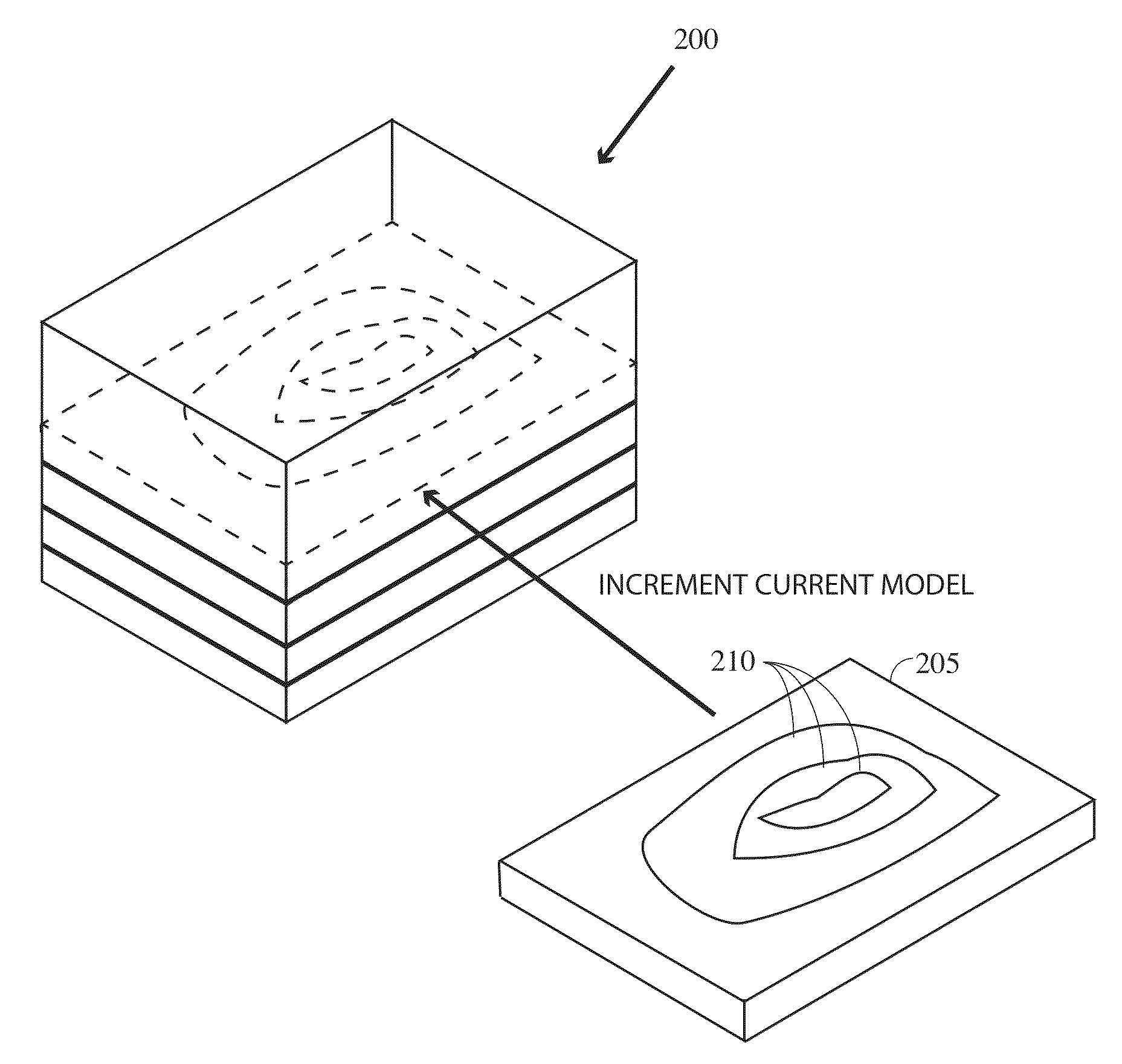
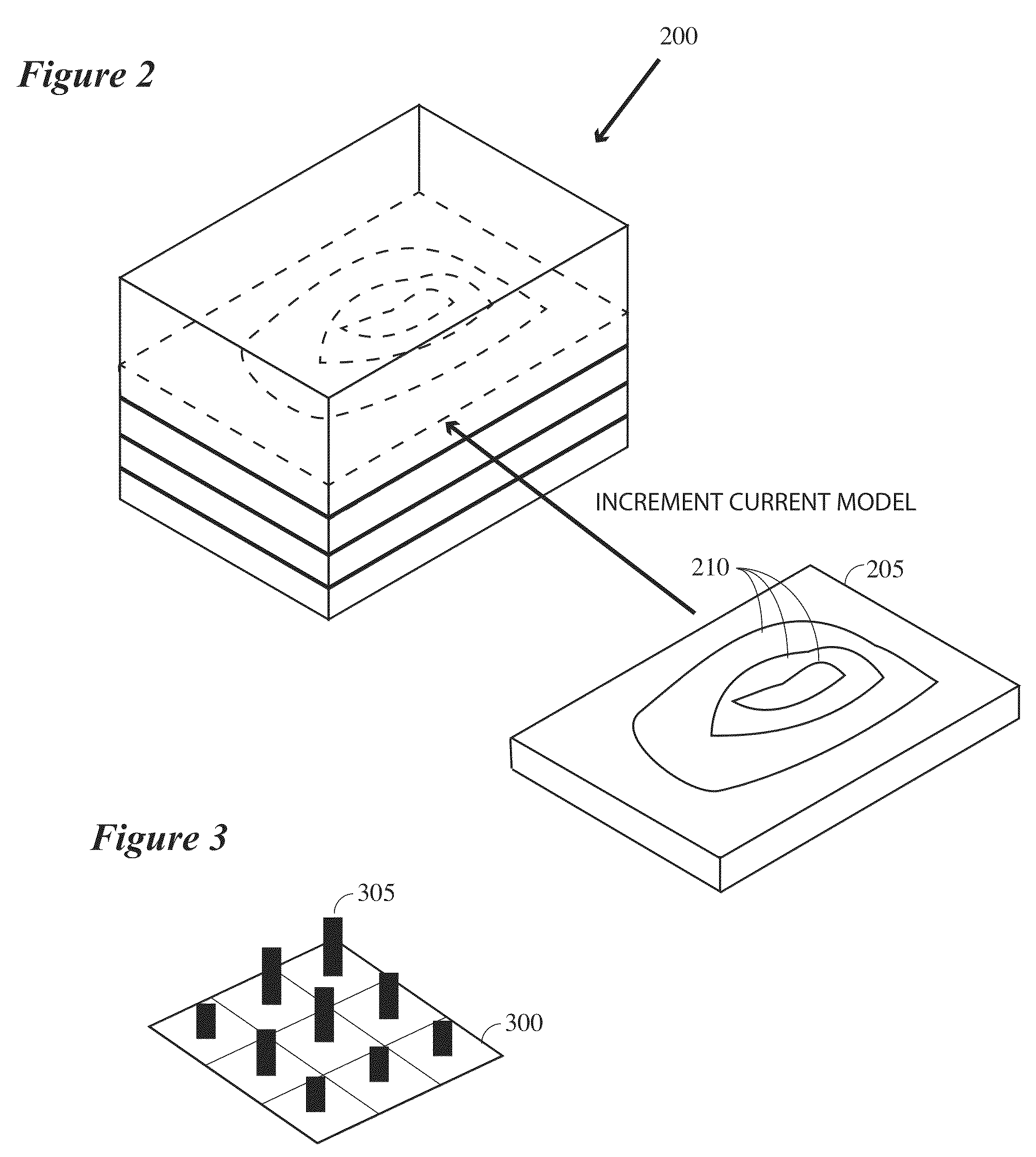
[0025]In one embodiment, a synthetic depositional simulation is used to mimic the stratigraphic setting of a reservoir that can be subsequently used in subsurface exploration for oil and gas, among others.
[0026]Turning first to FIG. 4, this figure contains a general overview of the instant invention and its associated environment. As is indicated, generally speaking a seismic survey (e.g., marine, terrestrial, combination, etc.) will be designed 410, usually with a specific subsurface target or targets in mind. Those of ordinary skill in the art will understand how such is done and especially how such is done where the object is to image a particular subsurface target.
[0027]In the field, seismic data will be collected conventionally or unconventionally (step 420) by positioning sources and receivers, activating sources, and recording the returning seismic signals. In some instances, the receivers will be sensors that are towed behind the source or another vessel. In other cases, the...
PUM
 Abstract
Description
Claims
Application Information