Method for determining a spatially resolved extent of error for position finding with a GNSS

a technology of spatial resolution and position finding, applied in the field of spatial resolution extent of error for position finding, can solve the problems of insufficient precision of gnss position provided by conventional gnss receivers, excessively difficult and expensive exact surveying of landmarks, and inability to comprehensively use surveyed landmarks for improving position determination via gnss

Active Publication Date: 2017-10-03
AUDI AG
View PDF31 Cites 1 Cited by
  • Summary
  • Abstract
  • Description
  • Claims
  • Application Information

AI Technical Summary

Problems solved by technology

For this use, the precision of the GNSS position provided by conventional GNSS receivers is not sufficient, since the uncertainty is too high.
However, this approach has the disadvantage that exact surveying of landmarks is exceedingly difficult and expensive.
A comprehensive use of surveyed landmarks for improving the determination of the position via a GNSS is therefore currently not feasible.
In addition, the precision of the GNSS receivers and thus of the GNSS positions determined by them is highly dependent on the environment, so that, for example, the precision on the highways where there is a free line-of-sight connection with the satellites is considerably higher than in the skyscraper canyons where the line of sight to the satellites is greatly limited or not at all directly possible.
In the example of the skyscraper canyons, the GNSS signal, if it reaches the receiver at all, reaches it only by way of the so-called multipath propagation, which in turn enormously worsens the precision that can be achieved.

Method used


Image

  • Method for determining a spatially resolved extent of error for position finding with a GNSS
  • Method for determining a spatially resolved extent of error for position finding with a GNSS
  • Method for determining a spatially resolved extent of error for position finding with a GNSS

Examples


Embodiment Construction

[0009]It is therefore the object of the invention, in particular for the preparation of an acquisition of landmarks for a database for the purpose of improving the position finding in a motor vehicle, to provide a robust possibility that can be implemented easily for the ascertainment of a site-dependent precision of the GNSS.

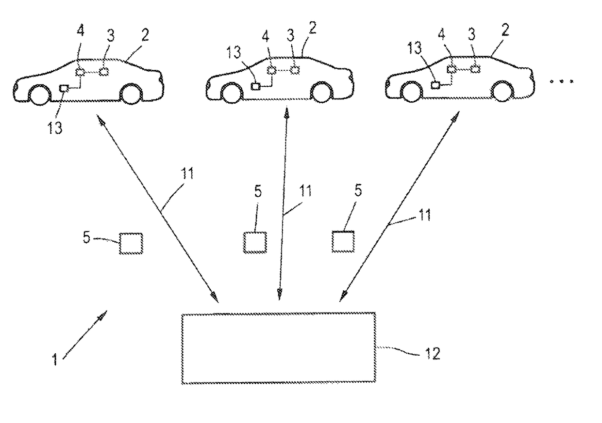
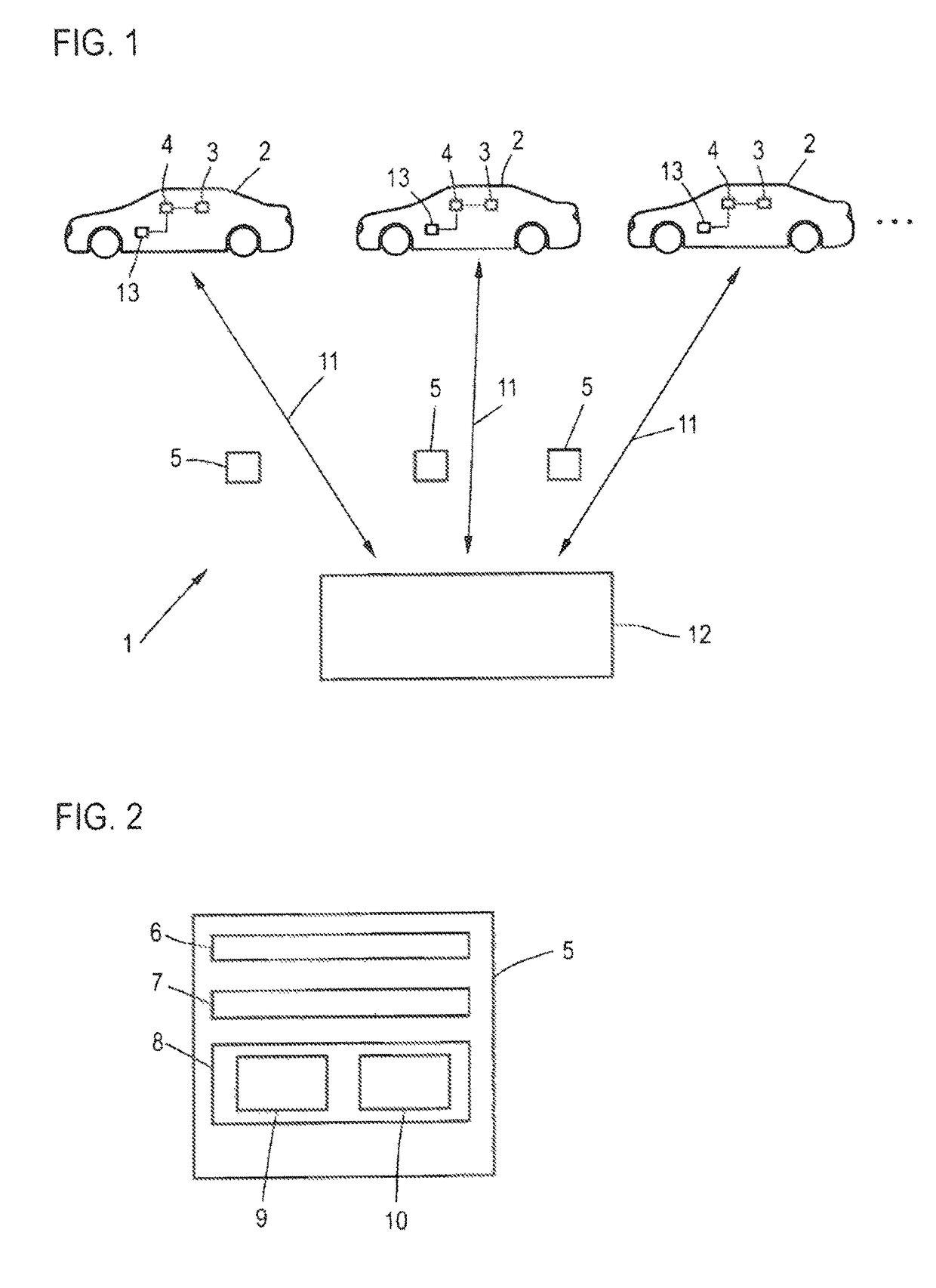
[0010]To achieve this object, according to the invention, a method is provided for determining a spatially resolved extent of error for position finding with a global navigation satellite system for a target area of interest using field data from a plurality of field apparatuses, particularly motor vehicles, each having a receiver for the global navigation satellite system and which are at least intermittently situated in the target area, comprising the following steps:

[0011]ascertainment of at least one field data record comprising a current GNSS position in the target area and an error value associated with said position, by the field apparatuses,

[0012]transm...


PUM


Abstract

A method for determining a spatially resolved extent of error for position finding with a global navigation satellite system for a target area of interest using field data from a plurality of field apparatuses, particularly motor vehicles, each having a receiver for the global navigation satellite system and which are at least intermittently situated in the target area, comprising the following steps: ascertainment by the field apparatuses of at least one field data record comprising a current GNSS position in the target area and an error value associated with said position, transmission of the field data records to a central computation device, updating of an error map containing the extents of error for various positions and/or subareas of the target area by statistical evaluation of the field data records in the central computation device.

Description

TECHNICAL FIELD[0001]The invention relates to a method for determining a spatially resolved extent of error for position finding with a global navigation satellite system (GNSS) for a target area of interest.BACKGROUND[0002]Global navigation satellite systems (GNSS) are already widely known in the prior art. GPS (Global Positioning System) is an example thereof. Here, on the basis of the signals received from several satellites, a current position is determined, for example, by means of a mobile telephone or a motor vehicle.[0003]Especially in motor vehicles there are more and more vehicle systems that require the most exact possible determination of the current position of the motor vehicle. This relates particularly to vehicle systems in the field of motor-vehicle-to-motor-vehicle communication (c2c communication) and in the field of motor-vehicle-to-infrastructure communication (c2x communication). For this use, the precision of the GNSS position provided by conventional GNSS rec...

Claims


Application Information

Patent Timeline
Patent Type & Authority Patents(United States)
IPC IPC(8): G01S19/40G01S19/45G01S19/49G01S19/48G01S19/03
CPCG01S19/45G01S19/40G01S19/48G01S19/49G01S19/03
Inventor BUCHHOLZ, JANENGEL, SEBASTIAN
Owner AUDI AG
Why Eureka
Try Eureka