

Systems and methods to enhance reliability of measured position data
a technology of position data and system, applied in the field of system and method for improving the accuracy of position measurements, can solve the problems of reducing the accuracy of the system at certain, affecting the accuracy of the system, and loran suffer from electronic effects, etc., to achieve the effect of enhancing the reliability and accuracy of the device, and increasing the accuracy of inferring
- Summary
- Abstract
- Description
- Claims
- Application Information
AI Technical Summary
Benefits of technology
Problems solved by technology
Method used
Image

Examples
Embodiment Construction
[0002]Field of the Invention
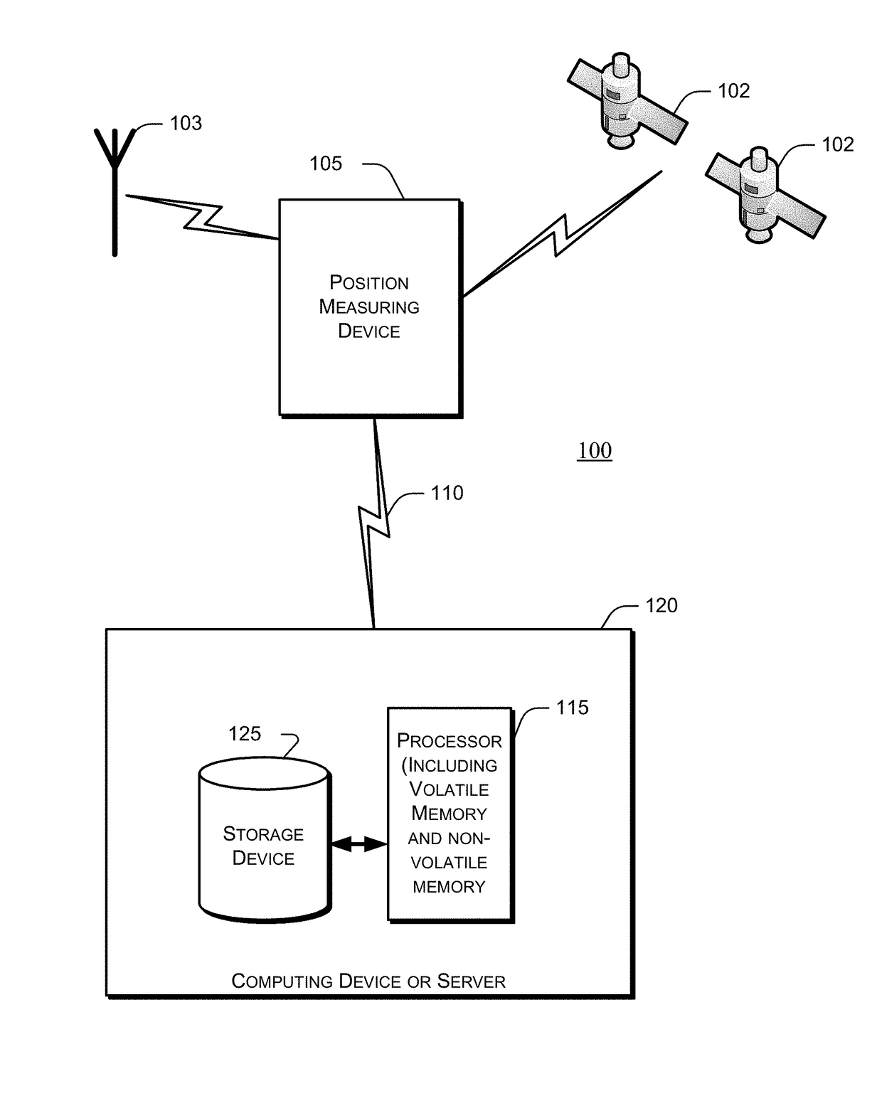
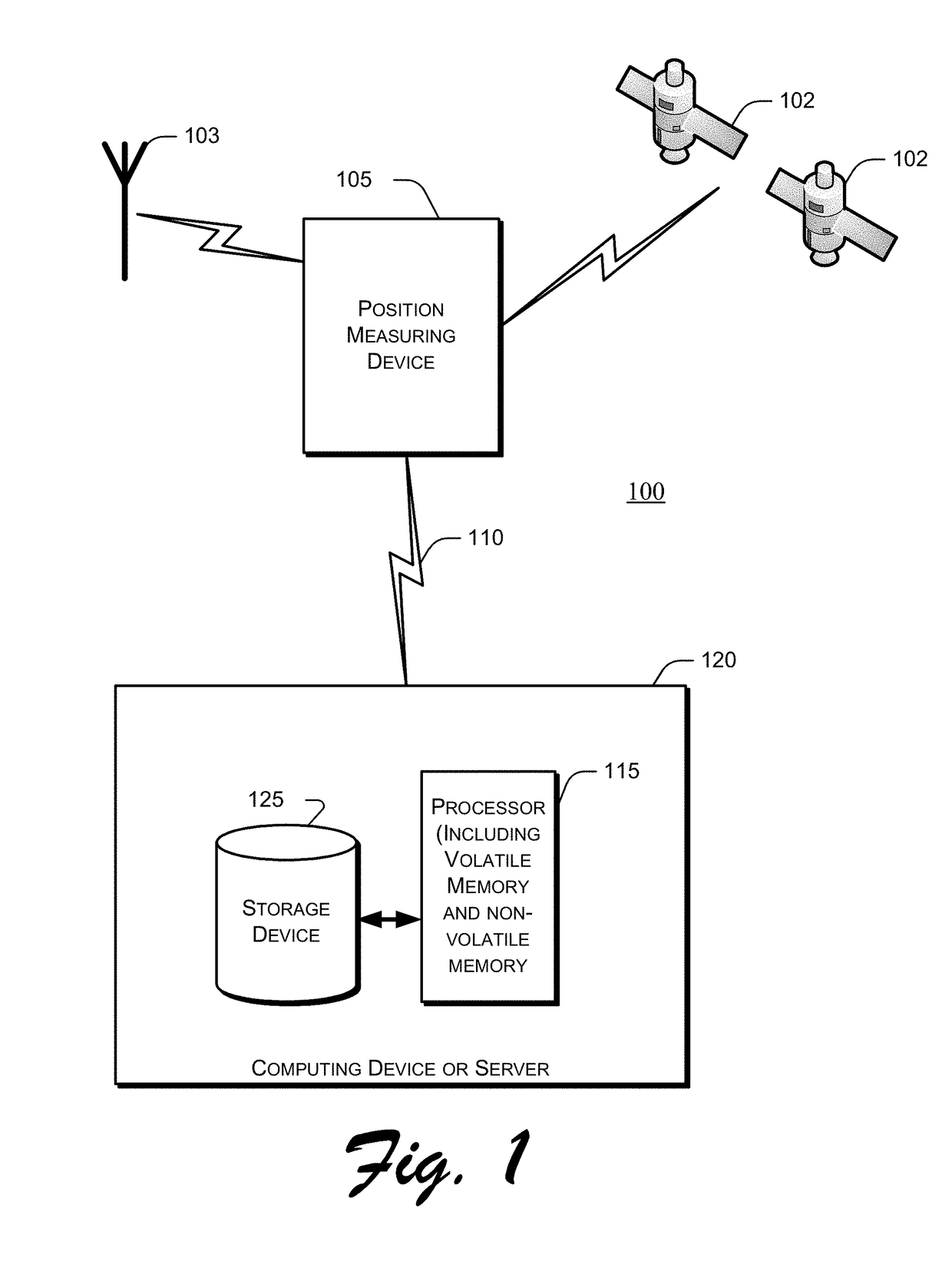
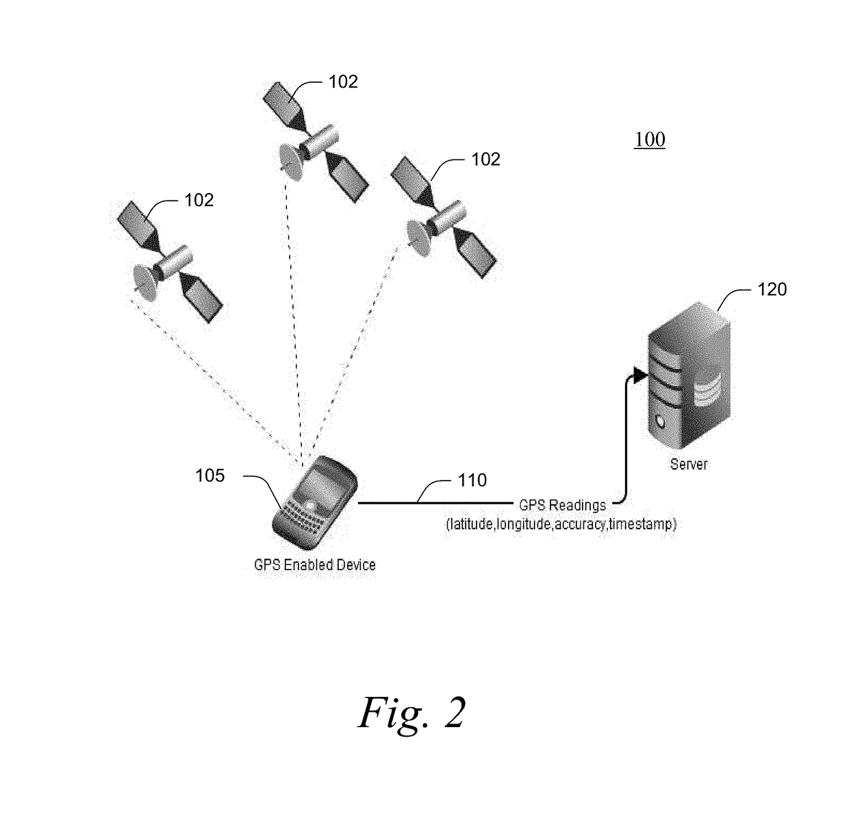
[0003]The present invention relates to systems and methods for improving accuracy of position measurements; and more particularly, for improving location measurements for devices operating with positioning systems such as the Global Positioning System (GPS).
[0004]Background of the Invention
[0005]For as long as mankind has needed to travel, methods to measure a person's location on the surface of Earth were needed. Well-known techniques such as celestial navigation have been used for centuries to attempt to calculate and determine the position of a point on earth, such as the current position of a ship at sea. In the twentieth century, electronic navigation systems such as the British GEE systems and the LORAN system were developed and used extensively in various embodiments around the world, providing a means to determine location regardless of whether time of day or weather permitted celestial position fixes. However, systems such as LORAN require the in...
PUM
 Abstract
Description
Claims
Application Information