Multiple observation points setting method based on simulated annealing algorithm

A simulated annealing algorithm and observation point technology, applied in computing, image data processing, instruments, etc., can solve problems such as huge differences in simulation computing complexity

Inactive Publication Date: 2007-09-12
INST OF SOFTWARE - CHINESE ACAD OF SCI
View PDF0 Cites 2 Cited by
  • Summary
  • Abstract
  • Description
  • Claims
  • Application Information

AI Technical Summary

Problems solved by technology

However, from the analysis of the complexity of the problem, it can be clearly seen that a large factor affecting the feasibility of solving the problem is the size of the terrain data. For the same piece of terrain, the simulation calculation of multi-observation point settings is performed on terrain data with different resolutions. Complexity varies widely

Method used


Image

  • Multiple observation points setting method based on simulated annealing algorithm
  • Multiple observation points setting method based on simulated annealing algorithm
  • Multiple observation points setting method based on simulated annealing algorithm

Examples


Embodiment Construction

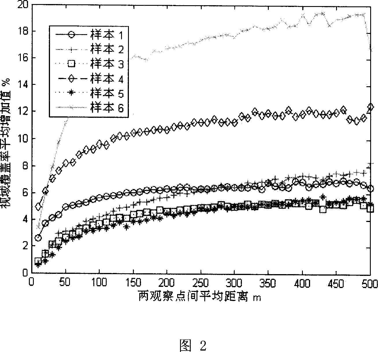
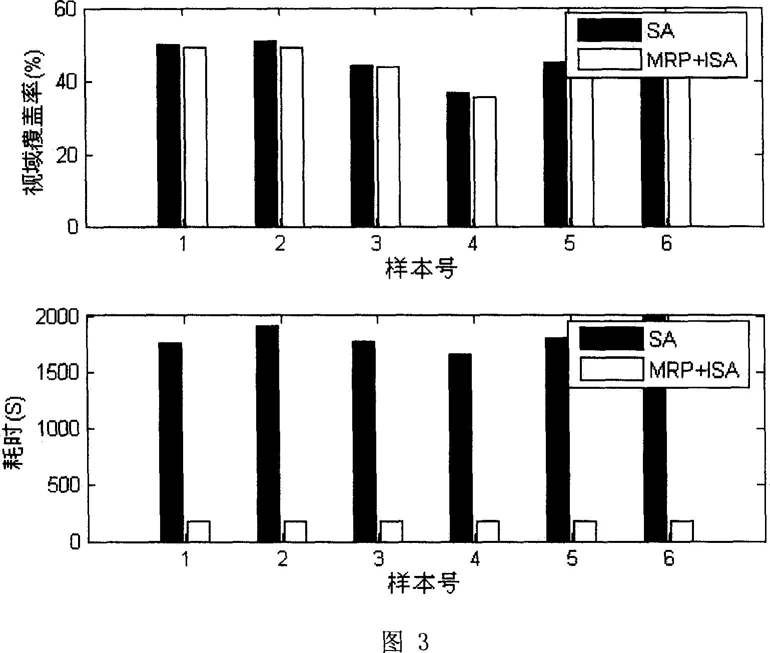
[0051] The terrain to be processed is: terrain sample 1, grid points 1024*1024

[0052] The number of observation points that need to be set is: 64

[0053] Annealing coefficient λ=0.9

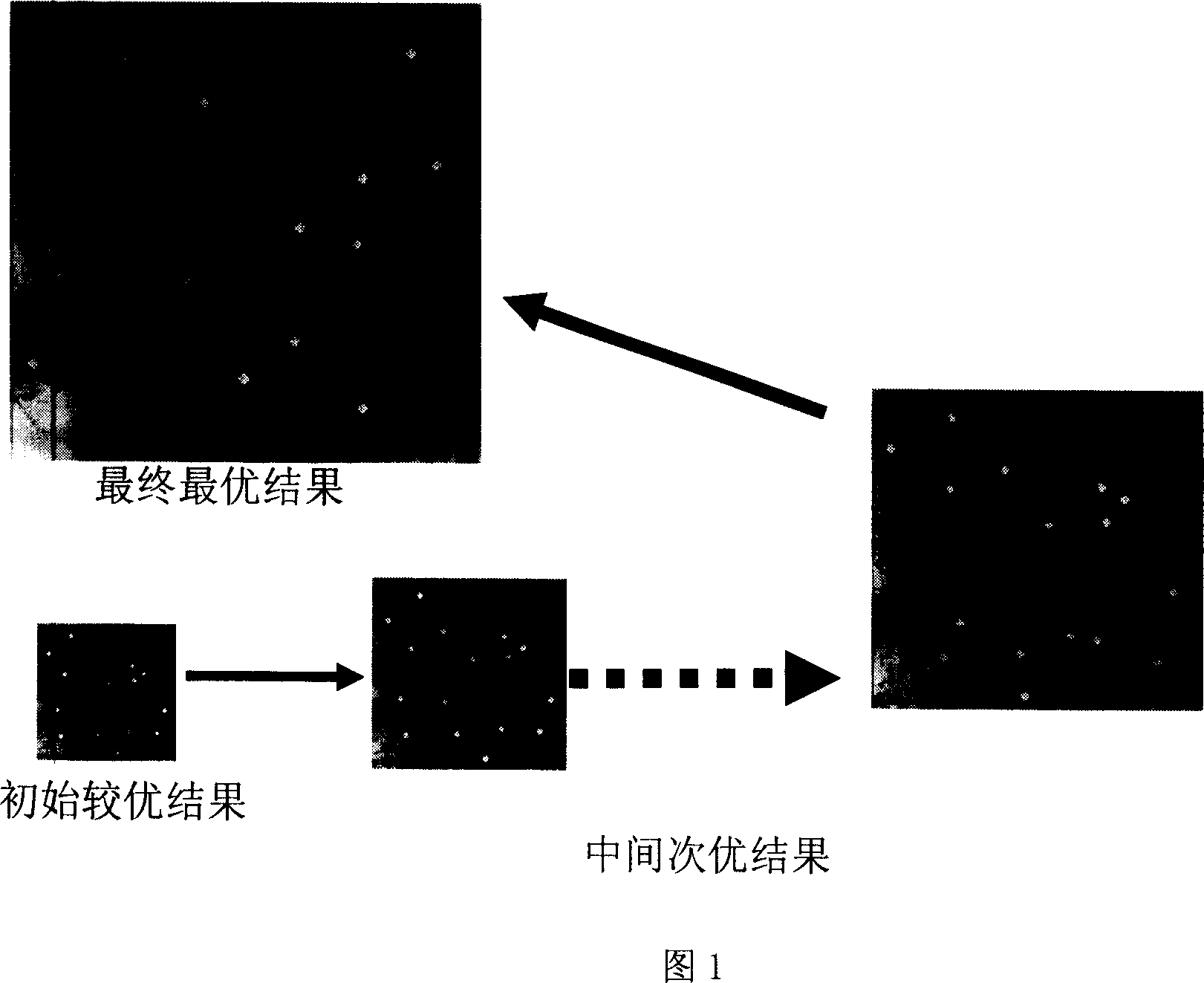
[0054] In the first step, the terrain is divided into 8 equal blocks according to the number of observation points to be set and the size of the terrain to be actually processed. The number of observation points in each block is 64 / 8=8.

[0055] In the second step, 8 observation points are randomly selected in each terrain block, and the viewsheds of all observation points and the visible coverage after the viewsheds are combined are calculated.

[0056] The third step is to use the results obtained in the second step as the initial state, and use the improved simulated annealing algorithm to find the best combination of observation points in each terrain block, and the change of observation points in each terrain block is limited to the terrain inside the block. From this, an approximate g...


PUM


Abstract

The invention supplies a multi- viewpoints establishment method based on the simulation anneal algorithm, first according to viewpoint integer n and the actual processing terrain divides terrain into K block; Then stochastically chooses a n/K viewpoint in each terrain block, and computation all viewpoints sight and sight merge visible cover scope; the obtained beforehand step result took as the original state, uses the new improvement the simulation anneal algorithm separately to extract the best viewpoint combination in each terrain block, from this obtains the approximate overall situation viewpoint establishment. This invention make the improvement to the classics simulation anneal algorithm from the objective function and drew back the warm function two aspects, overcame the defect of low establishment plan efficiency and could not apply to the actual shortcoming based on the traditional simulation anneal algorithm, the invention time efficiency enhances 15-20times, the precision loses in 2%.

Description

technical field [0001] The invention belongs to the technical field of terrain analysis, and in particular relates to an artificial intelligence-based method capable of quickly finding the most favorable viewing point on the terrain. Background technique [0002] Terrain Visibility Analysis (Terrain Visibility Analysis) is a method and technology that uses the principles of computational geometry and computer graphics technology to solve the visibility problem of the observation point set on the terrain. Under the condition of a given observation point property (person, repeater station, etc.), the visible area of ​​the observation point within the reachable range of its line of sight constitutes the viewing area of ​​the observation point. [0003] The observation point setting problem in terrain visibility analysis refers to finding as few observation points as possible for a terrain area, so that their joint viewshed covers a certain proportion of the area in the terrain ...

Claims


Application Information

Patent Timeline
Patent Type & Authority Applications(China)
IPC IPC(8): G06T7/00
Inventor 吕品张金芳李磊鲁敏李原野
Owner INST OF SOFTWARE - CHINESE ACAD OF SCI
Why Eureka
Try Eureka