Minisize rudders three-dimensional track emulation method under city environment

A technology of micro air vehicle and urban environment, applied in the field of three-dimensional real-time path navigation of micro air vehicle

Inactive Publication Date: 2008-02-06
TSINGHUA UNIV
View PDF0 Cites 59 Cited by
  • Summary
  • Abstract
  • Description
  • Claims
  • Application Information

AI Technical Summary

Problems solved by technology

In addition to the hardware interface input function of the general simulation system, this system also has the software interface input function, which can i

Method used


Image

  • Minisize rudders three-dimensional track emulation method under city environment
  • Minisize rudders three-dimensional track emulation method under city environment
  • Minisize rudders three-dimensional track emulation method under city environment

Examples


Embodiment Construction

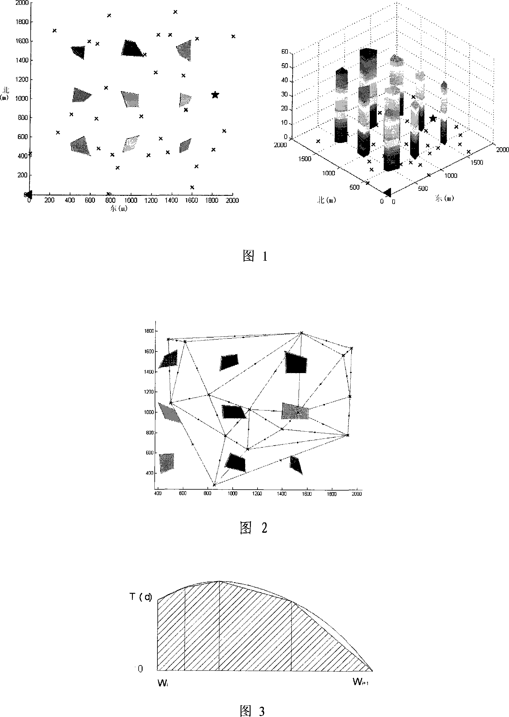
[0102] Aiming at the simplified three-dimensional model of the geographical environment, the present invention provides a system map initialization scheme, uses a geometric method to divide the map into various areas, so as to realize the mission planning of the micro-flight group. A realistic 3D visual simulation is given at the output in real time. The program design flow chart is shown in Figure 7.

[0103] The implementation process of the present invention is divided into the following steps:

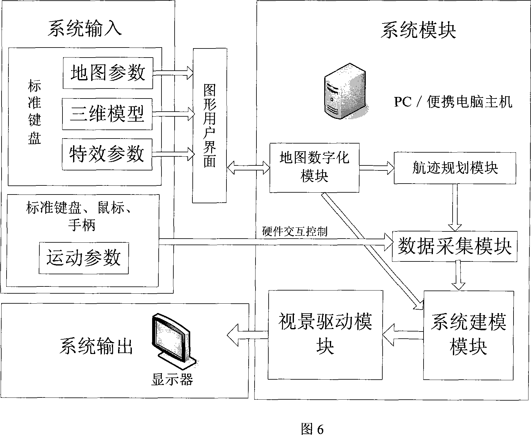
[0104] Step 1: The user inputs map parameters in the GUI through a standard mouse and keyboard, specifies the loaded 3D model library, and the system initializes the map;

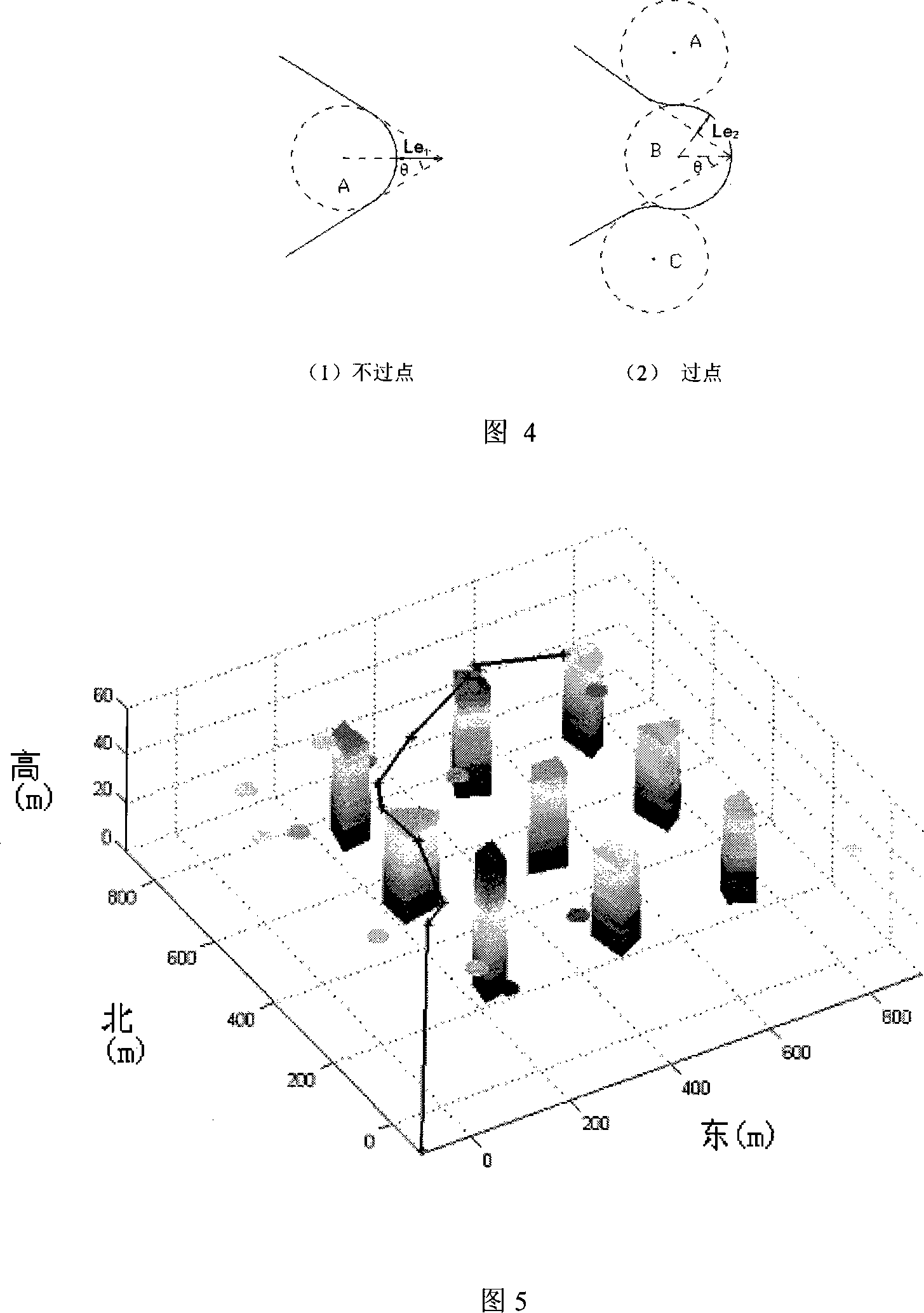
[0105] Step 2: The system uses the threat points to generate the Delaunay diagram to obtain the set of navigation points;

[0106] Step 3: The system invokes the trajectory planning module to calculate the flight trajectory and motion parameters;

[0107] Step 4: The system calls the initialization function t...


PUM


Abstract

The present invention relates to a method of the 3D track simulation for a miniature aircraft under urban surroundings and belongs to the field of the 3D real-time route navigation technology for a miniature aircraft. The following modules are set in a computer: a map digitalized module, which digitalizes the 3D model of urban surroundings including threat points, buildings, the departure and target points of a miniature aircraft that is inputted by the graphical user interface (GUI), map parameters and the coordinate of a candidate navigation point composed of the 3D model of urban surroundings and the map parameters; a flight path programming module, which inputs the data from the map digitalized module, calculates the overall route index that takes the flight resource consumption rate and the survival rate into consideration, figures out the most feasible route using network optimizing algorithm under the condition of taking barriers into consideration, and then smooths the bevel at turnings and generates a realtime flight orbit; a data-collecting module, which collects the coordinate values of the aircraft positions and postures outputted by the flight path programming module and forms a posture coordinate value including orthogonal coordinate variables X, Y and Z, a pitch angle h, a yawing angle p and a roll angle r. The present invention saves flight resources and improves flights simultaneously.

Description

technical field [0001] The three-dimensional trajectory simulation method of a micro-aircraft in an urban environment belongs to the technical field of three-dimensional real-time path navigation of a micro-aircraft. Background technique [0002] 3D path navigation visual simulation system for complex terrain environment, planning and navigating the 3D trajectory of moving object clusters (usually unmanned aerial vehicles), is a hot topic of virtual reality research at home and abroad in recent years. At present, most of the research at home and abroad is the path planning for robots to avoid obstacles or UAVs to avoid threat points (such as radar, etc.), because ground robots can only move on the ground plane, and the flying height of UAVs is generally high. Therefore, these two types of path planning algorithms are only two-dimensional navigation problems, and the research on three-dimensional path planning and collaborative navigation simulation technology is still relati...

Claims


Application Information

Patent Timeline
IPC IPC(8): G06Q10/00G06T17/00
Inventor 田凌温颖怡行开新
Owner TSINGHUA UNIV
Why Eureka
Try Eureka