

GIS automatic image-forming system and method thereof
A technology of automatic mapping and mobile computing, applied in the field of wireless network communication, can solve the problems of high cost of GIS electronic map, restriction of GIS system application, large amount of GIS geographic information, etc., and achieve low cost, high efficiency, and shortened collection time Effect
- Summary
- Abstract
- Description
- Claims
- Application Information
AI Technical Summary
Problems solved by technology
Method used
Image

Examples
Embodiment Construction
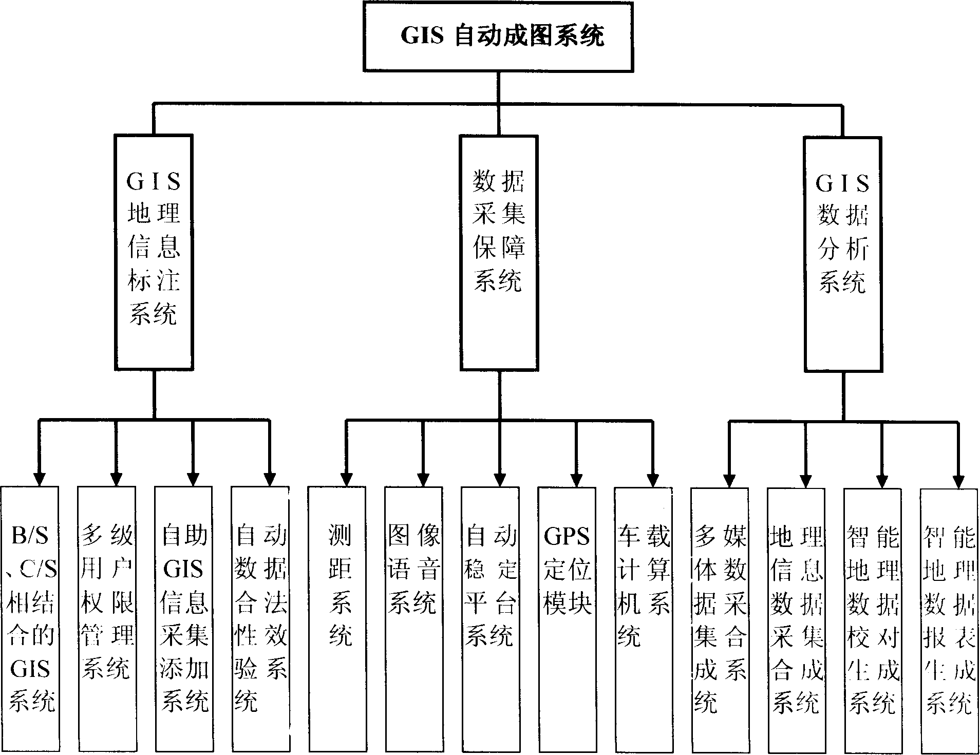
[0050] combine figure 1 , Figure 2 and image 3 As shown, the GIS automatic mapping system of the present invention mainly includes three parts: a GIS geographic information labeling system, a data collection guarantee system and a GIS data analysis system.
[0051] The GIS geographic information labeling system includes a GIS system combining B / S and C / S, a multi-level user authority management system, a self-service GIS information collection and adding system, and an automatic data legality verification system;
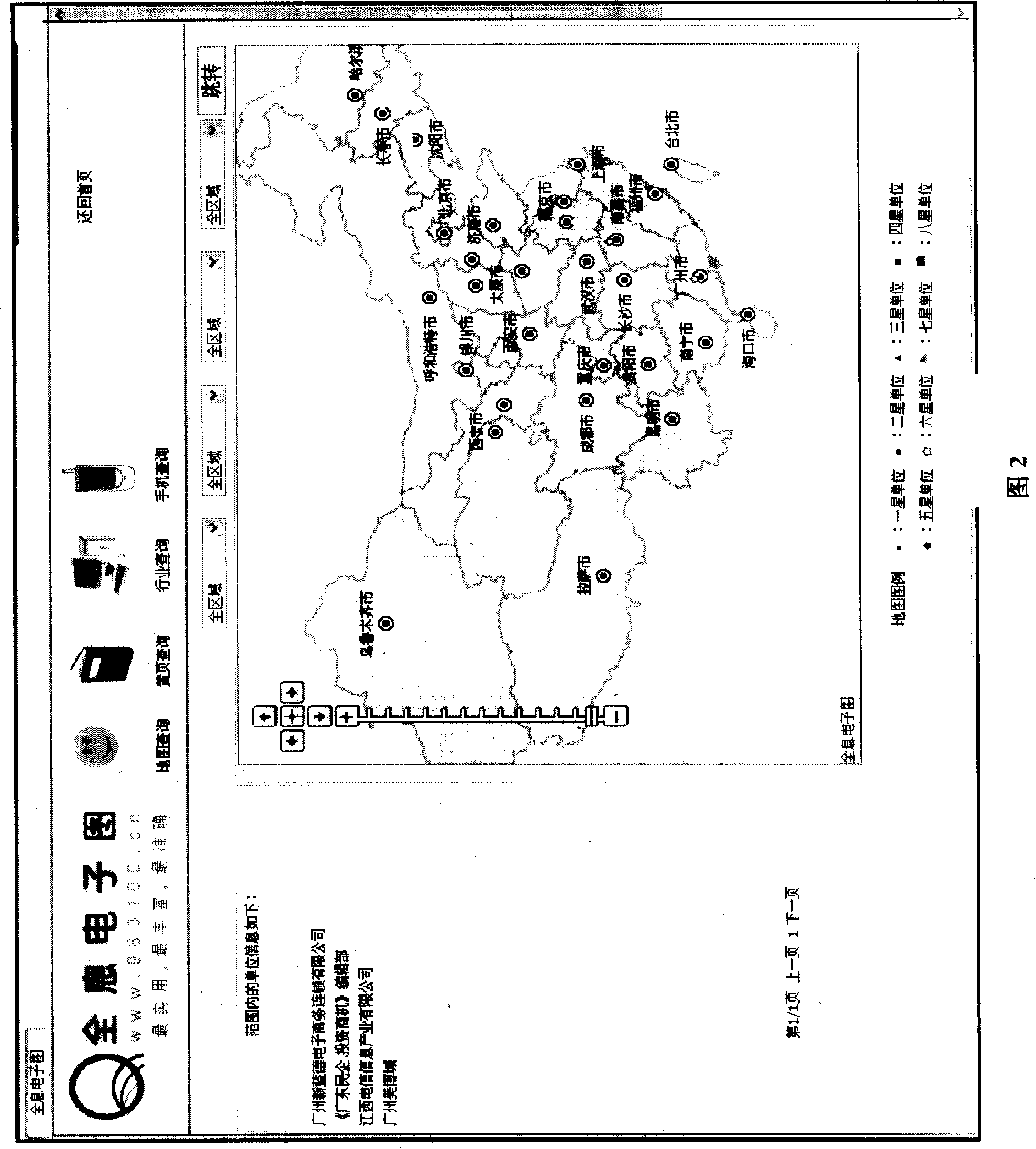
[0052] The GIS system combining B / S and C / S is the basis of this GIS geographic information labeling system. All electronic map information is added and the results after collection are displayed and operated through the GIS system. Its functions include map query, yellow page query, Industry query, mobile phone query, etc.; the multi-level user authority management system divides agents and members into several levels, each level of agents or members can be assig...
PUM
 Abstract
Description
Claims
Application Information