Wireless ranging omnidirectional image combined locating system

An omnidirectional image, wireless ranging technology, applied in satellite radio beacon positioning system, radio wave measurement system, beacon system using radio waves, etc. Working range, cascading flexible effects

Inactive Publication Date: 2008-06-11
BEIJING INSTITUTE OF TECHNOLOGYGY
View PDF0 Cites 21 Cited by
  • Summary
  • Abstract
  • Description
  • Claims
  • Application Information

AI Technical Summary

Problems solved by technology

This technique requires complex positioning algorithms and at least three transceivers distributed in different locations to determine the position of the mobile robot

Method used


Image

  • Wireless ranging omnidirectional image combined locating system
  • Wireless ranging omnidirectional image combined locating system
  • Wireless ranging omnidirectional image combined locating system

Examples


Embodiment

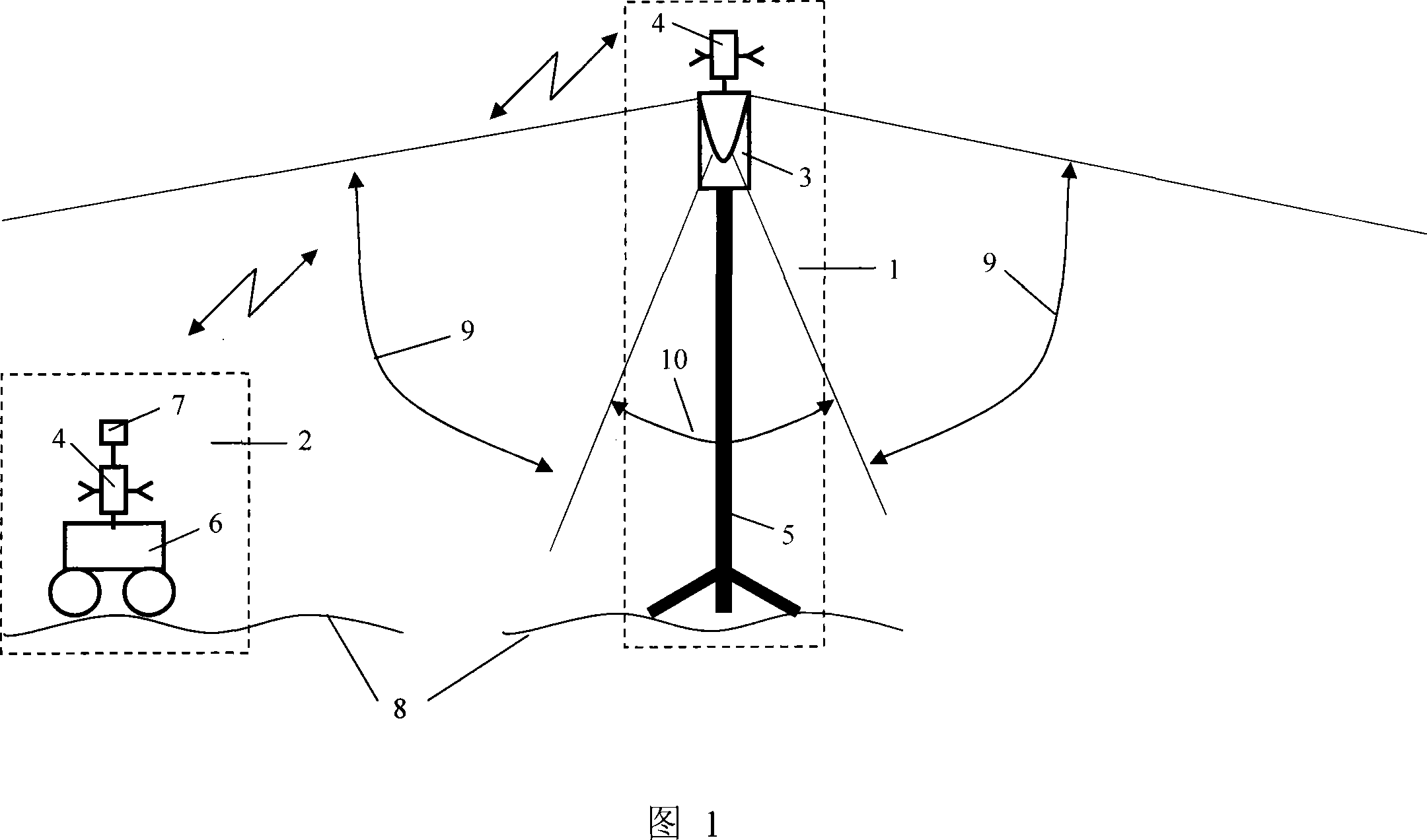
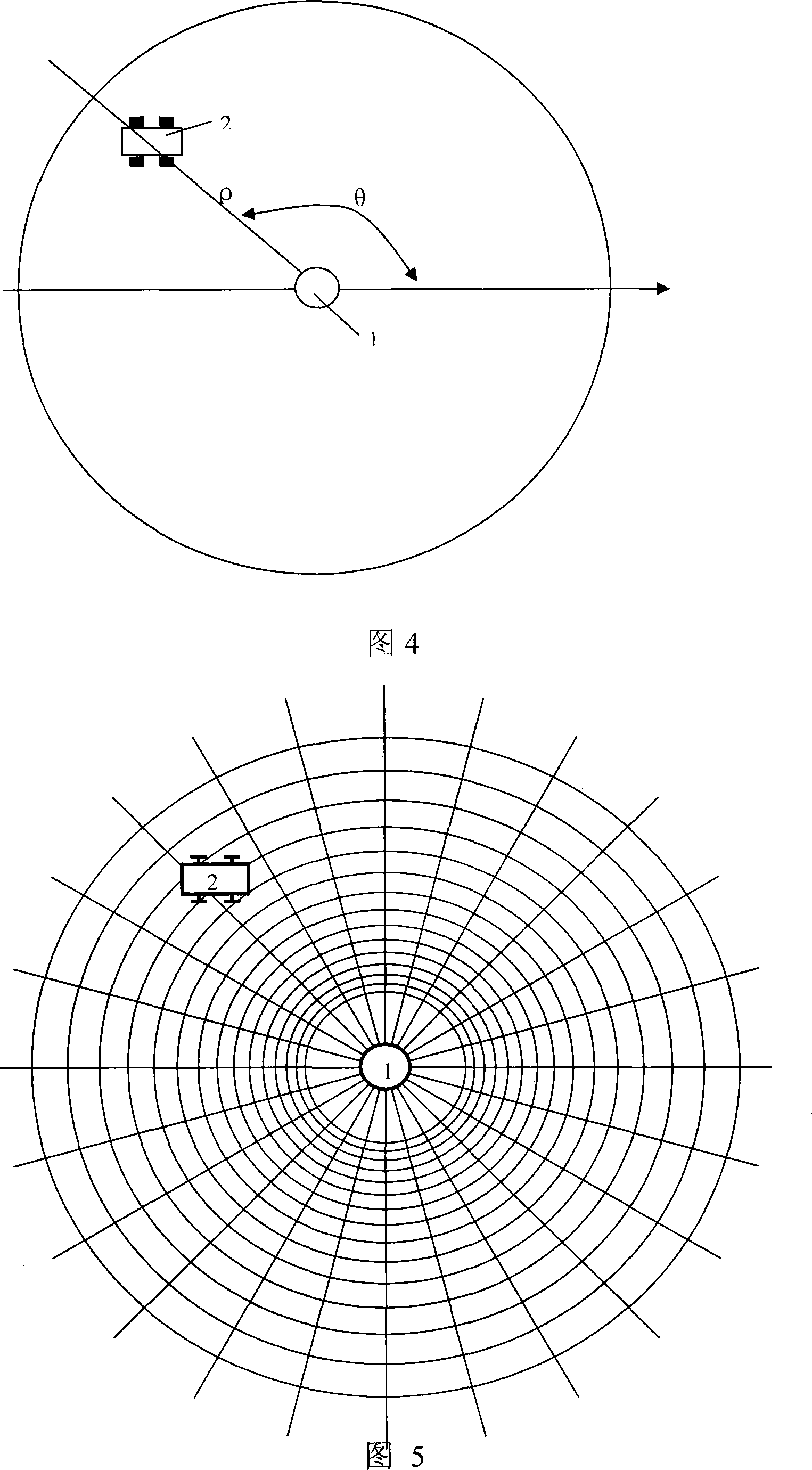
[0033] The system of the present invention is composed of a fixed node 1 and a mobile node 2. The fixed node 1 is composed of an omnidirectional imaging device 3 and a wireless transceiver 4 , and is mounted on a bracket 5 . The function of the bracket 5 is to fix the omnidirectional imaging device 3 and the wireless transceiver 4 . The height and posture of the imaging device 3 and the wireless transceiver 4 can be appropriately adjusted according to needs, so as to better obtain images of surrounding scenes and better realize wireless communication and measurement, as shown in FIG. 1 . Usually the optical axis of the camera of the omnidirectional imaging device 3 is perpendicular to the surface 8 of the planet.

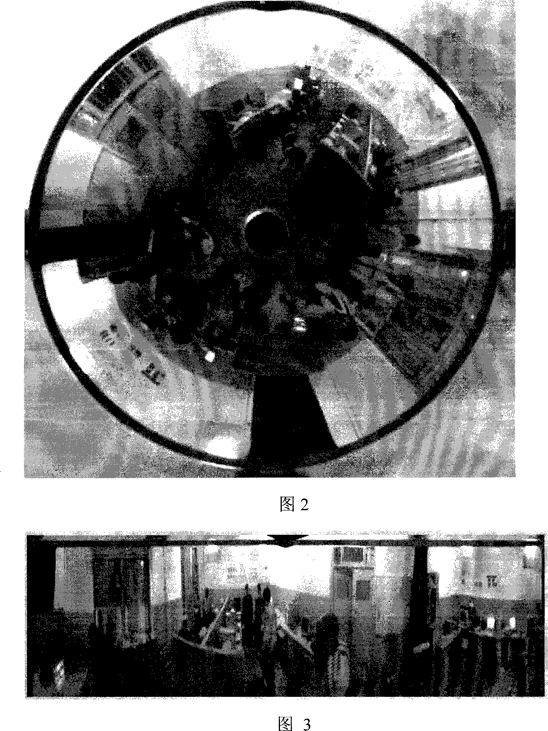
[0034] The omnidirectional imaging device 3 acquires a 360° omnidirectional image of the surrounding scene in real time, the vertical field of view angle 9 of the omnidirectional imaging device 3 is generally about 90°, and the imaging blind zone 10 facing the surf...


PUM


Abstract

The invention is a composite locating system for wireless distance measuring on the omnidirectional image, which belongs to the technical field of image locating and wireless communication locating. The system is composed of fixed node and move node. The fixed node comprises an omnidirectional imaging device, a wireless transceiver and a fixed bolster, while the move node comprises a mobile robot, a wireless transceiver and a cooperative light source. The omnidirectional imaging device on the fixed node can gain the real-time 360-degree scene around, and establish the system of polar coordinates by taking the center of the omnidirectional image as the top. The location of the mobile robot in the omnidirectional image is marked by polar coordinates Rho and Theta. The polar diameter Rho is measured by the wireless distance measuring system through the wireless transceiver on the move node and the wireless transceiver on the fixed node, while the polar angle is measured by the omnidirectional image. The invention is used for complete and independent locating and guiding of the mobile robot, and used for the collaboration and relative positioning sum of a plurality of mobile robots in the scene, which can fulfill the tasks like scene real-time monitoring, as well as scene digitization and visualization, etc.

Description

technical field [0001] The invention relates to a wireless ranging omnidirectional image combination positioning system and method, which belong to the field of image positioning technology and wireless communication positioning technology. It is used in the fields of planetary surface detection robots, digital battlefield unmanned combat platforms, and positioning and navigation. Background technique [0002] A type of mobile robot positioning technology widely used at present is GPS, which uses several positioning satellites to transmit positioning signals, and the user equipment receives the radio waves emitted by the satellites, determines the distance according to the transmission time, and then calculates the position. The effectiveness of this technique depends on the geometry and received power of the GPS satellites available at any one time. Like the American GPS, Russia's satellite positioning and navigation system GLONASS and China's Beidou satellite positioning ...

Claims


Application Information

Patent Timeline
Patent Type & Authority Applications(China)
IPC IPC(8): G01S5/14G01S1/02G01C21/00G01S19/00
Inventor 贾云得
Owner BEIJING INSTITUTE OF TECHNOLOGYGY
Why Eureka
Try Eureka