Image data fusing method

A fusion method and image data technology, which is applied in the field of remote sensing image data fusion, can solve problems such as inability to use quantitative calculation, and achieve the effects of high practical value, small calculation amount, and simple method.

Active Publication Date: 2009-07-29
SUN YAT SEN UNIV
View PDF0 Cites 22 Cited by
  • Summary
  • Abstract
  • Description
  • Claims
  • Application Information

AI Technical Summary

Problems solved by technology

[0009] The results obtained by the existing data fusion methods have more or less changed the spectral information of the color image, and the data fusion can no longer be used for quantitative calculations.

Method used


Image

  • Image data fusing method
  • Image data fusing method
  • Image data fusing method

Examples


Embodiment 1

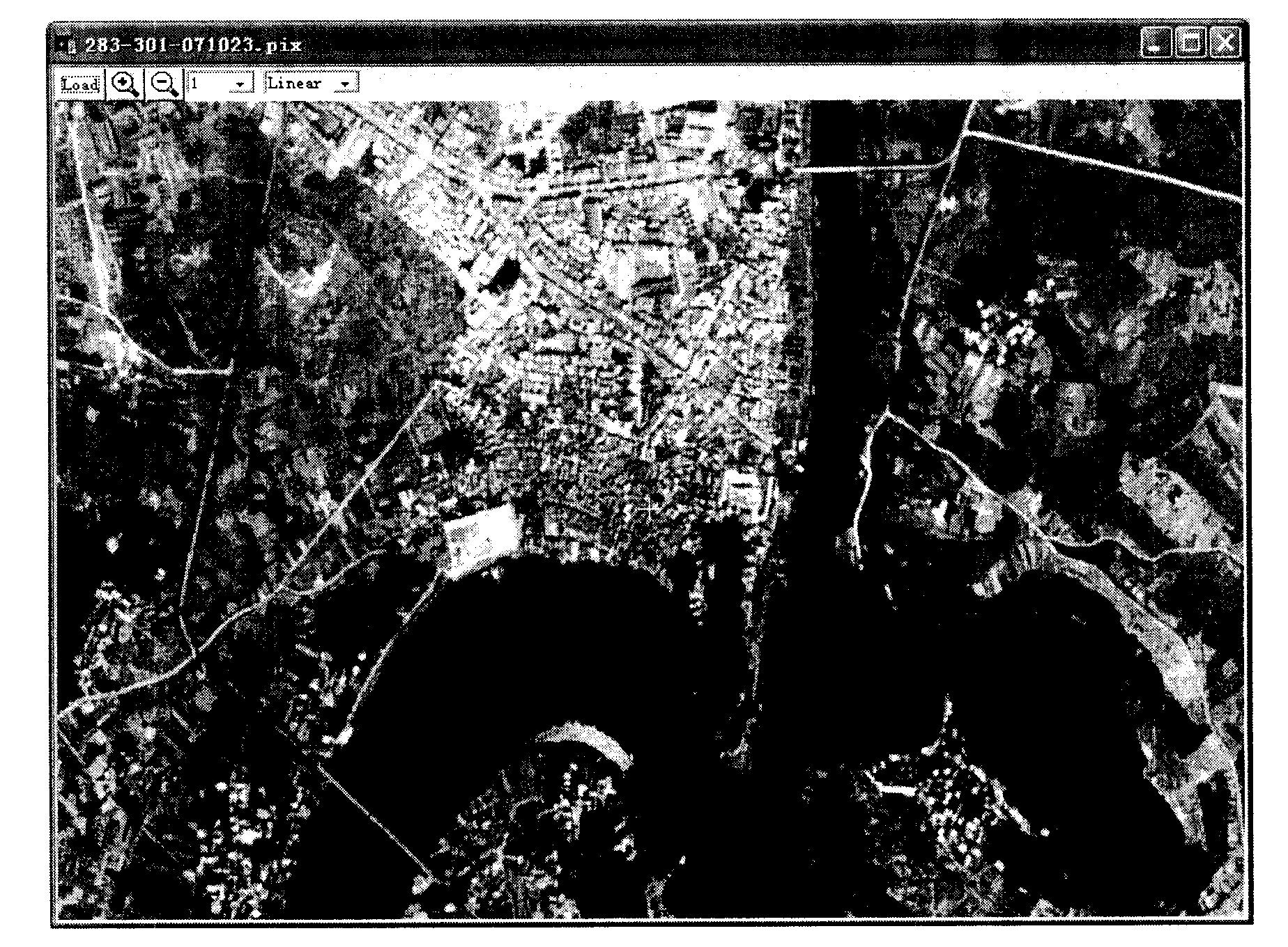
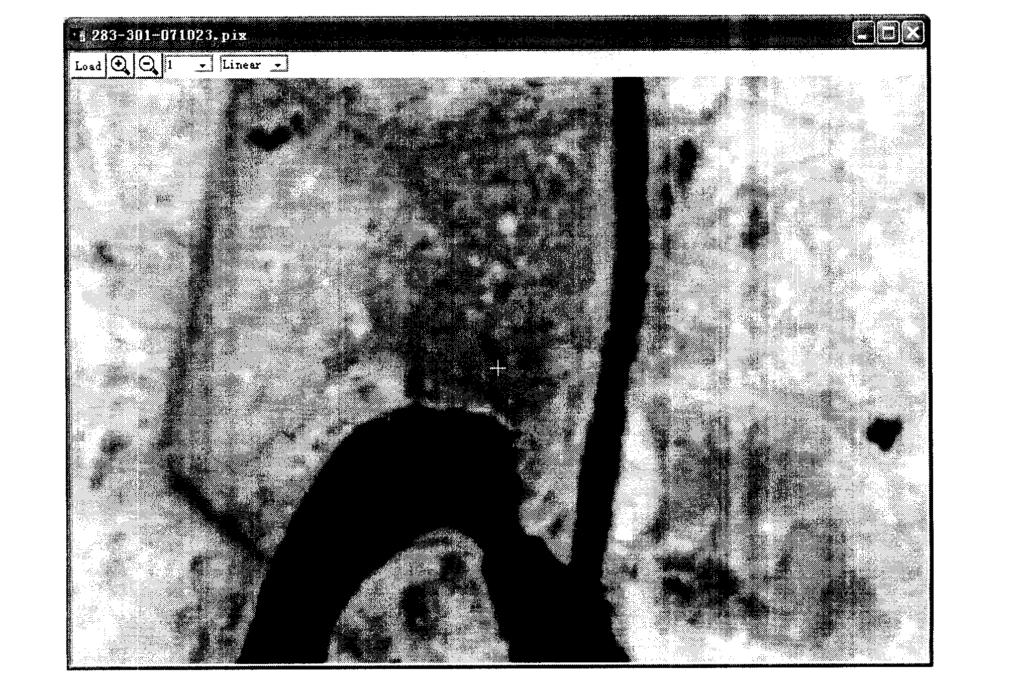
[0038] like figure 1 It is the original panchromatic band image with 2.5m resolution of SPOT satellite imagery, such as figure 2 It is an original color image with 10-meter resolution of SPOT satellite images. The main types of features in the picture are: mountains, rivers, cultivated land, roads and urban residential areas.

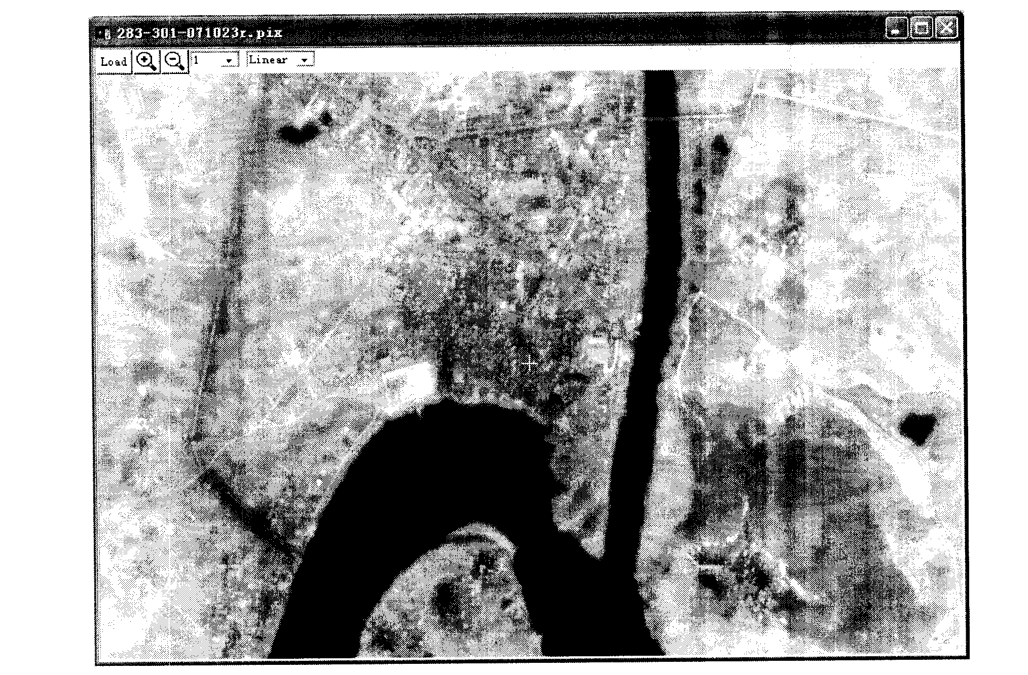
[0039] The satellite image processed by the data fusion method of the present invention is as follows: image 3 As shown, the geometric information of the image after data fusion and the original panchromatic band image with 2.5 m resolution ( figure 1 ), the same color and tint as the original 10-meter resolution color image ( figure 2 ) is the same (there is only a slight difference in the display color due to the different stretching degrees, and it is closer to reality after the change), maintaining all the spectral information of the original image.

Embodiment 2

[0041] like Figure 4 It is the original panchromatic band image with 2.5m resolution of SPOT satellite imagery, such as Figure 5 It is an original color image with 10-meter resolution of SPOT satellite images. The main types of features in the picture are: mountains, rivers, cultivated land, roads and villages.

[0042] The satellite image processed by the data fusion method of the present invention is as follows: Image 6 As shown, as in the above-mentioned embodiment, the geometric information of the image after data fusion and the original panchromatic band image with a resolution of 2.5 meters ( Figure 4 ), the same color and tint as the original 10-meter resolution color image ( Figure 5 ) are similar, maintaining all the spectral information of the original image.


PUM


Abstract

The invention discloses an adopted technical proposal, namely, an image-data fusion method. The method comprises the following steps: (1) re-sampling is conducted to a color image with low resolution to cause the size of pixels of the color image to resemble that of a black-white image with high resolution; (2) precise correction is adopted to lead the color image with low resolution and the black-white image with high resolution to be overlapped; (3) three wave bands of each pixel of the color image after re-sampling are all multiplied by a respective brightness ratio of the black-white image; and (4) a resulting image is output. The data fusion method not only completely integrates spatial information of the original black-white image and spectral information of the color image, without loss in the spectral information and differentiation in image color, but also is comparatively simple with less operation, fast processing and extremely high application value.

Description

technical field [0001] The invention belongs to the technical field of fusion of remote sensing image data, in particular to a fusion method of single-band image data with higher spatial resolution and multi-band remote sensing data with lower resolution. Background technique [0002] Image data fusion is the process of integrating useful information of two or more data images from different sources into the same image to obtain a high-quality image with useful information from multiple sources. The most widely used and most valuable in practical applications is the fusion of full-color black-and-white images or radar images with high spatial resolution and multi-band color images, so that the resulting images have high spatial resolution and high spatial resolution. Spectral information with color images. This work is an extremely important technique in modern remote sensing applications. The existing image data fusion methods usually convert the color image synthesized b...

Claims


Application Information

Patent Timeline
Patent Type & Authority Applications(China)
IPC IPC(8): G06K9/62G01S17/89G01S7/48
Inventor 邓孺孺
Owner SUN YAT SEN UNIV
Why Eureka
Try Eureka