
Method for performing space registration on radar and infrared sensor configured on identical platform

An infrared sensor and spatial registration technology, applied in the field of data fusion, can solve the problems of limited initial value of prediction covariance matrix, sensitive initial value of system state, and low registration accuracy.

Inactive Publication Date: 2011-09-07
SHENZHEN UNIV
View PDF2 Cites 8 Cited by
  • Summary
  • Abstract
  • Description
  • Claims
  • Application Information

AI Technical Summary

Problems solved by technology

[0007] The purpose of the embodiments of the present invention is to provide a method for spatial registration of radar and infrared sensors configured on the same platform, aiming to solve the inconsistency between the target state and the actual demand coordinate system of the spatial registration algorithm of radar and infrared sensors provided by the prior art , the existing spatial registration algorithm is sensitive to the initial value of the system state, has restrictions on the initial value of the prediction covariance matrix, and the registration accuracy is relatively low

Method used


Image

  • Method for performing space registration on radar and infrared sensor configured on identical platform
  • Method for performing space registration on radar and infrared sensor configured on identical platform
  • Method for performing space registration on radar and infrared sensor configured on identical platform

Examples


Embodiment 1

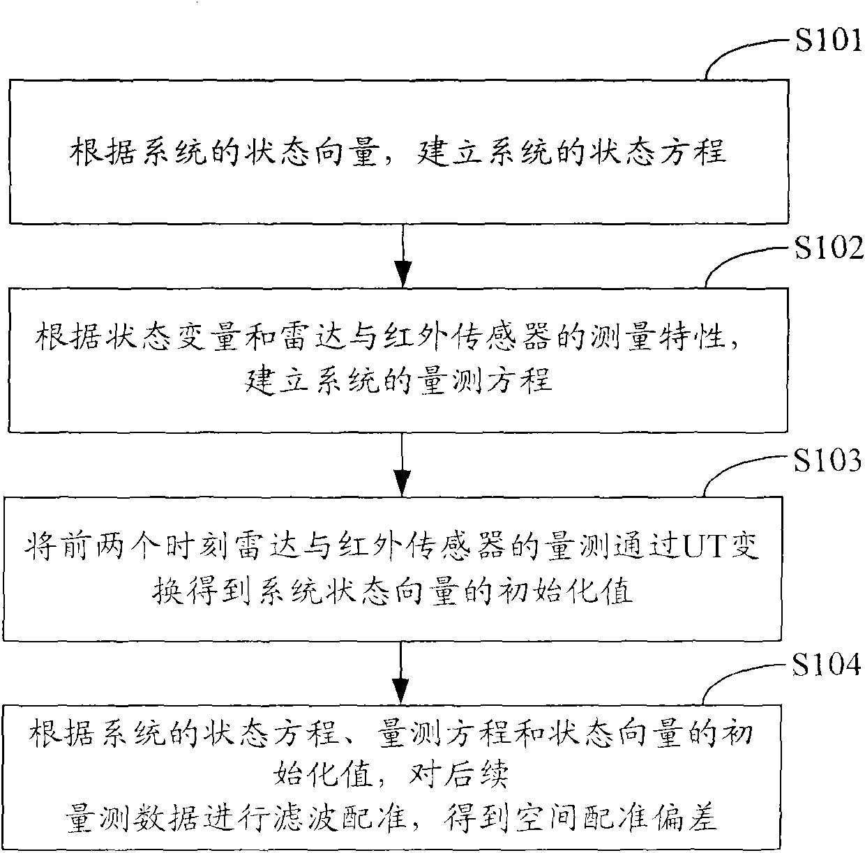
[0051] figure 1 It shows the implementation flow of the method for spatial registration of the radar and the infrared sensor configured on the same platform provided by the embodiment of the present invention, and the specific steps are as follows:

[0052] In step S101, according to the state vector of the system, the state equation of the system is established, namely:

[0053] X(t k+1 )=[h 1 (t k ), h 2 (t k ), h 3 (t k ), h 4 (t k ), h 5 (t k ), h 6 (t k ), h 7 (t k ), h 8 (t k )] T +W(t k ),in:

[0054] h 1 ( t k ) = sqrt ( ( ξ x ( t k ) + x · ...

Embodiment 2

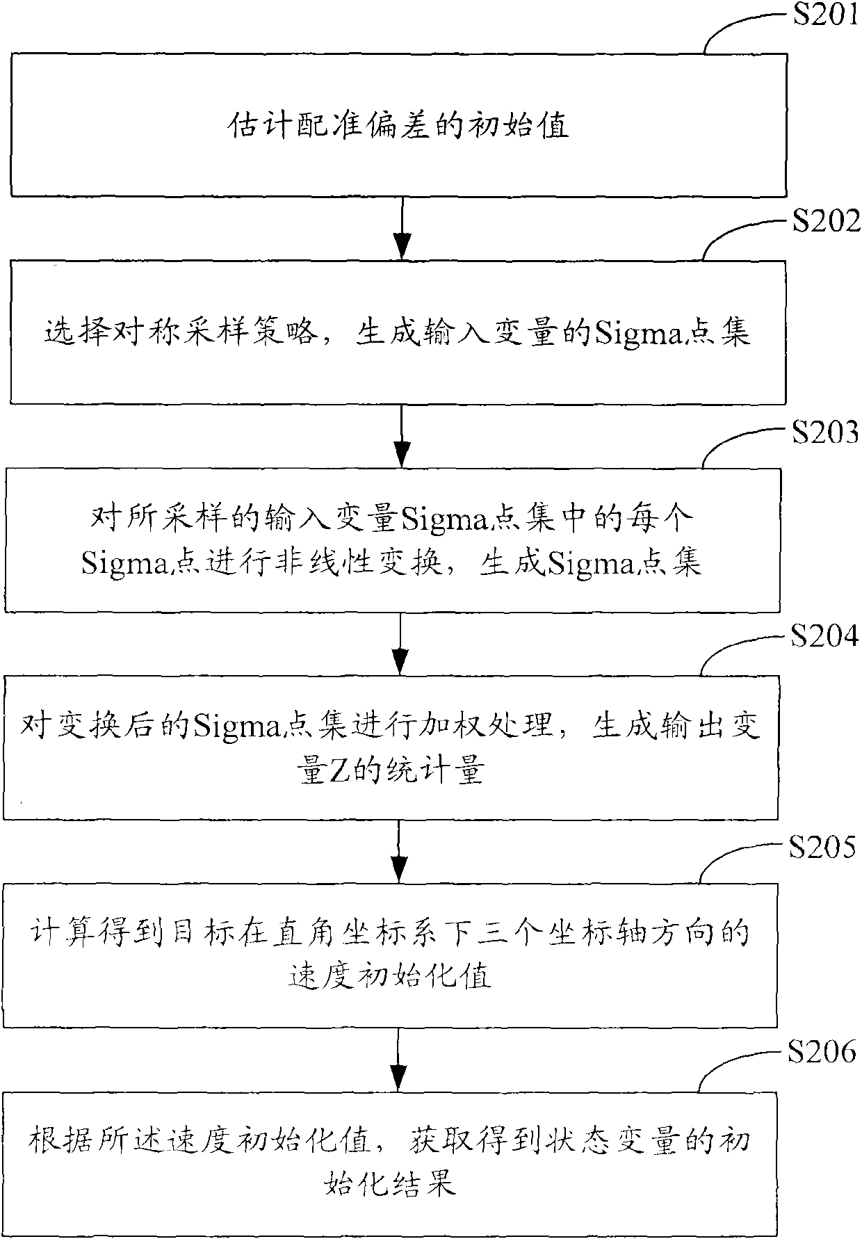
[0080] figure 2 It shows the implementation process of obtaining the initialization value of the system state vector through the UT transformation of the measurement of the radar and the infrared sensor at the first two moments provided by the embodiment of the present invention, and the specific steps are as follows:

[0081] In step S201, an initial value of registration deviation is estimated.

[0082] In the embodiment of the present invention, assume that the first two measurement data of the radar are respectively: (ρ r (t 0 ), θ r (t 0 ), η r (t 0 )), (ρ r (t 1 ), θ r (t 1 ), η r (t 1 )), the first two data of the infrared sensor are: (θ i (t 0 ), η i (t 0 )), (θ i (t 1 ), η i (t 1 )), so that the azimuth angle deviation and the elevation angle deviation of the infrared sensor are (Δθ i (t k ), Δη i (t k )), is the state vector of the system.

[0083] The azimuth angle deviation and pitch angle initialization deviation of the infrared sensor c...

Embodiment 3

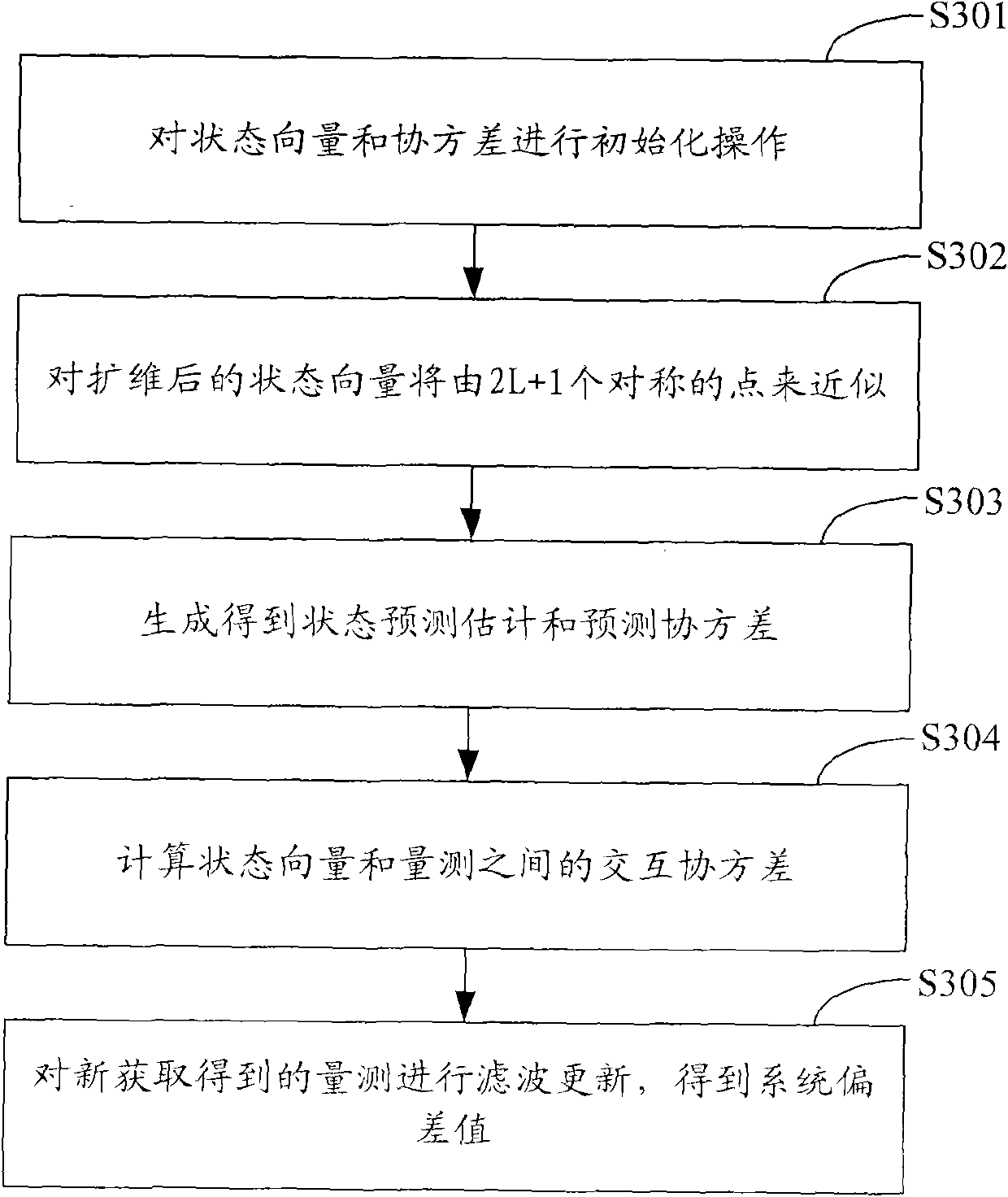
[0113] image 3 It shows the implementation process of performing UKF filter registration on the measurement data according to the initialization value of the system state equation, measurement equation and state vector provided by the embodiment of the present invention, and obtaining the spatial registration deviation of the infrared sensor relative to the radar, The specific steps are as follows:

[0114] In step S301, the state vector and covariance are initialized, namely:

[0115] x ^ 1 ( 0 ) = X ( t 0 ) = [ ρ r ( t 0 ) , θ r ( ...


PUM


Abstract

The invention is applied in the technical field of data fusion, and provides a method for performing space registration on a radar and an infrared sensor configured on an identical platform. The method comprises the following steps of: establishing a system state equation and a measurement equation taking polar coordinate positions, rectangular coordinate velocity and polar coordinate registration deviations as state vectors; performing unscented transform (UT) on the measurement, performed at previous moments, of the radar and the infrared sensor to obtain initial values of the system state vectors; and performing unscented Kalman filtering (UKF) registration on measured data according to the system state equation, the measurement equation and the initial values of the state vectors to obtain the space registration deviation of the infrared sensor relative to the radar. By the method, limitations to the conventional space registration of the radar and the infrared sensor are avoided,and registration accuracy is improved.

Description

technical field [0001] The invention belongs to the technical field of data fusion, and in particular relates to a method for spatial registration of radars and infrared sensors configured on the same platform. Background technique [0002] With the development of science and technology, the performance of sensors has been greatly improved, and various multi-sensor systems facing complex application backgrounds have emerged in large numbers. Especially after entering the 1970s, a large number of high-tech weapons, especially precision-guided weapons and long-range strike weapons, appeared, expanding the scope of the battlefield to the five-dimensional space of sea, land, air, sky and electromagnetic. Relying on a single sensor to provide information can no longer meet the needs, and the use of data fusion technology to process observation data from active and passive detectors covering a wide frequency band such as microwave, millimeter wave, television, infrared, laser and ...

Claims


Application Information

Patent Timeline
IPC IPC(8): G06F19/00
Inventor 黄建军蒋峰
Owner SHENZHEN UNIV
Learn More