Frequency domain imaging method of ground penetrating radar
An imaging method and ground penetrating radar technology, which are applied in the directions of reflection/re-radiation of radio waves, use of re-radiation, measurement devices, etc., can solve problems such as difficult near-field conditions, and achieve the effect of high imaging efficiency
- Summary
- Abstract
- Description
- Claims
- Application Information
AI Technical Summary
Problems solved by technology
Method used
Image
Examples
Embodiment Construction
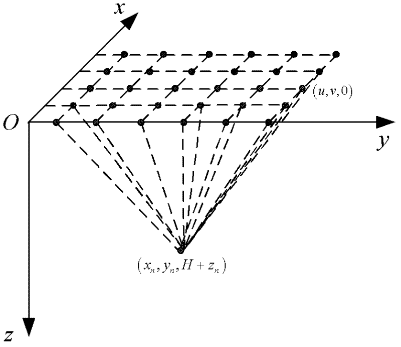
[0047] figure 1 Shown is the imaging diagram of the three-dimensional radar, the antenna scans along the two-dimensional direction on the surface, and (u, v, 0) is the scanning point of the radar on the ground.
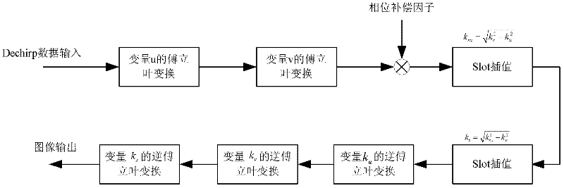
[0048] In order to achieve the three-dimensional imaging using the method of frequency domain in the ground penetrating radar, to obtain the purpose of underground images with better resolution, the basic idea of the present invention is: to make the frequency difference between the target echo signal and the reference signal received by the radar After processing, the echo after the difference frequency is obtained, and then the Fourier transform is performed on the signals in the two azimuth directions. Through the second slot interpolation, the three-dimensional Fourier transform spectrum of the echo signal can be obtained, and then the three-dimensional inverse Fourier transform can be obtained. Observation 3D image of the area.
[0049] For this reason, the pr...
PUM
 Abstract
Description
Claims
Application Information
 - R&D
- Intellectual Property
- Life Sciences
- Materials
- Tech Scout
- Unparalleled Data Quality
- Higher Quality Content
- 60% Fewer Hallucinations
Browse by: Latest US Patents, China's latest patents, Technical Efficacy Thesaurus, Application Domain, Technology Topic, Popular Technical Reports.
© 2025 PatSnap. All rights reserved.Legal|Privacy policy|Modern Slavery Act Transparency Statement|Sitemap|About US| Contact US: help@patsnap.com


