
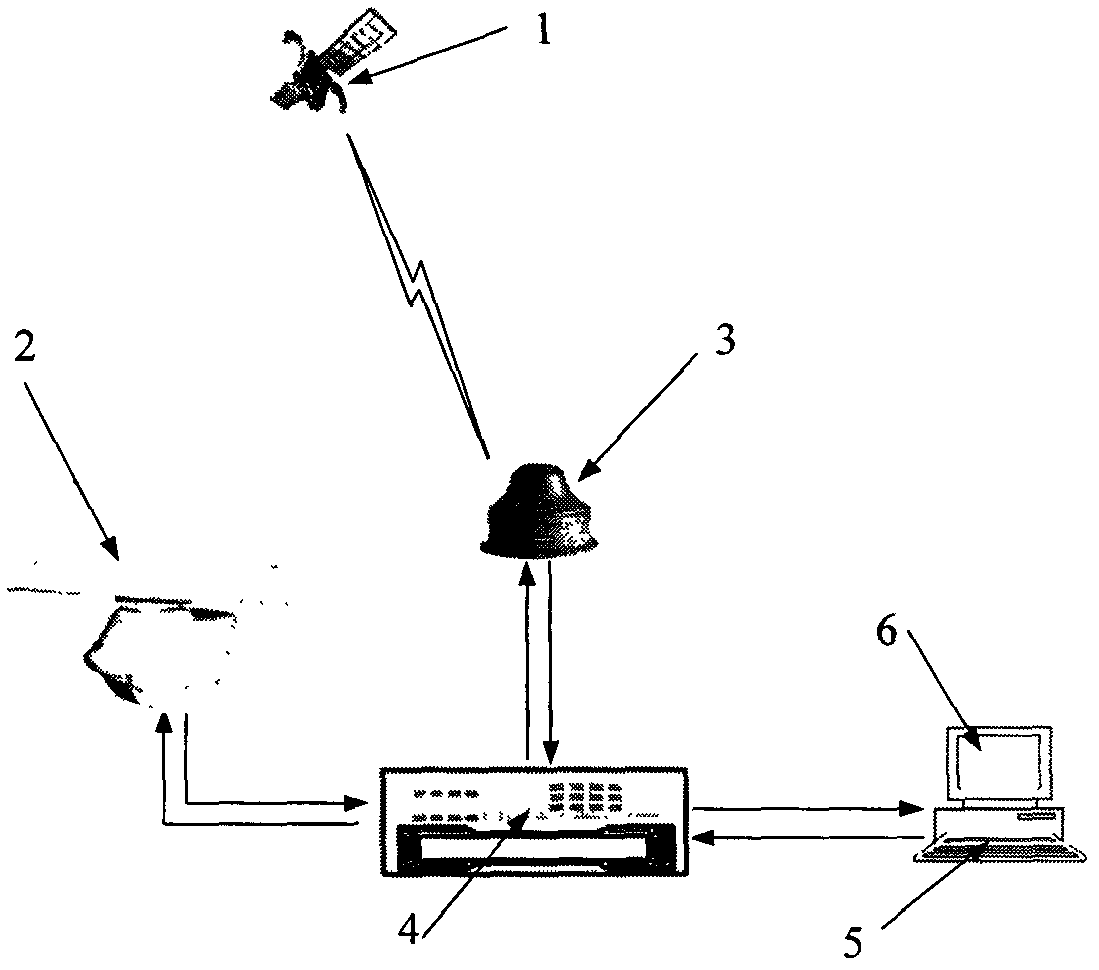
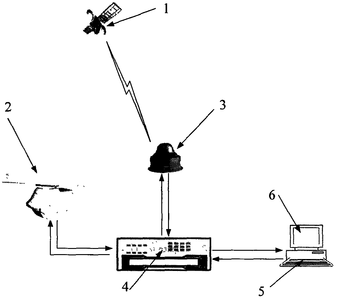
Multifunctional navigation radar based on Beidou satellite

A technology of navigation radar and Beidou satellite, which is applied in the field of Beidou satellite navigation system and radar, can solve the problems of no Beidou function and navigation radar integration, etc., and achieve the effect of strong man-machine dialogue ability, friendly interface and simple operation

Inactive Publication Date: 2012-08-08
BEIJING HUIMEI ELECTRONICS TECH
View PDF3 Cites 3 Cited by
  • Summary
  • Abstract
  • Description
  • Claims
  • Application Information

AI Technical Summary

Problems solved by technology

So far, there is no precedent for integrating Beidou functions with navigation radar functions and putting them into use

Method used


Image

  • Multifunctional navigation radar based on Beidou satellite
  • Multifunctional navigation radar based on Beidou satellite

Examples


Embodiment Construction

[0020] 1. Integrated design of navigation radar and Beidou user machine antenna.

[0021] The antenna of the Beidou user machine and the antenna of the navigation radar are integrated and installed together, so that the position coordinates of the radar antenna are consistent with the position coordinates of the Beidou receiving antenna, so as to reduce positioning errors and improve positioning accuracy;

[0022] 2. Use Beidou timing as the reference time information of the navigation radar.

[0023] Navigation radar requires precise time. For example, when the radar captures the target, it needs to stamp the target recorded by the radar with a time stamp and so on. In short, the working process of radar and Beidou is inseparable from precise time. Utilize the Beidou time information to calibrate the timer frequency (or time) of the radar, so that the time of the Beidou is consistent with the time of the radar, for the realization of the navigation, positioning, communicatio...


PUM


Abstract

The invention belongs to the field of application of a Beidou satellite navigation system, and belongs to the technical field of radars. Specifically, a Beidou satellite navigation system of China is applied to a navigation radar, and the Beidou satellite navigation system is integrally designed with the navigation radar, so that the functions of time service, positioning, speed measuring, navigation, communication, electronic chart and the like of Beidou are integrated with the target measuring and sea condition measuring functions of the navigation radar, the navigation radar has the multiple functions of accurate positioning of a ship, electronic chart, path planning, automatic path guidance, course replaying, path plotting, collision prevention alarming, target indication, ship network construction, connection with superior units, receiving of monitoring of superior units, inquiry of positions of brother ships, water surface situation monitoring, radar networking, sea condition measurement, information recording and reporting and the like, and the navigation capability of the ship navigation radar is improved greatly.

Description

Technical field: [0001] The invention belongs to the technical field of radar, and also belongs to the application field of the Beidou satellite navigation system. Specifically, it is to apply Beidou's timing, positioning, and communication functions to navigation radars, and then integrate functions such as electronic charts and AIS with navigation radar target measurement and sea state measurement functions, so that the navigation capabilities of ship navigation radars It has been greatly improved, and has multiple functions such as surface situation monitoring, own ship navigation, route planning, ship maneuvering calculation, collision avoidance warning, target indication, radar networking, sea state measurement, information recording and reporting, etc. Its outstanding feature is the multifunctional navigation radar using China's independent satellite navigation system. Background technique: [0002] Marine navigation radar is mainly used to observe buoys, islands and ...

Claims


Application Information

Patent Timeline
IPC IPC(8): G01S7/02G01S19/42
Inventor 李明湘马子健王伦发陈同义
Owner BEIJING HUIMEI ELECTRONICS TECH
Learn More