Mass airborne LiDAR point cloud Delaunay triangulation network parallel construction method and apparatus thereof

A triangulation network and mass technology, applied in the field of surveying and mapping, can solve the problems of large amount of triangulation calculation, slow algorithm execution, unable to meet the application of massive data network construction, etc., and achieve the effect of improving post-processing efficiency.

Inactive Publication Date: 2012-08-08
CHINESE ACAD OF SURVEYING & MAPPING
View PDF1 Cites 22 Cited by
  • Summary
  • Abstract
  • Description
  • Claims
  • Application Information

AI Technical Summary

Problems solved by technology

When the number of point clouds is large, the calculation of Delaunay triangulation in the process of constructing Delaunay triangulation is large, and the existing algorithm is very slow in execution speed and low in efficiency, which can no longer meet the current application of massive data network construction.

Method used


Image

  • Mass airborne LiDAR point cloud Delaunay triangulation network parallel construction method and apparatus thereof
  • Mass airborne LiDAR point cloud Delaunay triangulation network parallel construction method and apparatus thereof
  • Mass airborne LiDAR point cloud Delaunay triangulation network parallel construction method and apparatus thereof

Examples


Embodiment Construction

[0031] In order to describe the technical content, structural features, achieved goals and effects of the present invention in detail, the following will be described in detail in conjunction with specific embodiments and accompanying drawings.

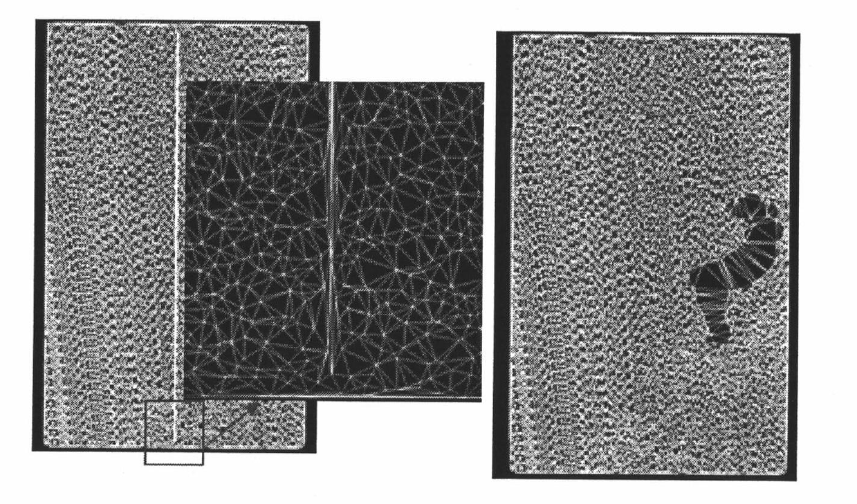
[0032] The invention aims to improve the construction speed of massive airborne LiDAR point cloud Delaunay triangulation, improve the efficiency of network construction, solve the problem of massive airborne LiDAR point cloud network construction, and provide efficient post-processing and related applications for airborne laser radar scanning data. , fast new methods and new devices.

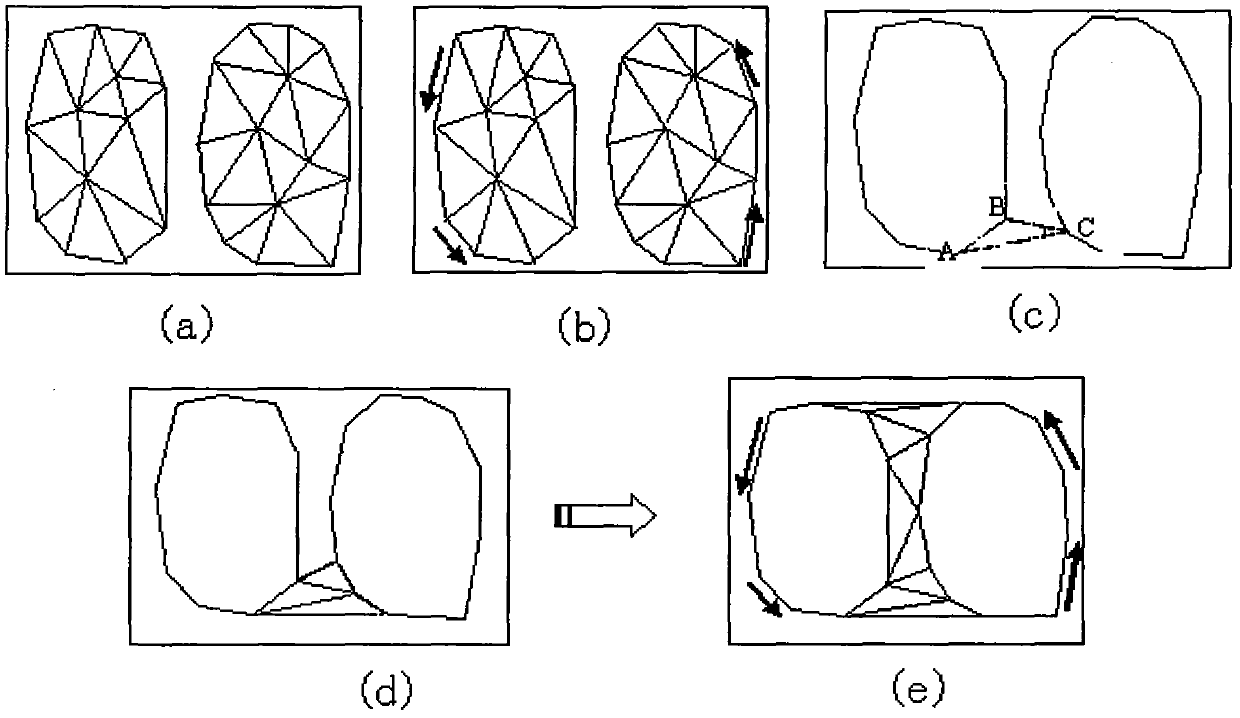
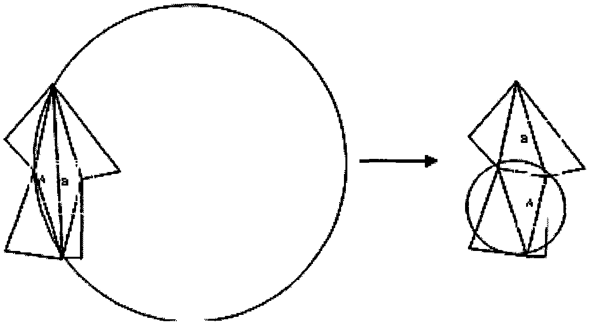
[0033] The implementation steps of the present invention can be summarized as the steps of task division, subtask triangular network construction, subtask triangular network merging and optimization. Each implementation step is further elaborated as follows:

[0034] 1) Task division:

[0035] This step carries out data block division and task distrib...


PUM


Abstract

The invention relates to a mass airborne LiDAR point cloud Delaunay triangulation network parallel construction method. The method comprises the following steps: carrying out data block division and task distribution on mass airborne LiDAR point cloud data; applying a pointwise insertion algorithm to each data block respectively so as to construct a sub-triangulation network in parallel, and acquiring a sub-triangulation network set; using a merging algorithm to connect the adjacent two sub-triangulation networks so as to generate the merged triangulation network; using an optimization algorithm to carry out optimization on a newly generated triangle and the adjacent triangle so as to obtain the merged triangle which accords with a Delaunay rule; repeating the merging and the optimization until all the sub-triangulation networks are merged and the complete Delaunay triangulation network can be obtained. The invention also provides a corresponding apparatus for executing the above method. By using the method and the apparatus of the invention, a post-treatment speed of the mass airborne LiDAR point cloud can be substantially increased. The method and the apparatus of the invention have great significance for practical application.

Description

technical field [0001] The present invention relates to the technical field of surveying and mapping, and more specifically, to a method and device for parallel construction of massive airborne LiDAR point cloud Delaunay triangulation. Background technique [0002] LiDAR has been widely used in the field of terrain surveying and mapping. Using airborne LiDAR for terrain scanning can obtain massive airborne LiDAR point cloud data. Based on the high-precision three-dimensional spatial coordinate information contained in the point cloud data, it can accurately express the surface spatial characteristics of the scanned object, which is the basis for various surveying and mapping applications, such as geospatial information research, urban planning, land management, etc. aspect is also important. However, LiDAR point cloud data usually has a large number of points, and the spatial distribution of each point has a certain degree of discreteness, so a scientific and efficient met...

Claims


Application Information

Patent Timeline
Patent Type & Authority Applications(China)
IPC IPC(8): G06T17/20
Inventor 刘正军梁静张继贤左志权
Owner CHINESE ACAD OF SURVEYING & MAPPING
Why Eureka
Try Eureka