Quick measuring method based on laser ranging device

A technology of laser rangefinder and measurement method, which is applied in the direction of line-of-sight measurement, measurement device, and distance measurement, and can solve problems such as difficult measurement and slow measurement speed

Inactive Publication Date: 2012-12-19
XIAN MEIHANG INFORMATION IND
View PDF8 Cites 14 Cited by
  • Summary
  • Abstract
  • Description
  • Claims
  • Application Information

AI Technical Summary

Problems solved by technology

[0006] The technical problem to be solved by the present invention is to provide a rapid measurement method based on a laser rangefinder, which is easy to use, easy to implement, fast in measurement speed and high in measurement accuracy, and can tru

Method used


Image

  • Quick measuring method based on laser ranging device
  • Quick measuring method based on laser ranging device
  • Quick measuring method based on laser ranging device

Examples


Embodiment Construction

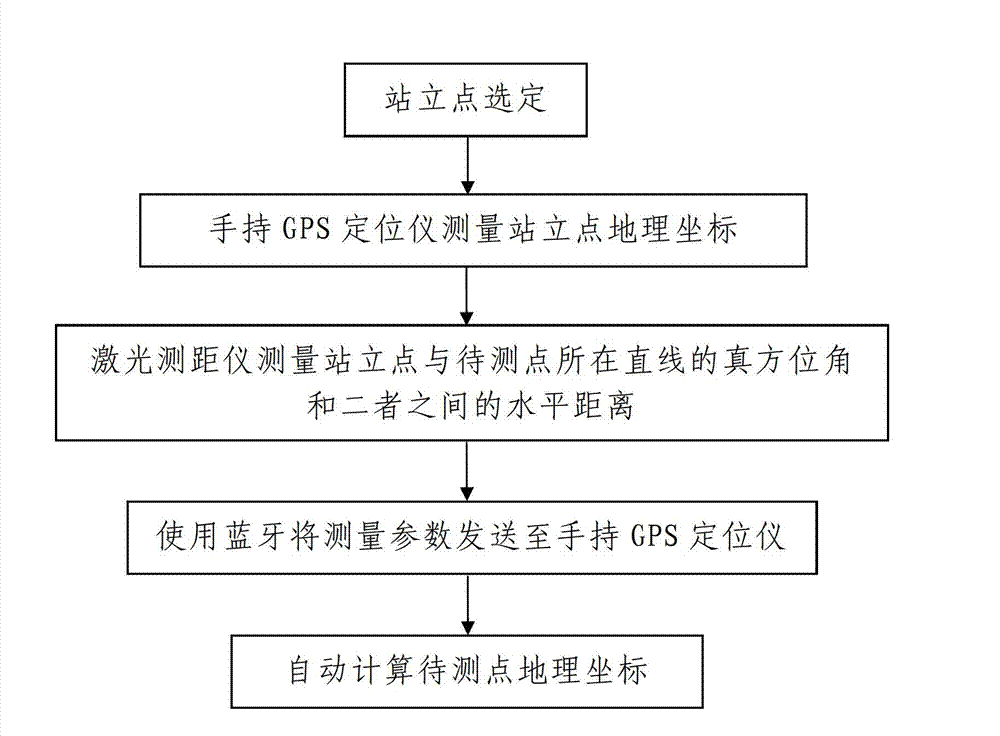
[0036] like figure 1 A fast measurement method based on a laser range finder is shown, including the following steps:

[0037] Step 1. Standing point selection: select an observation point that is conducive to GPS observation as the standing point P of the surveying staff 1 .

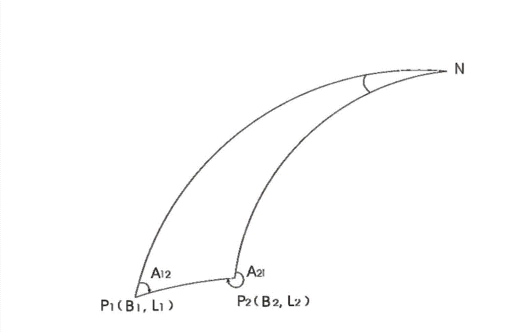
[0038] In this embodiment, the selected standing point P 1 and the point to be measured P 2 See through. Intersight refers to standing point P 1 and the point to be measured P 2 There are no obstacles between them, and there is good visibility, see figure 2 .

[0039] When actually selecting, choose a point with a wide view and easy access as the standing point P 1 , specifically select within the area to be measured.

[0040] Step 2, measurement of the geographical coordinates of the standing point: using a GPS measuring device, to the standing point P 1 The geographic coordinates of P 1 (B 1 , L 1 ) are measured where B 1 standing point P 1 The geodetic latitude, L 1 standing point P 1...


PUM


Abstract

The invention discloses a quick measuring method based on a laser ranging device. The quick measuring method comprises the following steps of: 1, selecting a standing point, that is to say, selecting an observation point, which is beneficial for observation of a GPS (Global Positioning System), as a standing point P1 of a measuring worker; 2, measuring geographical coordinates of the standing point, that is to say, measuring geographical coordinates P1 (B1, L1) of the standing point P1 by utilizing a GPS measuring device; 3, measuring by the laser ranging device, that is to say, measuring horizontal distances s among a true azimuth angle A12 of a straight line of the standing point P1 and a point to be measured P2, the standing point P1 and the point to be measured P2 by utilizing the laser ranging device, wherein the laser ranging device is a laser ranging device provided with an electronic compass; and 4, converting the geographical coordinates of the point to be measured P2. The quick measuring method, provided by the invention, has the advantages of simple operation, convenience for implementation, quick measuring speed, high measuring precision, and capability of really realizing quick and accurate measurement of a detail point, and effectively solving the problems of slow measuring sped and difficulty in measurement of the conventional handheld GPS measuring method.

Description

technical field [0001] The invention relates to a quick measurement method for geographic information, in particular to a quick measurement method based on a laser rangefinder. Background technique [0002] The laser range finder is an instrument that uses laser to accurately measure the distance of the target. When the laser range finder is working, it emits a very thin laser beam to the target, and the photoelectric element receives the laser beam reflected by the target. The timer measures the time from the launch to the reception of the laser beam, and calculates the distance from the observer to the target. The laser range finder is light in weight, small in size, easy to operate, fast and accurate, and its error is only one-fifth to several hundredths of other optical range finders. Nowadays, there are many laser range finders with built-in electronic compass on the market, that is to say, this type of laser range finder has its own electronic compass. [0003] GPS i...

Claims


Application Information

Patent Timeline
IPC IPC(8): G01C1/00G01C3/00
Inventor 张培宏赵军孙作勇
Owner XIAN MEIHANG INFORMATION IND
Why Eureka
Try Eureka