

Integral aerial triangulation method for airborne laser scanning point cloud and optical image
An airborne laser scanning and optical imaging technology, applied in the field of remote sensing images, can solve the problems of systematic offset of registration results, loose models, incomplete adjustment models, etc.
- Summary
- Abstract
- Description
- Claims
- Application Information
AI Technical Summary
Problems solved by technology
Method used
Image

Examples
Embodiment Construction
[0054] The technical solution of the present invention will be described in detail below in conjunction with the drawings and embodiments.
[0055] In order to facilitate understanding of the technical solution of the present invention, the following parts are described in the following sections:
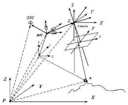
[0056] (1) Observation model based on LiDAR object space point
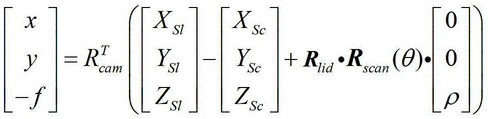
[0057] According to the principle of laser positioning, the relationship between the coordinates of the laser foot point and the system error can be expressed as formula (1). Where (X,Y,Z) is the coordinates of the laser foot point (that is, the coordinates of the object space point), (X SI ,Y SI ,Z SI ) is the scanning center coordinates at the moment of laser pulse emission, R lid is the attitude matrix at the time of laser pulse emission, R scan is the laser scanning angle rotation matrix, θ is the scanning angle, and ρ is the laser pulse ranging value.
[0058] X ...
PUM
 Abstract
Description
Claims
Application Information