Method for automatic monitoring and storage of remote sensing data products based on ftp and xml
A technology of remote sensing data and automatic monitoring, applied in the field of remote sensing data management, can solve the problems of multiple manual participation, time-consuming, error-prone, etc., and achieve the effect of less human-computer interaction, reducing steps and time-consuming, and saving time.
- Summary
- Abstract
- Description
- Claims
- Application Information
AI Technical Summary
Problems solved by technology
Method used
Image
Examples
Embodiment
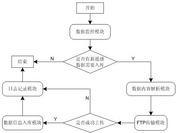
[0028] The first step is to select a piece of remote sensing data (including remote sensing data, metadata XML, thumbnails, etc.) as test data, put the data into the monitoring folder, and the data monitoring module will immediately detect this new data into the monitoring folder ;
[0029] In the second step, the data content analysis module parses and reads the metadata XML file in the test data. The content and description of the metadata XML file are as follows:
[0030]
[0031]
[0032] --Basic information, nodes correspond to all fields in the T_METADATA table in order
[0033] 05AUG27023226-M2AS_R03C3-005609151010_01_P001.TIF --file name
[0034] LANDSATETM slc-off repair image --theme
[0035] Multi --type of data
[0036] GeoTIFF --Data Format
[0037] 9 --Product Category
[0038] 1 --data quality
[0039] 1000000 -- scale denominator
[0040] 2.4 --resolution
[0041] XXX --Development unit
[0042] 20...
PUM
 Abstract
Description
Claims
Application Information
 - R&D
- Intellectual Property
- Life Sciences
- Materials
- Tech Scout
- Unparalleled Data Quality
- Higher Quality Content
- 60% Fewer Hallucinations
Browse by: Latest US Patents, China's latest patents, Technical Efficacy Thesaurus, Application Domain, Technology Topic, Popular Technical Reports.
© 2025 PatSnap. All rights reserved.Legal|Privacy policy|Modern Slavery Act Transparency Statement|Sitemap|About US| Contact US: help@patsnap.com

